

While laser scanning technology is not exactly new at this point, we are in a period of tremendous change around the tools used to collect data. Thanks to generally cheaper acquisition costs for sensors along with the shrinking of said sensors without sacrificing much in the way of power and accuracy – to say nothing of the implementation of SLAM and other key algorithms – there are more ways to collect data than ever before. Whether it’s utilizing a drone, or attaching a sensor to a car or train or crewed aircraft, or even simply wearing or holding a mobile device, it’s easier than ever to collect this data while on the move.
With all of these different options now on the table, surveyors and other professionals collecting the data are able to complete projects more quickly, and in some cases even take on projects that were previously not possible. That’s not to say this has been completely smooth sailing, though. Now, firms have challenges on a couple of different fronts, both in terms of trying to figure out when to utilize which option and how to successfully merge data from different sources into one final deliverable.
Recently, Geo Week News hosted a webinar sponsored by Exyn Technologies, who specialize in mobile and autonomous mapping, that specifically looked at this issue of combining mobile mapping with terrestrial scanning. You can register for free here and be sent an on-demand recording of the hour-long discussion.
This webinar had two speakers offering perspectives from manufacturers of both mobile scanners and terrestrial ones. Representing Exyn was Ben Williams, the company’s COO. Along with Williams, Trimble Senior Director of R&D Jim Coleman joined in the conversation to speak more from the perspective of the terrestrial scanning use cases.
At the start of the conversation, Williams provided some baseline context around what the terms like “mobile mapping” and “autonomous mapping” meant – the latter, as he explained, is different than “automatic” in that the latter is simply having the ability to complete repetitive tasks for which they were previously trained while the former can react to a changing environment around it.
He summed up why this technology is important, saying, “In a lot of the physical industries that most benefit from this type of mapping, they are often in difficult environments. They’re difficult to access or expensive to collect.” He continued, “To help physical industries catch up with a purely digital type of industry, you have to figure out ways to capture this information quickly, regularly, and consistently without being super expensive and without putting your team in danger.”
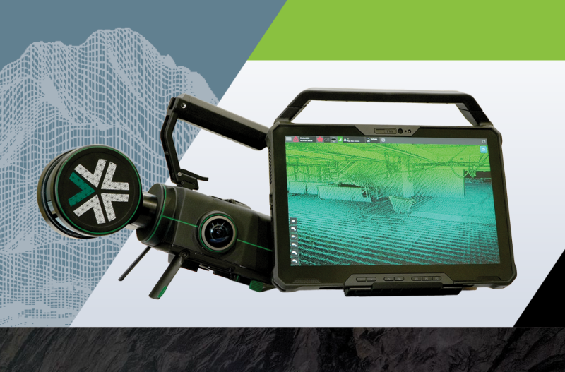
The two speakers also talked briefly about the tools they are generally talking about on their respective sides. Williams talked a bit about the Exyn Nexys, a modular mobile scanning device released earlier this year. Coleman, meanwhile, talked about Trimble’s X9 scanner, released last year and which boasts automated calibration, registration, and leveling to help with less experienced professionals.
After setting that context, the two got into the meat of their discussion, which largely revolved around real-world examples of how these two types of technologies can best be combined for maximum efficiency and accuracy for a project. It’s helpful to hear generalities about why combining the tools makes sense, but there is still nothing more helpful than hearing actual examples of how it’s been done in the real world.
The pair shared a number of examples and why it worked best, including a project to inspect a bridge. Williams noted that if they were just using a traditional terrestrial scanner the data collecting would have taken at least two hours with traffic being shut down around the bridge for the duration of the project. Using the Nexys with a UAV, however, they could complete the project with just a three-minute flight and 15 minutes of traffic being shut down. Overall, the best results considering both accuracy and timing utilized both tools being used in concert.
The pair also shared examples of how the combination can be used in spaces like construction sites, airports, and other large facilities with a mobile system being used as a handheld or attached to a ground robot like Boston Dynamics’ Spot while a terrestrial system can be used for complex spots like MEP systems on the site. Speaking of Spot, they also shared one prototype they’ve tested a couple of times combining both a terrestrial scanner and a mobile scanner on the robot with the latter creating a base map and helping navigation while the TLS was triggered in important spots within a facility.
After delving into some of these specific case studies, the pair took a number of questions from the audience touching on a number of different topics from specific logistical queries to broad, overarching ones. Among the most important discussions to come out of this was around some best practices for those looking to combine these techniques for their jobs. The consensus was that the most important step is to figure out exactly what you’re trying to capture and how accurate it needs to be. Find the places that need, for example, millimeter-level accuracy and those are spots that a TLS should be utilized.
Specifically speaking to new users, Williams recommended that they first capture an entire area using only a mobile mapping system, and then find spots in the data where that level of accuracy won’t do. From there, you can go back and use a TLS and eventually have a better feel for what areas in a new project which require which tool.
This is only scratching the surface of this 60-minute conversation, with the two delving much deeper into the case studies than I did in this recap and answering many more questions beyond the one about best practices. To get your free access to the on-demand recording of the conversation, register here.


