Simultaneous Localization and Mapping (SLAM) is a technology that combines hardware and software for the purposes of mapping and positioning. SLAM enables autonomous systems to build maps of unknown environments while tracking their own position in real-time. SLAM was initially used in the automotive industry, but has since also been applied in handheld and static scanning. For example, handheld SLAM-enabled scanners have enabled capturing GPS-denied spaces, such as tunnels, caves, and buildings.
This application made people believe that SLAM is only useful when GPS is not available, but both technologies have different purposes; SLAM is used for capturing the environment, while GPS is about positional information and accuracy. This is why professional total stations and laser scanners also include SLAM.
Today, SLAM is used in architecture, construction, infrastructure inspection, mobile mapping, forestry, gaming, and others. The many different use cases for SLAM show the popularity of highly detailed 3D data captured with SLAM.
One such use case is property reality capture and analysis. Canvas is a Denver-based software company that created a mobile app to capture indoor spaces with lidar-enabled Apple devices. On their blog, they explain the workflow to capture and generate as-built models using lidar, SLAM, and more. With regards to SLAM, Canvas developed proprietary SLAM technology and 3D reconstruction technology to boost scan accuracy and offer guidance during the capture process.
In the same blog, Canvas points out that their proprietary SLAM extends Apple’s framework for AR app development, ARKit, which relies on SLAM. ARKit makes it easier for others to develop apps for compatible iPhones, turning them into handheld scanners, such Topcon’s CR-P1.
SLAM devices are either non-dedicated or dedicated. A dedicated SLAM device is purpose-built specifically for SLAM tasks, with SLAM being the only or primary function. A non-dedicated SLAM device is a general-purpose device that can run SLAM algorithms as part of its capabilities.
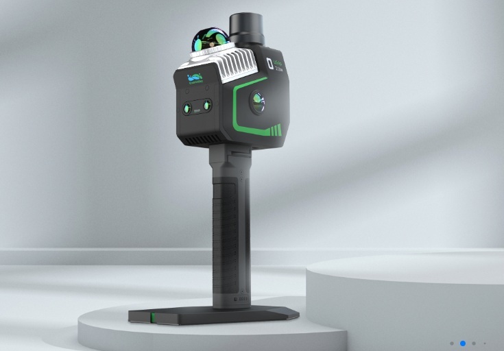
Many scanners today combine different functionality, including scanning and imaging. The following three examples are all mobile scanners (backpack or handheld) that include SLAM among its capabilities. The Tersus MVP S2 (also named Metaverse Painter S2) is a mobile SLAM 3D scanner, equipped with lidar, panoramic imaging, and RTK. Use cases include smart city mapping, BIM modeling, transportation infrastructure, and geospatial surveys in complex environments.
GreenValley International (GVI) just announced the LiGrip O2 Lite, a “light-weight all-scenario handheld lidar scanner”. This is GVI’s latest-generation handheld SLAM product, which uses MLF-SLAM (Multiple Localization Fusion-SLAM) multi-sensor fusion positioning technology. It overcomes mapping challenges in featureless environments such as airports, beaches, and rivers, achieving centimeter-level data collection using a Visual SLAM (VSLAM) and lidar-SLAM deep fusion algorithm. The LiGROP 02 Lite is the successor of the LiGrip O1 Lite light-weight 3D laser scanner, which was made commercially available first in May 2024.
Mobile mapping camera builder Mosaic announced the Mosaic’s Xplor, a 360º mobile mapping backpack for exploring, capturing, and analyzing hard-to-reach environments. While it integrates two lidar sensors that capture up to 400,000 points per second, it places cameras and image quality at the forefront of its design. The backpack is equipped with six 12.3-megapixel image sensors to capture 13.5K resolution panoramic images, to provide the photorealistic detail often overlooked by lidar-centric systems.
A blog post that introduces the system and describes different use cases states that the Mosaic Xplor is not a dedicated SLAM device, but that it integrates SLAM technology to enhance its mapping capabilities, particularly in GNSS-denied environments.
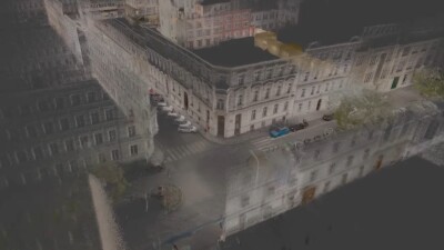
XGRIDS provides 3D content generation tools and development platforms, focusing on 3D reconstruction and spatial computing. Last year, the company released the Lixel L2 handheld lidar scanner. The L2 uses two cameras and scanners to create real-time, colored point cloud models by fusing sensor and location data with Gaussian Splatting, a technology that allows for rendering photorealistic 3D scenes in real-time.
SLAM-based laser scanning makes a great combination with Gaussian Splatting. The point cloud data from SLAM-based laser scanners can help calibrate and position Gaussian Splats, as these scene renderings are not spatially accurate enough for many use cases.
XGRIDS just announced Lixel CyberColor (LCC), its new SLAM-Based Gaussian Splatting software for rapid, photorealistic 3D environment creation. LCC is a cloud-based platform for creating photorealistic 3D models and digital twins by integrating (fusing) lidar and visual data from XGRIDS’ Lixel series scanners. More specifically, LCC combines 3D Gaussian Splatting with multi-SLAM technology. Multi-SLAM technology uses multiple types of sensors together to improve SLAM performance, such as lidar, cameras, and IMU.
The LCC product announcement states that LCC offers multiple deliverables targeted at eight different verticals, including architecture & construction, real estate, entertainment/gaming, and education. The deliverables include detailed as-built documentation with precise measurement capabilities, immersive virtual property tours, and digital twins.
In addition to this new platform release, XGRIDS released a plugin to bring SLAM-based 3D Gaussian Splatting technology directly into Autodesk Revit workflows, delivering efficiency improvements in BIM modeling while maintaining survey-grade accuracy. The plugin was developed in partnership with Autodesk to seamlessly connect Revit with LCC models to deliver efficient, intuitive, and detail-rich BIM modeling experiences. The plugin aligns with industry trends toward outcome-based BIM powered by accessible, granular data.