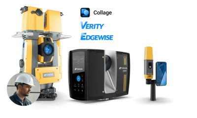
Topcon Collage Site software enhancements
Collage Site by Topcon is an innovative field software platform designed to collect, process and view point cloud data in real time, directly on-site. Traditional scanning workflows require capturing data in the field, returning to the office, and then processing it into a usable point cloud. Collage Site eliminates that delay, enabling users to fully register data in the field without office support, visualize processed data instantly, and carry-out in-field quality assurance tasks.
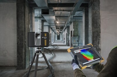
Now, with the introduction of the new CR-P1 scanner, these unique capabilities can be paired with best-in-class hardware, delivering high-performance, real-time data acquisition for precise building design, renovation, and construction progress monitoring. This integration boosts speed, accuracy, and efficiency, streamlining workflows and reducing dependance on back-office processing.
Together, Collage Site and the CR-P1 deliver a significant boost to productivity. Site teams can instantly verify construction work, catch errors early, and share live updates with clients and stakeholders. This powerful combination transforms reality capture from a reactive process into a proactive tool, helping teams make faster, more informed decisions with confidence.
Compatible hardware systems
Boosting user productivity
Collage Site goes beyond just speed: it improves the whole workflow. With direct integration into design software like ClearEdge3D EdgeWise by Topcon, users can access their 3D scans in the design model and ensure that on-site progress aligns with existing plans, speeding up the vital construction verification process with current, detailed scans.
What’s more, the collaborative features allow multiple stakeholders to view and interact with the data in real time, whether they’re on site or remote. This keeps everyone aligned and dramatically reduces the need for re-work. Ultimately, it means users are not just scanning faster; they’re managing the entire verification and progress-monitoring process more efficiently.
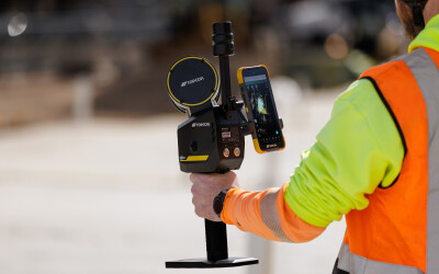
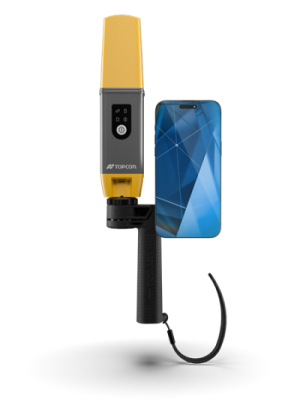
CR-H1 handheld scanner
The CR-P1 is a product of this partnership, bringing together FARO’s scanning capability with Topcon’s field-ready software and construction focus, and Topcon is excited to continue collaborating on solutions that further reduce the complexity of generating, analyzing and sharing point cloud data and make verification processes quicker and simpler.
The CR-H1 is an easy-to-use and intuitive handheld scanner designed for rapid, high-accuracy capture. It combines a specialized mobile app for iPhone, developed in partnership with Pix4D, with integrated lidar, the HiPer CR receiver by Topcon and a custom-made handle to generate geo-referenced images and point clouds.
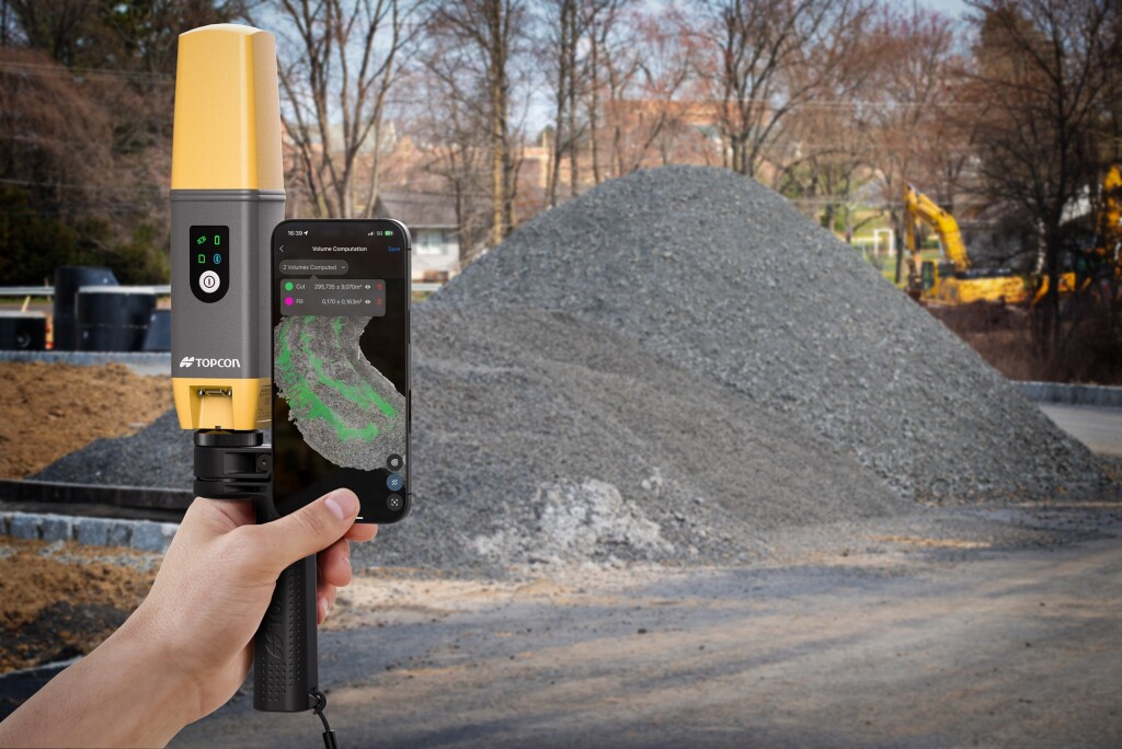
With these elements working in concert, users are set to immediately begin gathering data. This is then processed into full-color, high-resolution 3D models which can be analyzed and shared with stakeholders via Collage Site. With the addition of Topnet Live, the CR-H1 produces highly accurate data right from the field. It is simple enough for anyone to use yet remains powerful enough for professional-grade deliverables, including full-color point clouds, standard point clouds, and imagery. These outputs are optimized for use within the Collage software, giving users everything they need for detailed analysis, verification, and visualization.
HiPer CR receiver specifications
The HiPer CR receiver delivers centimeter-level accuracy, even in challenging environments. When combined with the CR-H1, it ensures that the resulting point clouds are not only rich in detail but also precisely geo-referenced. It's designed for simplicity: within five to 10 seconds, virtually any user can begin collecting data. It’s compact, intuitive, and perfectly suited to the needs of modern field teams.
The HiPer CR receiver also provides multi-constellation tracking, across a range of satellite services such as GPS, GLONASS, Galileo, BeiDou, and QZSS. The receiver can be used in a variety of configurations, including as a network RTK rover when used in collaboration with Topnet Live, in base and rover setups, and for integrated hybrid use with a robotic total station.
In terms of specifications, the HiPer CR offers wireless multi-channel Longlink Bluetooth for transmitting corrections across sites and to rovers, eliminating licencing or interference problems. As a base station, it can also support up to three additional HiPer CR rovers within 300 meters, which can be extended by connecting to a wireless radio.
The CR-H1 is designed as an entry-level, accessible option with a lower price point and virtually no learning curve. Training takes just minutes, and the system is intuitive enough for use by professionals across real estate, utilities, factory management, and more. It lowers the barrier to entry for 3D data collection and enables wider adoption of laser scanning outside of traditional surveying roles.
“The motivation behind developing he CR-H1 was simple: creating a straightforward, efficient way to collect high-quality point cloud data using tools that many people already have. With the increasing capabilities of smartphones, especially those equipped with lidar, we saw a clear opportunity to democratize scanning and bring the technology to new markets, speeding up processes for professionals across many industries. Over the next three to five years, we anticipate broader integration of correction services and expanded application support, making mobile scanning a key part of the professional geospatial toolkit”, concludes Julian Norton, Senior Product Manager at Topcon Positioning Systems.