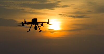
Imagine being dropped into a completely dark, unfamiliar room and asked to draw a map of it, while also marking exactly where you are at every moment. That's the challenge engineers faced when building autonomous machines that needed to operate without GPS, without prior knowledge of their surroundings, and without human guidance. The solution they arrived at is called SLAM - Simultaneous Localization and Mapping - and when paired with lidar, it became one of the most transformative tools in modern robotics and spatial computing.
Lidar, which stands for Light Detection and Ranging, works by firing thousands of laser pulses every second and measuring how long each one takes to bounce back. From that data, it constructs a richly detailed three-dimensional picture of the world. A dense cloud of points that collectively describe every surface, edge, and obstacle in the environment. On its own, it's an incredibly powerful sensor. However, combined with SLAM, it becomes something more: the foundation for genuine machine intelligence about space.
The Dance Between Mapping and Localization
What makes SLAM so elegant, and difficult, is that mapping and localization are fundamentally dependent on each other. To build an accurate map, you need to know where you are. But to know where you are, you need an accurate map. SLAM algorithms solve this circular problem by doing both things at once, continuously and in real time.
As a lidar-equipped device moves through an environment, it stitches together successive point clouds into a growing spatial model. At the same time, it compares incoming sensor data against what it has already mapped, using that comparison to estimate its own position. Over time, as the device revisits areas it has already seen, the algorithm performs what's called "loop closure" - recognizing familiar geometry and using it to correct small errors that have accumulated along the way. The result is a map that becomes more accurate the longer the system operates, and a machine that always knows where it stands within that map.
From Warehouses to Self-Driving Cars
The applications of SLAM lidar are used often where machines need to physically move. It enables cars to understand their environment at highway speeds, detecting pedestrians, reading the geometry of intersections, and navigating complex urban terrain where GPS signals are unreliable or absent. In warehouses, robots use it to move through dynamic environments of moving people and shifting inventory, never losing their bearings even when the layout changes. Drones equipped with SLAM lidar can fly into collapsed buildings or dense forests, generating precise 3D maps in real time and sending them back to operators who couldn't safely enter themselves.
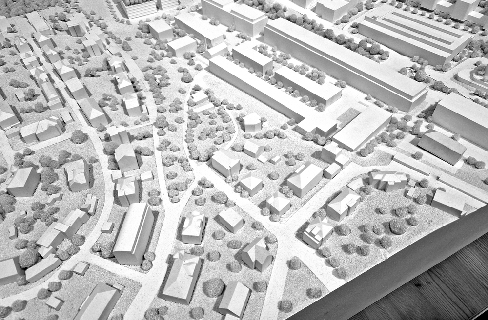
Surveyors and construction professionals have embraced it too, using handheld or drone-mounted devices to capture detailed models of buildings, bridges, and landscapes in a fraction of the time traditional methods would require. In consumer technology, the same underlying principles power the spatial awareness features in devices like the Apple Vision Pro, which must understand the geometry of a room in order to convincingly anchor digital objects within it.
Why It Matters More Than Ever
GPS changed the world by telling us where we are. SLAM lidar is doing something arguably more profound: it's teaching machines to understand where everything is, and to navigate that reality autonomously. As the physical and digital worlds continue to converge, and as autonomous systems take on more responsibility in transportation, logistics, healthcare, and beyond, the ability to perceive and reason about 3D space in real time becomes not just useful, but essential.
SLAM lidar is not a single product or a single invention. It's a capability - one that sits at the intersection of physics, mathematics, and computer science - and it is quietly becoming the spatial backbone of the autonomous age. Every self-driving car that merges onto a highway, every robot that navigates a hospital corridor, every drone that maps a disaster zone is, in some form, doing what that person in the dark room was asked to do: figuring out where it is, and drawing the map as it goes.