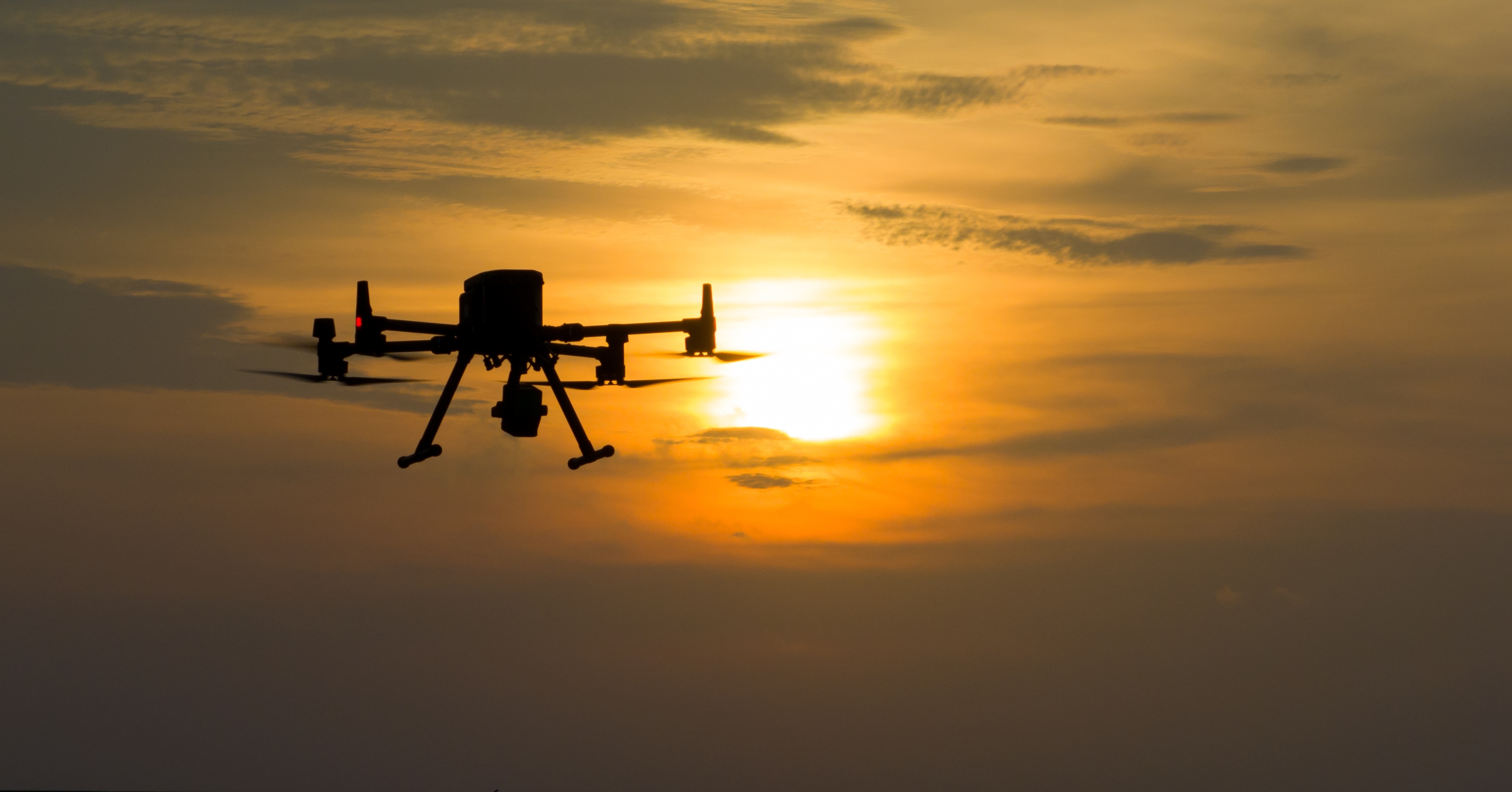
Lidar, historically, has been anchored to aircraft, vehicles, or tripods. While powerful, some of those approaches can be slow to deploy or expensive to operate, depending on the scale of the area to be scanned. Drones have changed that. By mounting a lidar sensor on an uncrewed platform that can be launched from the back of a truck, flown at low altitude, and repositioned in minutes, operators now have a tool that is both nimble and genuinely flexible. That combination is driving rapid expansion across industries, and the real-world results are starting to add up.
Getting to the Data Faster
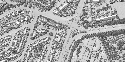
The practical advantage of utilizing drone-mounted lidar isn't just cost, it's speed and access. A surveying crew that once needed days to collect ground-based measurements can now fly the same area in hours and return denser, more accurate data. More importantly, drones can reach terrain that's unsafe or physically impossible to survey on foot: steep cliffs, active construction sites, post-disaster zones, underneath bridges, and around dense vegetation.
Moreover, the ability to take advantage of sudden breaks in the weather, relocate your flights when conditions change, and have a more easily deployed platform means that there are fewer lost days of work. These are only some of the reasons why the technology has appeared in everything from infrastructure corridor surveys to archaeological discoveries.
Surveyors are taking notice. As Matt Collins reported for Commercial UAV News, what was once little more than theory - a lidar sensor on a UAV - has shifted into standard expectation. Many of today's surveyors aren't just asking whether drone lidar is accurate enough for real-world projects; they're asking for the same kind of seamless, end-to-end workflow that photogrammetry already offers. The "easy button" era of drone lidar is what the industry is now actively building toward.
Autonomy Needs Spatial Awareness
As the drone industry pushes toward autonomous and BVLOS (beyond visual line of sight) operations, lidar is becoming less of an optional payload and more of a core navigation component. Cameras fail in low light, fog, and dust, but lidar doesn't. For a drone flying a pre-programmed route along a power line corridor at dusk, or navigating inside a GPS-denied industrial facility, real-time lidar scanning is what keeps it from flying into something.
This is one reason the FAA's evolving BVLOS framework matters so much for lidar adoption. As regulatory pathways for autonomous flight open up, demand for reliable obstacle detection sensors will grow with them. Lidar is well-positioned to fill that role.
The autonomy story isn't limited to the United States. Nigeria-based Terra Industries is building a drone manufacturing operation designed to sit outside both Chinese-dominated mass production and higher-cost Western markets. The company pairs its hardware with ArtemisOS, an AI-driven software platform, and its drones are reported to be up to 55% less expensive than comparable international systems. Two rapid funding rounds in early 2026, totaling roughly $34 million, signal strong backing for a model that could reshape how autonomous sensing infrastructure gets deployed across Africa and beyond.
The Inspection Use Case Is Maturing Fast
If there's one vertical where drone lidar has moved from emerging technology to standard practice, it's infrastructure inspection. Utilities, rail operators, and civil engineers are now routinely using drone lidar to capture precise 3D models of bridges, towers, and transmission corridors, then comparing those models over time to detect structural change before it becomes a problem.
What's notable about where this market is heading is the increasing integration of lidar with other sensors - thermal cameras, multispectral imagers, and RGB video - on the same platform. The point cloud gives you geometry and structure; the other sensors add context. Together, they give inspectors a more complete picture than any single sensor could provide alone.
From Farmland to the Ocean Floor: Unexpected Frontiers
Some of the most compelling drone lidar applications are emerging in places few anticipated.
In Ukraine, the humanitarian stakes couldn't be higher. Four years into the war, millions of landmines are scattered across a thousand-kilometer front line, buried in some of the world's most fertile farmland. The HALO Trust, the world's largest landmine clearance organization, has cleared over 36,000 explosives and returned 20 million square meters of land to Ukrainian families. They're doing it faster and safer than ever before, using drones and AI to transform one of humanity's oldest and most dangerous tasks. Drone-based sensing isn't just accelerating the work, it's changing what's survivable for the people doing it.
Meanwhile, at Harvard, mechanical engineering students Kuma McCraw and Mikaya Parente have built a fixed-wing eVTOL drone specifically designed to track sperm whales off the coast of Dominica. The drone launches vertically from a research vessel and is built for long-duration operation, no runway required. It's a reminder that the most important advances in this space aren't always about flying faster or farther. Sometimes they're about seeing more clearly, in places humans simply can't go.
Where It Goes From Here
The drone lidar market is still in an expansive phase. Sensors continue to shrink in size and price, AI-assisted point cloud processing is reducing the time from flight to actionable data, and new platforms purpose-built for lidar payloads are coming to market regularly. Growing interest from sectors like public safety, precision agriculture, urban planning, humanitarian demining, and marine research reflects how broadly the technology is finding traction with each discovering that drone lidar solves problems no previous tool quite addressed.
The underlying technology isn't new, but what drones have done is make it deployable, repeatable, and economically viable at a scale that simply wasn't possible before. That's not a small shift, it's the reason an entire industry has been built around it.