There's a version of the future where it might be possible for robots to glide effortlessly through every environment, mapping and navigating in real time without a single pre-installed marker or GPS signal. SLAM lidar is the technology closest to making that vision real. However, the honest story of where this technology stands today is one of genuine, proven capability in specific domains, and stubborn, unsolved limitations everywhere else.
The Environments Where It Has Earned Its Place
Walk into a modern fulfillment center and you're likely already watching SLAM lidar at work. Autonomous mobile robots navigate these semi-controlled spaces with remarkable reliability, building and updating maps in real time, rerouting around obstacles, and doing it all without the constraints of earlier systems. In warehouses and manufacturing floors, the conditions align almost perfectly with what the technology needs: consistent geometry, predictable traffic, and well-defined spaces. It's not a coincidence that this is where large-scale commercial deployment happened first.
When GPS Disappears, Lidar Steps In
The case gets even stronger in environments where satellite positioning simply doesn't exist. Underground mines, tunnels, dense urban canyons, and subterranean facilities all share one feature: GPS can’t be used effectively. In these spaces, SLAM becomes one of the only credible options for precise, real-time localization. DARPA's Subterranean Challenge put this to the test in some of the most demanding conditions imaginable, and the results demonstrated clearly that for GPS-denied navigation, SLAM isn't just viable, it's often the best tool available.
Transforming How We Document the Physical World
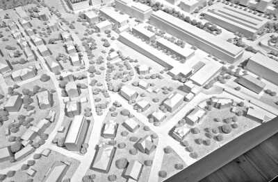
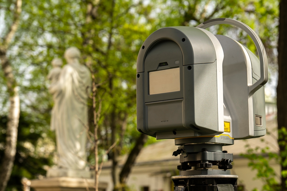
The impact on construction and infrastructure has been quieter but equally significant. Where site documentation once meant days of painstaking work with static tripod-mounted scanners, handheld and mobile SLAM devices now let surveyors walk a building and generate millimeter-accurate point clouds as they move. The resulting data feeds directly into BIM workflows, reducing both the time and the margin for error on projects where precision matters enormously. For as-built documentation, this is less an emerging technology and more an established practice.
The Problem With a World That Won't Sit Still
Here is where the narrative shifts. SLAM, at its core, is built on an assumption that the world is mostly static and that the geometry captured a moment ago is still the geometry that exists now. In a warehouse operating on predictable schedules, that assumption mostly holds. In a hospital corridor, a crowded retail floor, or an active construction site, it breaks down constantly. Moving people and equipment create artifacts in the map, introduce drift in localization, and force the system into recovery behaviors that consume time and processing resources. Filtering dynamic objects in real time is an active area of research, not a solved problem.
The Geometry Has to Give the Algorithm Something to Work With
Even in static environments, SLAM depends on finding distinctive geometric features to anchor its position. Long featureless corridors, open parking structures, and flat agricultural fields offer very little for the algorithm to grip. The result is a phenomenon called perceptual aliasing, where the system mistakes one location for another because the geometry looks identical. It's a subtle failure mode, but in applications where localization accuracy is critical, it can quietly undermine confidence in the entire system.
Weather Remains an Unsolved Adversary
Autonomous vehicle programs have spent billions of dollars learning a humbling lesson: the physical world is not a controlled environment. Rain, fog, dust, and intense sunlight all degrade LiDAR returns in ways that are difficult to fully compensate for. Unlike cameras, lidar doesn't rely on visible light, which gives it some advantages over purely vision-based systems—but it is far from immune. Designing systems that perform consistently across weather conditions, not just in ideal ones, remains one of the harder open problems in the field.
The Cost and Compute Ceiling
For all its capabilities, SLAM still carries a price tag that limits where it can go. High-performance lidar units capable of supporting robust real-time SLAM can run into tens of thousands of dollars per unit. Solid-state technology is gradually pushing that number down, but the cost still excludes a wide range of consumer applications and low-margin use cases. Alongside the hardware cost sits the computational burden: point cloud registration, loop closure detection, and continuous map optimization are intensive processes that strain embedded systems and often require careful tradeoffs between accuracy, latency, and power consumption.
Maps Get Old, and Environments Don't Wait
There is one more limitation that tends to get less attention than it deserves. SLAM maps are built from the world as it was, not as it is. A warehouse that gets reorganized, a construction site that evolves week by week, a retail floor reshelved between shifts - all of these require map updates, and updating maps at scale, incrementally and automatically, is still largely an unsolved problem for real-world commercial deployments. Most systems handle it through periodic remapping, which works until the pace of environmental change starts outrunning the update cycle.
What the Technology Actually Is
The clearest way to understand SLAM lidar is as a powerful but narrowly optimized tool. In structured or geometrically rich environments, it performs with a reliability that has moved into genuine industrial deployment. Outside those conditions, the assumptions underlying the technology begin to crack, and the gaps between what the demos show and what production systems encounter become consequential. The teams getting the most out of it are the ones who understand that distinction, and who pair lidar with complementary sensors, design for graceful degradation, and resist the temptation to deploy a solution past the edges of where it actually works.