At Geo Week, we've been following the Gaussian splatting space closely for a while now, and if you work in geospatial or construction and haven't come across Michael Rubloff's work yet, let me fix that for you right now.
Rubloff recently released a video covering the breadth of real-world Gaussian splatting applications he's been tracking across industries. The whole thing is worth your time, but starting around the 11:30 mark, he gets into construction and geospatial specifically, and it's one of the clearest, most grounded summaries of where this technology actually stands that I've heard.
The part that struck me is how matter-of-factly he describes how companies are already using splats on job sites, not as a pilot or a proof of concept, but as a working part of how they capture, communicate, and document. Having read a lot and heard some talks at Geo Week over the last few years that were more on the "this is neat" end of the usefulness spectrum, seeing people actually putting it to serious work was eye opening and, frankly, inspiring!
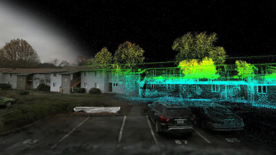
Imagine... workers walking a site with a handheld scanner, reconstructing it in full, and then sharing it via a single URL that renders on almost any device... that's the kind of workflow improvement that sounds almost too simple until you realize how much time and friction it replaces.
He also highlights something that doesn't get enough attention: the fact that Gaussian splatting handles thin structures, reflective surfaces, vegetation, and glass far better than traditional photogrammetry. For geospatial professionals who have spent years working around those exact limitations, that's not a minor footnote, that can be game-changing.
There's also a measurement accuracy angle worth noting. Esri discussed with booth visitors how they are able to achieve survey-grade measurements directly from splats.
Other big names have joined Esri in slipping these splats into their products as well. DJI has added Gaussian splatting support to both Terra and FlightHub. Bentley Systems, through its acquisition of Cesium, is in the mix. Niantic relaunched Scanoverse with renewed focus. XGrids spatial cameras are showing up on job sites. The ecosystem is building fast!
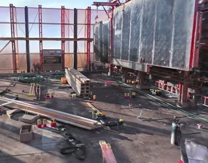
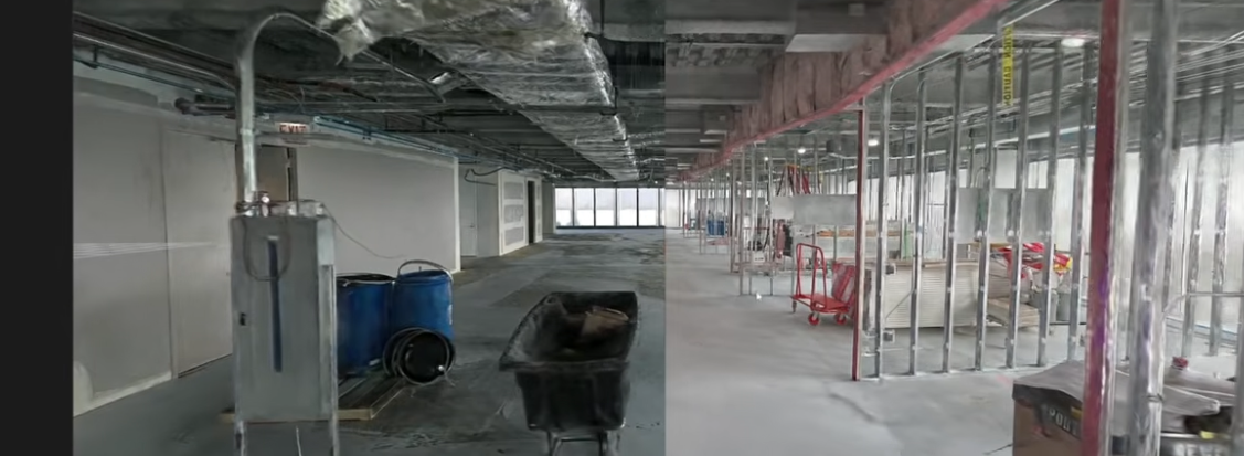
The 4D potential Rubloff mentions, e.g., layering captures over time to document construction progress in photorealistic detail, are use cases that would have sounded impossible with where Gaussian splatting stood two years ago.
Geo Week will be covering more about Gaussian splatting and what it means specifically for the geospatial industry in the months ahead. But in the meantime, I do recommend you watch Rubloff's video. Start at 11:30 if you're short on time. Then probably go back and watch the whole thing.