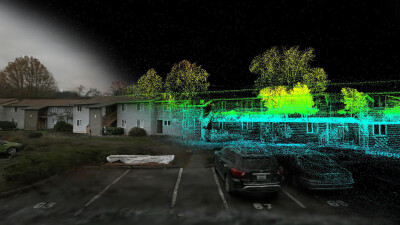
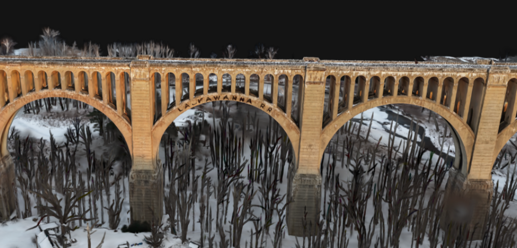
Gaussian splatting has been building momentum in geospatial circles for a while now, mostly as a visualization technique. The renders are visually striking and high fidelity, and they are gaining quick ground among professionals in many fields for their ability to visualize challenging scenes. But for professional survey workflows, a good-looking model is not enough on its own. Accuracy, reliability, and clean data at every stage of the pipeline are what actually matter to the people on the ground.
PIX4D's latest update to PIX4Dmatic, announced on a recent blog, takes a different approach to Gaussian splatting than the broader industry conversation might suggest. Rather than positioning it as a visual upgrade, the company has integrated the technology as a structural improvement to its processing pipeline, one that reshapes how data quality flows from initial reconstruction all the way through to final deliverables.
A georeferenced pipeline, start to finish
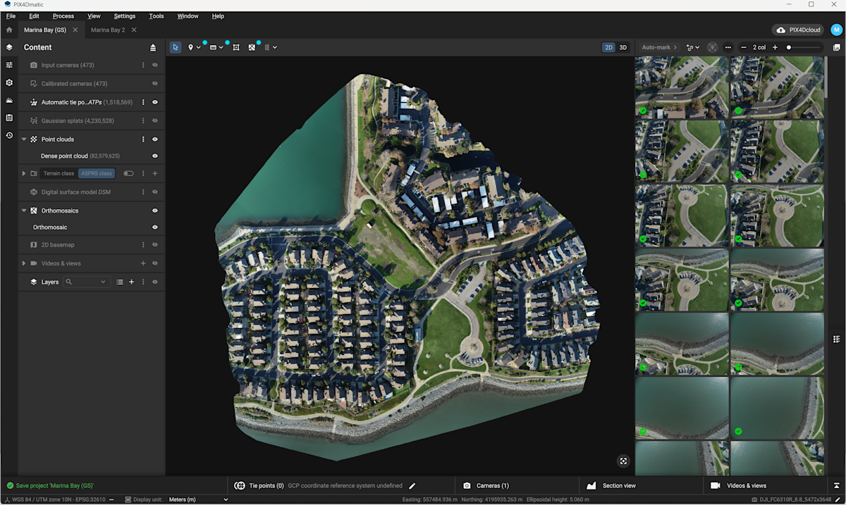
The context here matters. PIX4D already offered Gaussian splatting in PIX4Dcatch, its mobile capture app, and in PIX4Dcloud, its cloud-based processing platform. What was still waiting was the connection to professional desktop control, and now PIX4Dmatic fills that gap.
These results can be shared to PIX4Dcloud via a Share to Cloud option. The entire path from field capture to processed deliverable now runs through a connected, georeferenced ecosystem rather than a set of isolated tools. That is the loop being closed.
For survey professionals, this is a meaningful shift. Bringing mobile and aerial datasets together has often required moving data between separate platforms, sometimes with consistency compromises at each handoff. A unified pipeline would reduce those friction points and keep the reconstruction logic aligned throughout.
Better point clouds, not just better pictures
One of the more underappreciated consequences of Gaussian splatting in PIX4Dmatic is what it does to the dense point cloud. In traditional photogrammetry workflows, the point cloud comes out of a densification process that can struggle with low-texture areas, reflective surfaces, and complex geometry. Gaps, noise, and uneven density in these areas are common, and they require cleanup time before the data can move forward.
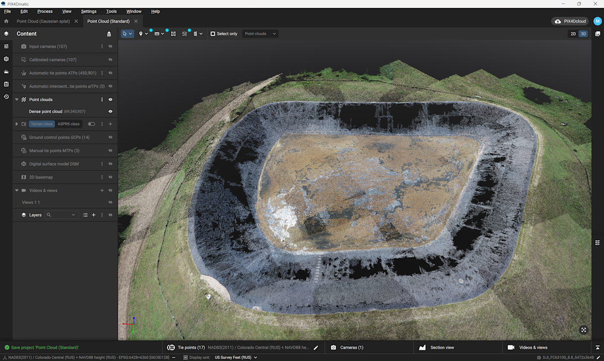
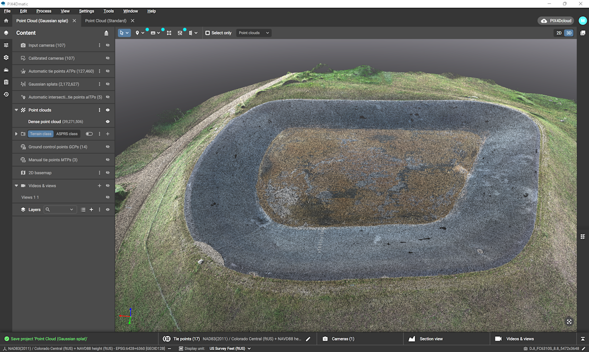
Gaussian splatting builds the reconstruction on a more continuous representation of the scene. The resulting point cloud is more evenly distributed and less affected by the noise and inconsistencies that typically accumulate in those challenging zones. According to PIX4D, this is not simply a visual improvement. It translates into a dataset that requires less correction and carries more reliability into downstream stages of the workflow.
This is true for orthomosaicas as well, which are the most sensitive outputs in any photogrammetry pipeline because they will show every weakness in the reconstruction, particularly along water edges, reflective materials, and low-texture ground. Gaussian splatting, as implemented here, can provide a more continuous underlying scene representation, helping the orthomosaic stitching to come out sharper and more complete.
Surfaces that behave, meshes that hold up
The improvements from the addition of Gaussian splats can propagate upward through the pipeline. On its face, a 3D mesh is only as reliable as the data it is built from, and considerable time in many workflows is used to stabilize mesh surfaces, resolve irregular triangulation, smooth transitions, and correct artifacts introduced during reconstruction.
With a more coherent dataset at the base, that cleanup effort is significantly reduced. PIX4D describes the mesh in PIX4Dmatic as behaving more predictably as a result: triangulation becomes more consistent, transitions are smoother, and edge conditions are better defined. Subtle inconsistencies that might not be visually obvious but can affect measurements are less likely to propagate through.
Volume comparisons and the cost of noise
PIX4Dmatic's new surface comparison tool adds another dimension to what these improvements make possible. The tool allows users to compute volumes by directly comparing two surfaces to quantify change between surveys, track progress against design, or compare as-built conditions to what was planned.
This kind of analysis has always been highly sensitive to data quality. Small inconsistencies in reconstruction could show up as apparent (but false) changes or hotspots, which are particularly costly in workflows like earthworks monitoring, stockpile tracking, or infrastructure progress assessment. Gaussian splatting, as applied here, reduces those inconsistencies at the source so the surfaces being compared align more coherently. What this means in practice is that surveyors spend less time checking whether a detected difference is real or an artifact.
Performance and the hardware equation
Generating Gaussian splats at this quality level requires computing power. PIX4Dmatic processes locally through GPU resources, and PIX4D recommends modern NVIDIA GPUs with sufficient VRAM to get the most out of the feature. For teams with constrained local hardware or projects that need to scale, processing can be offloaded to PIX4Dcloud without disrupting the workflow or compromising consistency.
What it means for the industry
The broader significance here is about how reconstruction quality improvements travel through a pipeline. When the foundational representation of a scene gets better, it does not stay isolated at the visualization stage. It changes the point cloud, the orthomosaic, the mesh, and the volumetric analysis, and it does so in ways that reduce the manual intervention required at each step.
PIX4D's integration of Gaussian splatting into PIX4Dmatic, available as part of PIX4Dmatic Pro, is designed for workflows that require the highest level of reconstruction quality. For survey professionals already working within the PIX4D ecosystem, it completes a connected pipeline that keeps fidelity and georeferenced accuracy intact from capture through to final output.