The other night, my YouTube algorithm directed me to a 1961 British Pathé newsreel about the Ordnance Survey, Britain's national mapping agency, and I haven't been able to stop thinking about it. It opens with bulldozers carving fresh motorways across the English countryside, and the narrator asks the question that gives the whole film its energy:
"What are the map makers doing to keep pace with these breathless changes?"
The answer, delivered in that wonderful clipped mid-century newsreel style, is a tour through the state of the art in 1961. There's the Tellurometer, an early electronic distance measurement device that sent out high-frequency microwave signals to measure distances. Four men used it to measure a baseline in two days that had taken 42 pre-war surveyors nearly a month with tripods and steel tapes.
There are the early computers, described with charming understatement as "adding machines," doing in an afternoon the mathematics that used to occupy two people for an entire year.
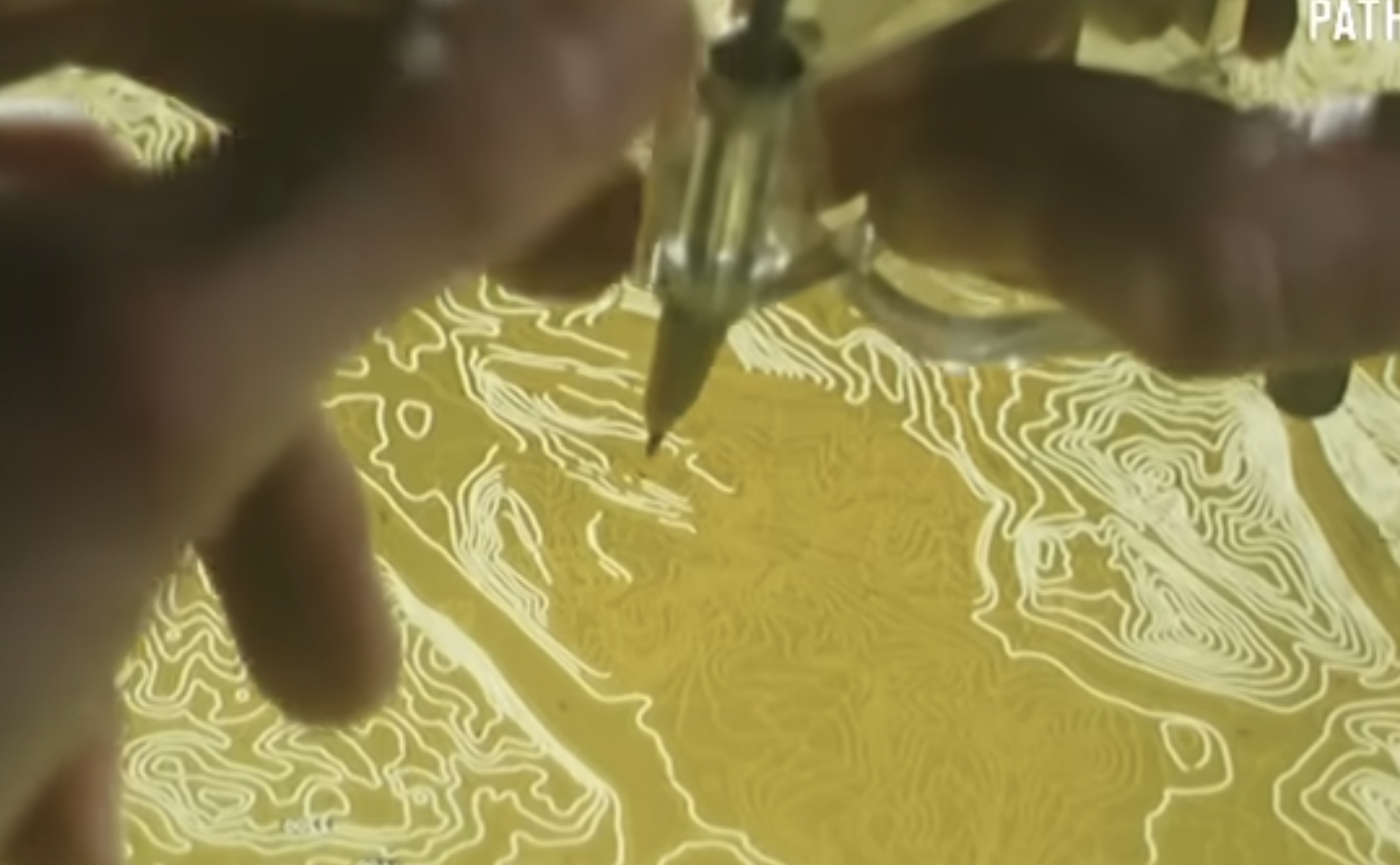
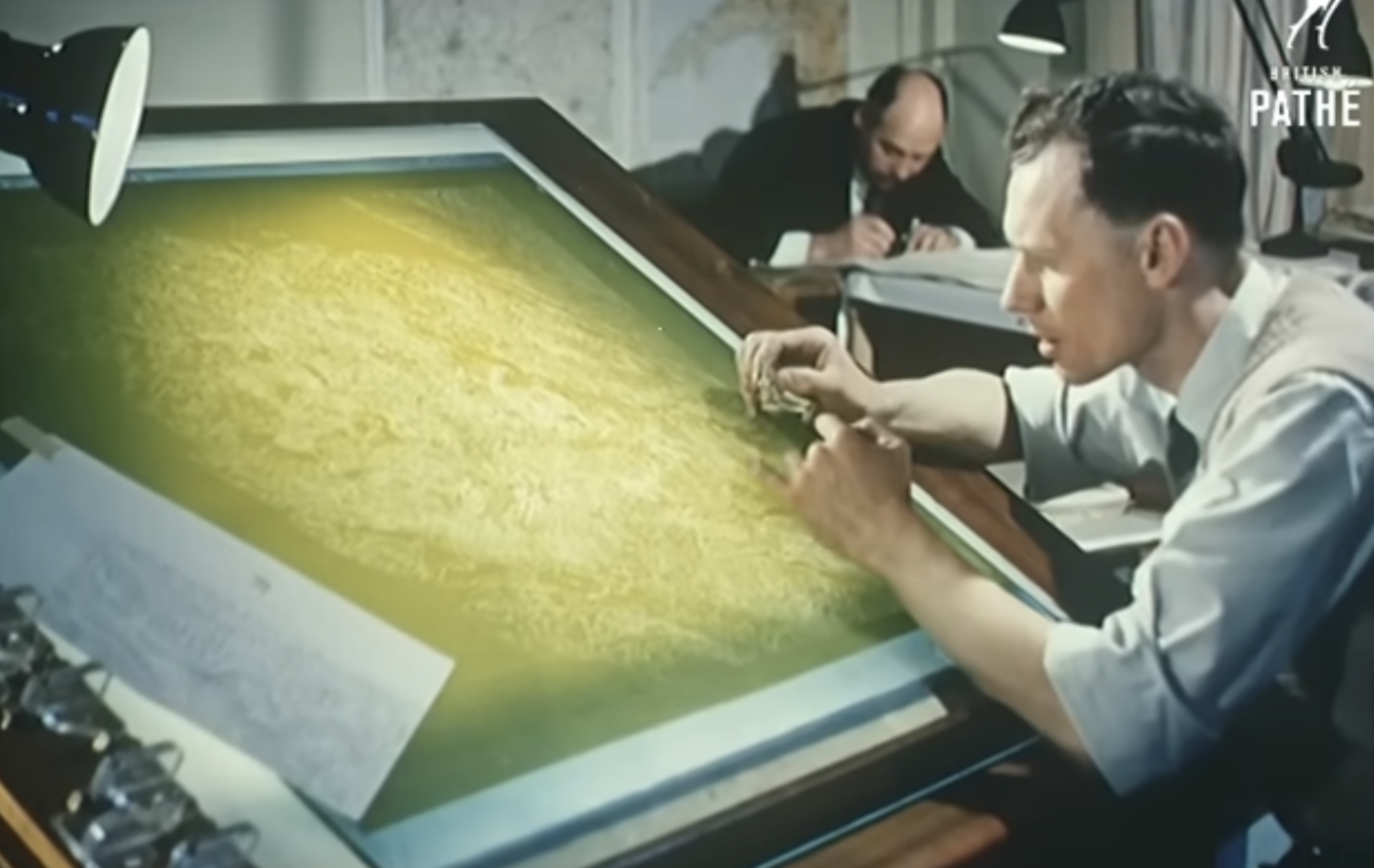
And there is footage of men in full suits stereo plotting: viewing aerial photographs through an optical instrument that fuses two flat images into a three-dimensional model, and then tracing every contour onto the map at his elbow. Scribing, the painstaking process of etching those traced lines into wax-coated glass to produce printing masters, follows. Then the printing presses themselves, running each sheet through five times to lay down ten colors. The Ordnance Survey map was, as the film notes with quiet pride, a product that Britain had largely pioneered.
I found it genuinely moving to watch. The care and craft in every step. The pride in doing something hard, accurately, at scale.
A Profession That Never Stopped Moving
The film is a snapshot of a profession in the middle of a transformation that has never really stopped. The Tellurometer was a revolution over steel tapes. Stereo plotting was a revolution over planimetric surveying. Each generation inherited a craft and handed it forward faster, more accurately, and more capably. What has happened in the six decades since that newsreel is almost difficult to comprehend when you hold it against those images of technicians bent over their scribing instruments.
Just last month, thousands of geospatial and mapping professionals gathered at Geo Week 2026 in Denver. The conversations happening there were about millimeter-accurate mobile mapping systems, AI-assisted point cloud classification, drone-based corridor surveys, and digital twins of entire cities. Sessions covered everything from large aerial survey projects using crewed aircraft equipped with lidar systems and large-format multi-camera systems to ground-penetrating radar for subsurface utility mapping.
The lidar systems on display today are a different species from anything the Ordnance Survey or any other surveyor could have imagined in 1961. Modern airborne lidar equipment can now create high-resolution ground elevation models with a vertical accuracy of centimeters, collecting millions of individual points as a three-dimensional point cloud from which structures and vegetation can be stripped away to reveal the bare earth beneath. And at the high end, terrestrial and mobile systems push into the single-digit millimeter range for accuracy. The technician who spent weeks coaxing a contour map out of a stereo plotter would not believe it.
3DEP: A Mission Essentially Complete
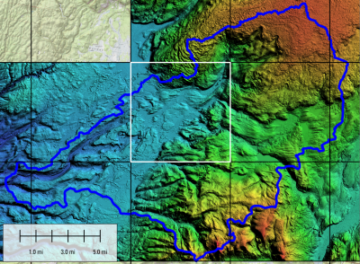
Perhaps the most concrete symbol of how far the profession has come is the USGS 3D Elevation Program. What began over a decade ago as an ambitious call to systematically collect high-quality elevation data across the entire country is now essentially done. At Geo Week 2026, USGS confirmed the completion of 3DEP, marking the end of a long-term nationwide effort to cover the United States and its territories with consistent, high-resolution topographic data.
The newest product emerging from that effort merges an enormous volume of terrain data into a single continuous national surface. Unlike earlier elevation products that were published as disconnected project tiles, this new dataset is seamless, uniform, and built to a standard that makes it genuinely usable at scale. The Ordnance Survey map of 1961 required ten carefully printed colors, a five-pass printing press, and years of fieldwork to cover Britain at one inch to the mile. We are now building a seamless national terrain model at one-meter resolution for an entire continent. That is not a small thing.
The Ground Beneath Our Feet Is Being Redefined
The National Geodetic Survey is in the midst of modernizing the National Spatial Reference System, replacing the aging datums that have underpinned U.S. mapping and surveying for decades. The existing horizontal and vertical reference frameworks have accumulated limitations over time, including positional offsets and degraded benchmark reliability, that modern GNSS technology and gravity modeling can now correct. The updated system is designed to deliver centimeter-level accuracy aligned with global standards, a meaningful leap forward for anyone whose work depends on precise coordinates or elevations.
At Geo Week, NGS shared the latest on the modernization timeline, with beta products being released incrementally for public testing. The surveying community is being asked to prepare now: update software, audit workflows, and get ready for a change that will touch every legal description, every infrastructure design, and every elevation certificate in the country. From everything I've seen, they are doing exactly that, with the same methodical seriousness the effort deserves.
FYI: Want to go deeper on what the NSRS modernization means for your practice? Geo Week is hosting a webinar on March 25, NSRS Modernization Is Here: What Surveyors Need to Know Now, that you may find useful.
Thank You
I think about the people in that 1961 film, and I think about the field crews flying lidar missions over mountain ranges, and the geodesists refining the gravimetric geoid in NOAA offices, and the licensed surveyors setting control points in the early morning hours, and the photogrammetrists processing images at 11pm to meet a deadline. They are all part of the same unbroken thread.
The surveying and geospatial community does work that the rest of us rely on every single day, mostly without knowing it. Every time a flood map is drawn, a road is designed, a property boundary is adjudicated, or an emergency response is routed, it rests on a foundation of careful, exacting, largely invisible work by this community.
So during National Surveyors Week, a genuine thank you. What you do matters enormously. The progress of the last six decades, from those scribing instruments to millimeter lidar and a seamless national elevation model, is one of the great professional achievements of our era. You should be proud of it.