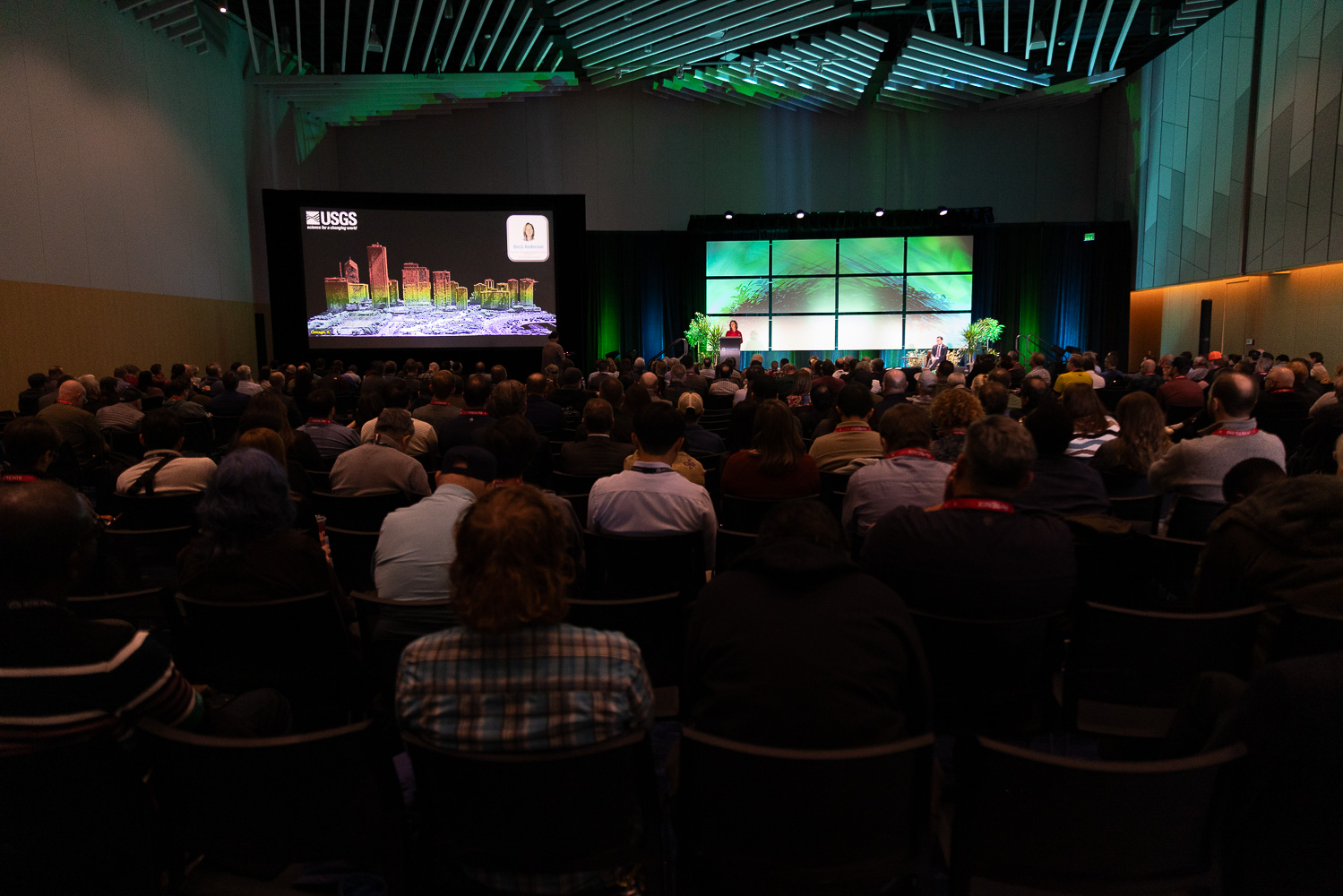
At Geo Week 2026, the U.S. Geological Survey made an announcement decades in the making: the baseline data acquisition for the 3D Elevation Program, known as 3DEP, is complete. What began as a vision that many said was impossible has become the largest national elevation mapping effort in the world, built on a billion dollars in funding and the contributions of hundreds of partners from virtually every level of government and the private sector.
A Century of Mapping Evolution

The story of 3DEP cannot be told without understanding what came before it. Early USGS surveyors carried plane tables and survey equipment on mules, climbing to the highest points they could find to chart territories that had never been mapped. That tradition of topographic mapping, launched in the era of John Wesley Powell in the 1880s, took more than a century to produce the complete 1:24,000-scale map series.
"If you think about it from when Powell was around in the 1880s and 1890s, all the way to 1991 to get those 1 to 24K maps complete... getting the entire United States mapped using lidar in about a decade is just amazing to me," said Dr. Jason Stoker, who has been part of the program since its earliest days.
USGS Director Dr. Ned Mamula framed that evolution in even broader terms.
"Today, our mapping efforts ride smoothly and rapidly on the latest and best technology... from the use of aerial photography to orbital platforms... to using lidar to the use of artificial intelligence."
Building the Case and the Community
Making 3DEP operational required more than technology. It required convincing hundreds of agencies, states, and local governments that the investment was worth it. The National Enhanced Elevation Assessment was a turning point, surveying needs across 42 federal agencies and all 50 states to build an authoritative picture of lidar's value.
Former USGS executive Kevin Gallagher described the value proposition that ultimately made the partnerships work.
"The value proposition was: for every dollar invested at USGS, we can bring four to five partner dollars to match... if there ever was a no-brainer in government, this is fully one of them."
But sustaining a federal program also meant communicating value to audiences well outside the geospatial community.
"How do we get beyond the echo chamber that is our own professional community? How do we get to the farmers, the foresters, the realtors, the roofers... and policy makers?" Gallagher asked.
His answer involved deliberate outreach, coalition building, and a clear-eyed understanding of how Congress operates.
“The nature of the program itself allowed us to show progress immediately."
Turning Points into Decisions
On the technical side, 3DEP pushed the entire industry to grow. What was once considered cutting-edge quality level 2 lidar coverage quickly became the minimum acceptable standard as densities increased, costs dropped, and automation matured.
"Lidar isn't just data, it's big data, and the 3DEP is... lidar for one of the largest countries in the world. The 3DEP forced us all to grow quickly to become successful in this reality," said Kimberly Mantey, Director of the National Geospatial Technical Operations Center.
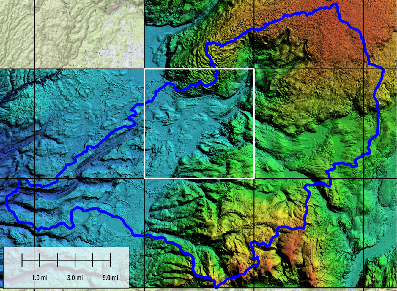
The program has now accumulated 76 trillion lidar points across the country.
The data is already proving its worth across a wide range of applications. After the Eaton fires in Los Angeles County, high-resolution 3DEP data were released publicly within weeks, enabling partners to rapidly produce debris flow modeling, safety assessments, and restoration planning. Becky Anderson, acting Director of the National Geospatial Program, put it plainly.
"When we say 3DEP, we're not talking about maps. We're talking about possibility. The 3DEP turns elevation into decisions."
Forests, she noted, are "no longer green blobs on a map," with lidar resolving canopy height and structure to power change detection and risk mapping.
What's the Next Fire?
Completing the baseline is not the end of the story. USGS is already building toward a 3D National Topography Model that integrates elevation data with hydrography to create what Stoker described as a "living model" and landscape-scale digital twin of the country.
Gallagher closed his remarks with a challenge to the community that helped build 3DEP: "What's the next fire? What's the next fire that we're going to light? We need a community effort... to achieve it."
After a decade of continuing resolutions, furloughs, shutdowns, and a pandemic, the answer seems clear: the people in that room have already proven they are capable of exactly that.