At Geo Week 2026, the geospatial industry came together against a backdrop of genuine upheaval. Artificial intelligence is reshaping how spatial data is collected, processed, and interpreted. A landmark federal mapping program (3DEP) just crossed the finish line after years of effort. The tools professionals rely on are evolving faster than the standards meant to govern them. And the next generation of talent needed to carry all of this forward is not entering the field fast enough to meet demand. The conversations that happened in Denver, across keynotes, panel discussions, roundtables, and the exhibit hall floor, revealed a community reckoning seriously with what comes next, and with what it will take to get there.
When professionals in any industry gather in one place, something more than networking happens. Trends that have been quietly building in separate corners of the field suddenly become visible as a whole. Partnerships form in hallway conversations. A question asked in one session gets answered in another. The accumulated weight of what everyone is individually experiencing becomes, briefly, a shared picture.
Here is what that picture looked like this year.
AI Is No Longer a Future State
If there was one idea that threaded through almost every corner of Geo Week 2026, it was artificial intelligence. Not AI as an aspiration or a pilot program, but AI as an embedded, operational reality in geospatial workflows.
Burkhard Boeckem, Chief Technology Officer at Hexagon, set the tone in his Day 2 keynote, declaring to a packed room of geospatial professionals that we have entered what he called the "Age of Intelligence." His presentation traced the long arc of measurement, from the ancient Egyptian cubit to today's sensor-fused digital environments, positioning AI not as a replacement for the industry's professionals, but as a tool to augment them. In his framing, the data collected by geospatial workers helps "ground AI into reality," giving machine learning systems the spatial grounding they need to be useful. The message was clear: those working in the field today are more essential than ever, not less.
Dr. Aaron Morris of Woolpert offered a complementary perspective during a panel discussion, describing a shift he calls "encodification," where established workflows are being trained directly into AI systems rather than simply automated. He sees AI functioning ultimately as an "information amplifier," combining sensor data and GIS inputs to produce richer, more actionable outputs. He also highlighted agentic AI as a technology worth watching closely, noting its potential to democratize access to spatial data for communities that have historically lacked it.
At the same time, voices at the conference were careful not to oversell. Aaron Addison of the World Geospatial Industry Council pushed back on AI hype, introducing the concept of "decision-grade data," a framework for pairing outputs with a clear understanding of the underlying model rather than treating AI results as a black box. His point, echoed by others throughout the week: trust in geospatial data is everything, and that trust has to be earned through transparency.
The 2026 conference program itself reflected this urgency, with a dedicated session on reimagining mapping with AI and scalable technologies, covering applications from automated road and asset detection to large-scale environmental monitoring using large language models and generative simulations.
Infrastructure Is a Major and Urgent Use Case
Geospatial technology has long served infrastructure projects, but Geo Week 2026 made clear that the scale and urgency of this work is intensifying.
A session on the first day of the conference titled "DOT Case Studies in Digital Delivery" brought together representatives from state departments of transportation to showcase how mobile lidar, cloud-based collaboration tools, and data governance frameworks are being deployed on real projects at scale. One highlight involved a collaboration between Michael Baker International and Mach9 on a statewide asset inventory project for TxDOT. The stakes were made concrete: traffic backups in Texas's major metro areas can cost the economy as much as $30 million per hour, a figure that underscores why accurate, up-to-date roadway asset data matters beyond the purely technical.
A complementary session from Oregon State University's Michael Olsen introduced a national Surveying and Mapping Guide for Transportation Projects, an effort to address the lack of standardized practices across state DOTs. In a line that drew knowing laughs from the audience, Olsen compared standards to toothbrushes: everyone agrees we need them, but nobody wants to use someone else's. Still, he made the case that the timing could not be better, given the impending modernization of the National Spatial Reference System (NSRS), which will require coordinated updates to reference frames and workflows across the entire surveying community.
That NSRS modernization was itself one of the six defining questions framing this year's program, described by Geo Week organizers as one of the most consequential changes the field will face this decade.
A Milestone in National Elevation Data
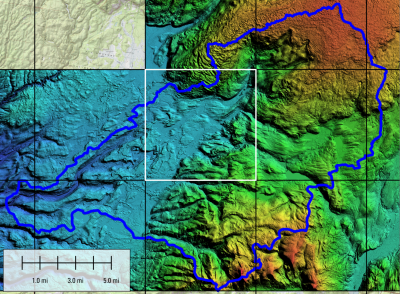
One of the most significant announcements of the week came not from a vendor, but from a federal agency. The U.S. Geological Survey confirmed the completion of its 3D Elevation Program (3DEP), a long-running national initiative to collect high-resolution, three-dimensional topographic data across the United States and its territories.
The completion of 3DEP represents the first consistent, nationwide baseline of high-resolution elevation data ever assembled. The implications are broad: better infrastructure planning, improved natural hazard assessment, stronger resource management, and more reliable environmental monitoring. USGS released new imagery accompanying the announcement that illustrated both the scope and quality of the dataset.
For an industry that has spent years making the case for the value of spatial data in public decision-making, 3DEP's completion is a landmark proof of concept.
The Workforce Gap Is a Crisis in Plain Sight
If AI was the dominant technical theme of Geo Week 2026, the workforce was the dominant human one.
Day 2 of the conference featured an extended discussion of what researchers are now quantifying as a structural crisis: demand for geospatial talent in North America is growing nearly five times faster than the number of qualified graduates entering the field. That gap has been widening for years, and the panel made clear it will not close on its own.
Grace Braver, a master's student at East Tennessee State University, offered some of the most grounding testimony of the week. In six years as a geospatial student, she had never once seen a geospatial company at a campus career fair. Entry-level job postings range from requiring a high school diploma to demanding a master's degree and years of experience. Conferences where real networking happens are expensive, and for students weighing rent against a plane ticket, attendance is not a realistic option.
Her ask to the industry was simple: show up. Go to universities. Make your presence felt before students are already lost to other fields.
Proposed structural solutions discussed on the panel included a university consortium modeled on Space Force academic partnerships, a shared seasonal talent pool among smaller firms, and dedicated student networking spaces at industry conferences with travel support. The most persistent theme, though, was simply connection. Jessica Touchard of GeoSearch Inc. put it directly: personal relationships are how most people find their way into this field, which means the field will only grow as fast as the people in it are willing to reach out.
What It All Adds Up To
Geo Week 2026 made the case, repeatedly and from multiple directions, that geospatial technology is no longer a niche specialty. It is becoming foundational infrastructure for how societies plan cities, manage assets, respond to disasters, protect ecosystems, and make decisions under uncertainty.
The professionals in Denver this week are working at the center of that transformation. The challenges are real: fragmented data, a talent shortage, standards that lag behind practice, and the constant pressure to prove the value of spatial thinking to people who don't yet think spatially. But the tools are more capable than they have ever been, the applications are expanding into new industries and new scales, and the energy at the event reflected a community that knows it is building something important.