
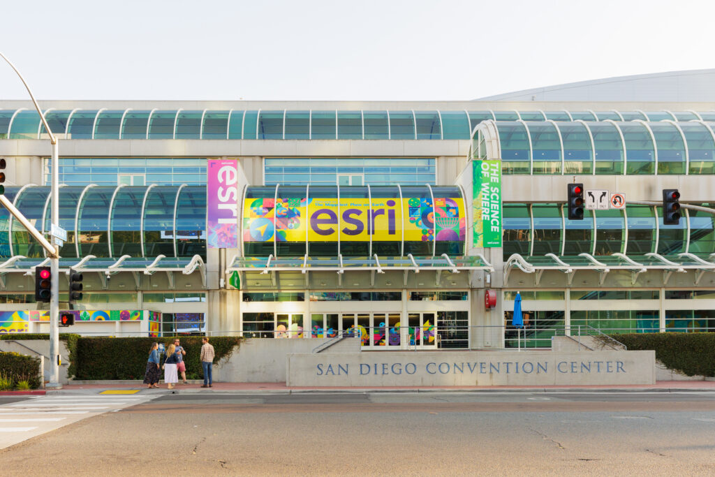
Every summer in San Diego, California, GIS professionals and others from the broader geospatial industry come together for the annual Esri User Conference, one of the biggest events on the schedule every year for the sector. The company says that over 20,000 people generally attend the event in person, with roughly the same number attending virtually around the world, which reflects Esri’s outsized presence in the geospatial world. The week-long event includes a full day of plenaries, traditionally kicked off by Esri founder and president Jack Dangermond, followed by a week of sessions around Esri’s products and GIS more broadly, and a packed exhibit hall floor.
This year, Geo Week News was able to make the trip to attend the first three days of the event, sitting in on those plenaries, talking with staff members from the California-based host company, witnessing demonstrations from start-ups and users of Esri’s tools, and speaking with professionals from every corner of the sector. There is a lot to unpack from this massive event, and last week we published a few of the big announcements made by Esri in the week. Today, we’re stepping back to highlight our three biggest takeaways from this year’s event.
Mapping is the Common Thread
As alluded to above, the traditional kick-off for this annual conference – or meeting, as Dangermond tends to refer to it – is the founder taking the stage to set the tone for the week. The general theme of this talk is pretty consistent year-to-year, talking about the ways that mapping and geography brings together so many disparate pieces of our society, but tying in the latest technological developments that have shaped the modern industry. This year was no different, with Dangermond effectively hammering home the idea that maps are the common language that tie together the different parts of our society.
“Geography, the science of our world, provides us a kind of instrument, a scientific lens, for not only seeing but also illustrating and understanding everything,” Dangermond told the large plenary room. “Maps provide us the language for that common understanding, telling stories about everything.”
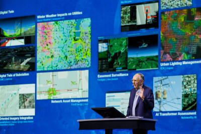
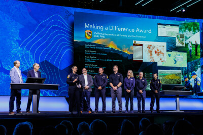
To further illustrate this point, Dangermond looked at all of the different industries that are utilizing Esri’s ArcGIS products based on submissions from thousands of their customers. Nearly every sector one can think of utilizes GIS technology and provides further context for their customers and internal teams with maps. He showcased things like environmental monitoring, tracking biodiversity across time and space. Healthcare breakthroughs, discoveries, and treatments are being augmented with this geographic context. Public safety is being revolutionized by this process, as demonstrated through a presentation from Cal Fire. And of course, industries like construction and surveying regularly rely on this data to complete their work.
It’s often said that Esri is one of the largest companies you’ve never heard of – “you” referring to the general public and not the geospatial industry, of course – and I think that same sentiment applies to mapping more generally. Most people hear about mapping and think about the explorers from centuries ago, discovering the “New World” for the first time. What they don’t realize is that nearly every entity they interact with relies in some ways on mapping data – something only becoming more true as more services become location-based. On the flip side, I think those in the industry can forget just how differently, but equally as powerfully, other industries are using the same technology. One of the things I always appreciate about the Esri UC is this opening talk, bringing this idea to the forefront and having everyone on this page to start the event.
GeoAI
While that opening plenary from Dangermond is always pretty similar, one of the big differentiators for this year’s User Conference was the presence of artificial intelligence in nearly every conversation and presentation. This wasn’t the first UC for which AI was a major talking point, of course; there hasn’t been a tech conference in three years that hasn’t been heavily centered around the topic. However, this is the year it felt like the industry stopped talking about what could be done, and the conversation shifted to what is being done. Just look at the announcements mentioned above – many of those center around the developing AI tools.
At one point during the plenary presentations, it was mentioned that ArcGIS is “becoming a GeoAI platform.” In many ways, it makes sense that GIS would be one of the areas in which artificial intelligence can make a major impact in its current form, to say nothing of what AI could look like in two, three, or even five years. To put it in its simplest terms, GIS involves layering multiple datasets on top of one another to create one, visual, contextual piece of a puzzle. Many times this can be simply visualized, but as more layers are added, and these layers contain more complex data, the process of analyzing the data – or even creating the visual – becomes more difficult.
Esri showed off throughout the week how artificial intelligence is starting to change this. They introduced, for example, new coding assistants that will allow users to type in common language prompts to create code for specific problems, streamlining what can be a tedious process to get the desired end result. At an imagery summit held later in the week, presenters showed countless ways in which AI is being used to parse vast amounts of imagery data to, for example, quickly detect meaningful changes to certain locations on the globe.
As an attendee, though, the light bulb moment for AI’s power in this field was some of the public-facing opportunities. One of the most powerful uses of GIS can be to express future plans, or current realities, for local areas. The public is not always able to easily read these maps, however, or figure out how to file a georeferenced request for service. Esri showed off how large-language models are being leveraged to create chatbots that can query and give back details from the system – these were shown for both external and internal users – as well as a tool to submit a maintenance request in a different language that was automatically translated to English. While not the kind of innovation that will transform an organization, these developments can make real and meaningful differences for local communities.
Is AR/VR Making a Comeback?
Or maybe it never left? It has seemed that, over the last couple of years, the enthusiasm for virtual and augmented reality tools in enterprise spaces has waned a bit. That’s not to say it’s been gone entirely – we’ve covered plenty of AR and VR tools at Geo Week News in that time who have been embraced by their users – but it hasn’t met the hype that many had for it five to ten years ago. Last week in San Diego, though, there were multiple mentions of the technology, and it seems like more use cases are being explored, thanks in part to GIS.
Virtual reality specifically came up during the plenary presentations, with Esri representatives and customers showing how their 3D maps can be viewed in virtual reality, either wearing a headset or moving through the scene on a desktop. This method, they say, allows for greater collaboration and immersion, really being able to see a plan or area in full context in a way that wasn’t possible a few years ago.
One demonstration from Houseal Lavigne, an urban planning and design firm, hammered this idea home, though through a gaming system rather than virtual reality. They described a project they had been working on with the city of Wake Forest in North Carolina, with new buildings being proposed around the downtown area. Locals had been against anything over three stories being put in the area for fear of drowning out the historic downtown, but this virtual walkthrough showed that, thanks to the topography of the area and hills around downtown, even a six-story building would not be visible from the downtown area due to the surrounding hills. This kind of immersion helped pass the proposals through.
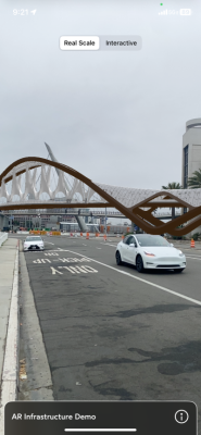
Another demonstration leaned more directly on mixed reality, with Incitu demonstrating the power of their AR tools, Also working to help the public better understanding a new proposed project, or one under construction, they showed how they can create QR codes to be scanned by the public to see a virtual model, in real-world context, through a phone. Often, it can be one thing to describe a project, but actually seeing how it will look and fit within a current development can change one’s views completely.
There is still plenty of room for skepticism around the large-scale adoption of VR tools, especially over the next few years, as it’s unclear that many organizations want to pay for multiple high-quality headsets, or if professionals want to wear headsets for significant parts of their days. However, this year’s User Conference showcased very real use cases for both VR and AR, even without those headsets, and how being able to tie them to specific geographic context can drive more of this value.


