It was the end of the rainy season in the Amazon Jungle, and we had only two months left to comply with the customer’s request to determine the height of the tree canopy in his mining concession in the dense, tropical forest. The only map available in the area had contour lines exclusively of the vegetation and there was no information about the ground elevation or features.
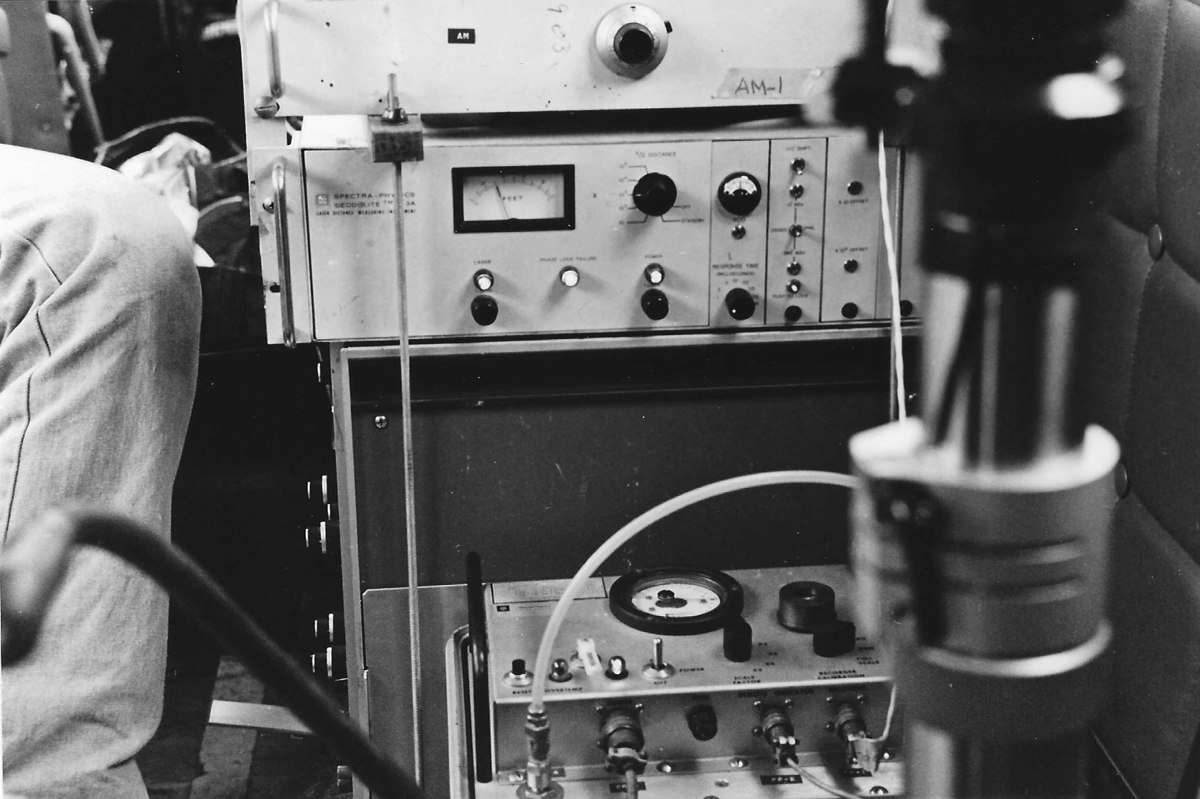
We were testing a new technology: a vertically mounted single-beam laser that would hit the trees in a straight line and occasionally would reach the ground, giving us enough data points to extrapolate the contour lines of the rough surface. The bulky equipment was an Airborne Profile Recorder (APR) called Geodolite 3A and manufactured by Spectra Physics and equipped with an analog printer attached to it that registered the laser hits on the surface below and a barometric altimeter to record the flying altitude.
Because in those days satellite navigation was in its early stages and mainly for military purposes, positioning the laser lines precisely on the terrain was a challenge and we resorted to traditional photogrammetry by mounting a 35 mm camera right beside the laser beam to photographically record the terrain and use these features to identify the location of each line.
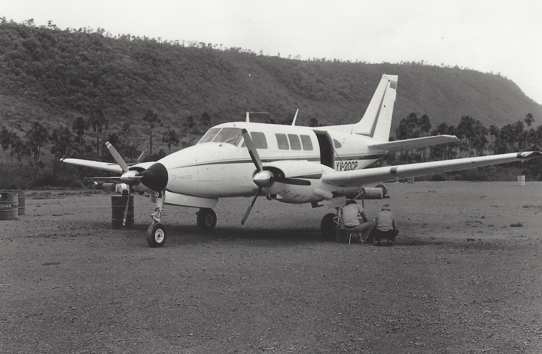
It was early 1981 and we had mounted the laser, the printer and the camera in a 1962 Beechcraft Queen Air that had the bottom fuselage opening big enough to accommodate the bulky piece of equipment.
Unfortunately, a key component in the laser that generated the concentrated light was weak and the beam was not strong enough to penetrate the photogrammetry glass that was installed on the aircraft, so we were forced to remove it and fly with that horrendous noise for hours on end. In order for the narrow laser to register the altitude of the canopy and occasionally the ground, we were forced to fly at 2,500 feet, which in the Amazon is dangerously low, but we had no choice.
The signal was just enough to start our mission, so we ordered a new part to the U.S. and departed due south to what would be our home for the next few weeks, the Canaima National Park airport deep in the jungle. In those days this remote airport was used once a day by a commercial airliner jet that brought tourists to the area to see Angel Falls, the world's highest waterfall, with a total height of 3,212 feet. It was a convenient location because it had a hotel, a restaurant and a relatively quiet runway. The plan was to fly with the weak laser until we could replace it with a new component that would give us better altitude with the same APR results. So, we ordered the part and left for the Amazon jungle on our Queen Air.
The mission was simple enough, flying a straight grid of lines North-South and East-West separated one mile from each other and covering an area of 325 square miles or roughly 208,000 acres. It was a total of 700 linear miles of flying; 350 in East-West direction and 350 in the North-South direction. To determine height of the vegetation, every time the laser hit the canopy and occasionally penetrated and hit the ground, it was recorded in continuous graphical form on paper tape. Profiles would be identified on the mapping photography by means of the 35-mm photographs exposed every 3 seconds to yield stereoscopic coverage of the ground beneath each APR line.
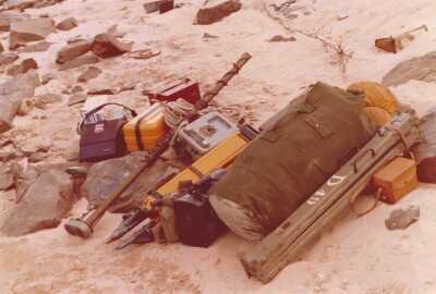
The flight south was uneventful enough and we landed in Canaima in time to check the 16, 55-gallon drums of fuel that we had purchased in advance. There were no fuel services in Canaima, except for the commercial airliner, but it was jet fuel and useless to us in a piston aircraft. The daily fueling of the aircraft was an ordeal in itself that involved a manual pump, buckets and a chamois cloth to absorb the water in the fuel.
The next day the weather was acceptable, and we flew the 15 minutes to the location of the project and began flying north-south lines maintaining a strict separation of one mile between lines. While the aircraft was flying at 2,500 ft altitude AGL (above ground level) and about 110 knots (126 mph), the laser was hitting the thick canopy and occasionally the ground and the results were shown on a continuous piece of paper on the printer.
The upper line in the printer, in color green, showed the canopy and the occasional long hit defined a point on the ground, so we manually connected these bottom points with a continuous line using a brown, wax crayon, thus extrapolating the ground profile.
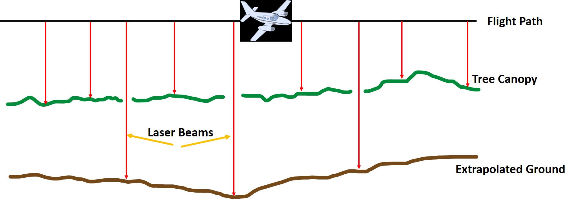
Every time we flew over a river, the two lines became one, as the canopy laser hits and the line drawn in brown crayon merged, becoming a helpful feature to locate the position of each flying line on the map.
I noticed that the green line was beginning to show gaps, so I asked the pilot to descend to 2,000 ft and that solved the problem. After a few more lines, the gaps in the green line returned, so I asked the pilot to descend to 1,500 ft and once again the green line became continuous.
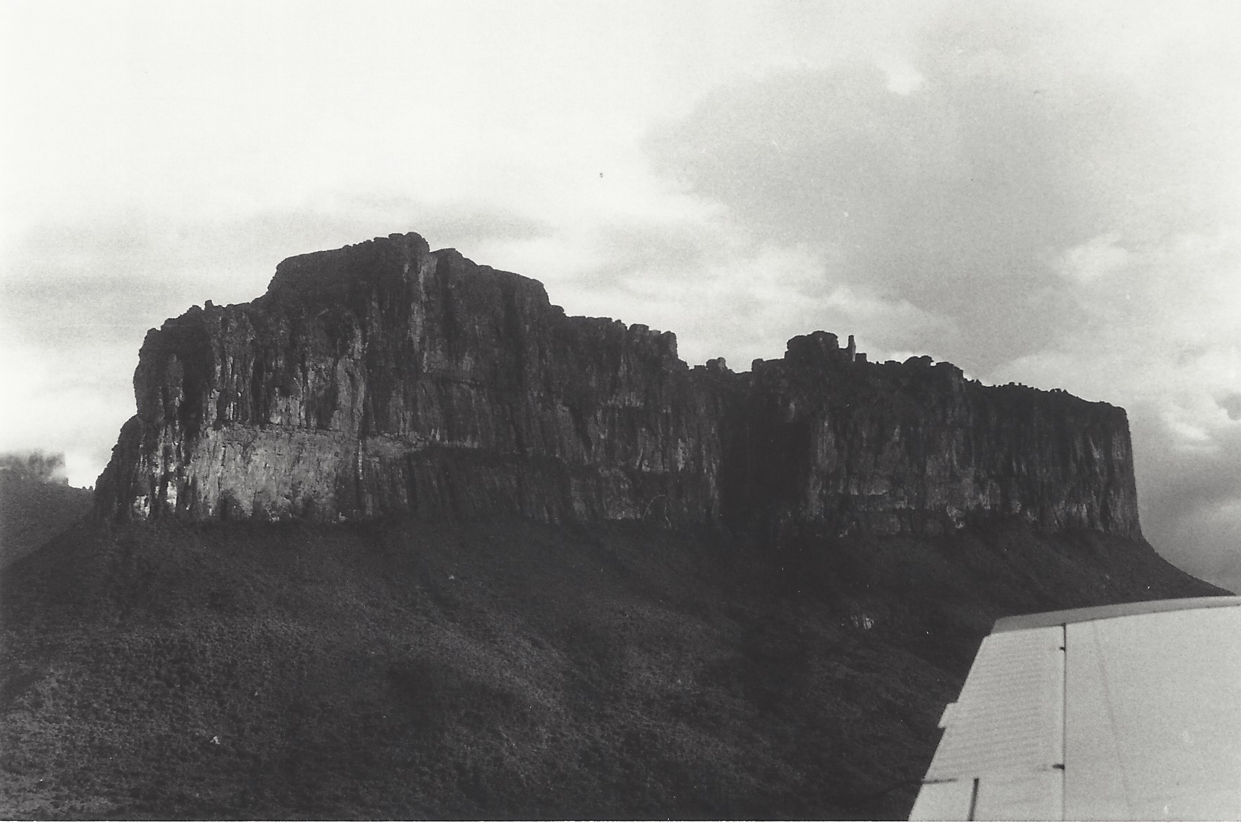
It was obvious that the laser was losing power by the minute, and I had to make a decision on how low I was comfortable with flying over such unforgiving terrain. Suddenly one of the engines coughed, possibly because of a few drops of water in the fuel lines and we lost 500 ft in an instant. I looked out the window and what I saw convinced me that our current altitude was not safe. We were flying about 1,000 feet below the nearest mesa and that was unacceptable due to the possibility of clouds obscuring the top and creating Instrument Meteorological Conditions (IMC) in a geographical area without any navigational aids.
After another brief cough from one of the engines we made the painful decision to cancel the flight and return to Canaima.
The day’s mission may have been grounded, but the story was only just beginning.
To Be Continued….