A continuation of a story from Juan Plaza about his experience with the APR. Read Part 1 >>
After the excitement (and disappointment) of the flight we had to scrub was behind us, I sound found myself aboard a commercial airliner back to Canaima with a little brown box covered in postal stamps. It weighed about a pound and inside was the spare part to return the laser of our APR to full strength, which would hopefully allow us to fly at least at an altitude of 4,000 ft AGL (and save us from flying below those intimidating cliffs).
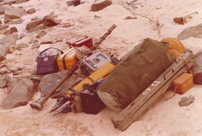
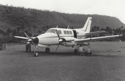
As soon as I deplaned, the team was waiting for me at the small terminal and we walked directly to the aircraft, parked about two hundred feet from the busy commercial section of the airport. Rudy and the pilot had already opened the case that houses the laser—a sturdy, padded container designed to protect the delicate optics and electronics from the jostling of the flight. Before we finished, I took a moment to refill the printer with fresh green ink. With the supplies topped up and the system tested, we all felt ready to seize the next window of clear weather, hopeful for a longer and more fruitful flight.

It was too late in the day to attempt a test flight, so we decided to wait until the next day, and thankfully our patience was rewarded.
The next day was clear with low humidity (for the Amazon jungle, that is) and a forecast of light showers in the afternoon, so we took off and climbed to 4,000 immediately to save fuel. As we approached the area with the first line, we turned on the laser, the printer and the camera and tested the entire set; everything was working fine, so we entered the first line with wings leveled and began our first session of the day.

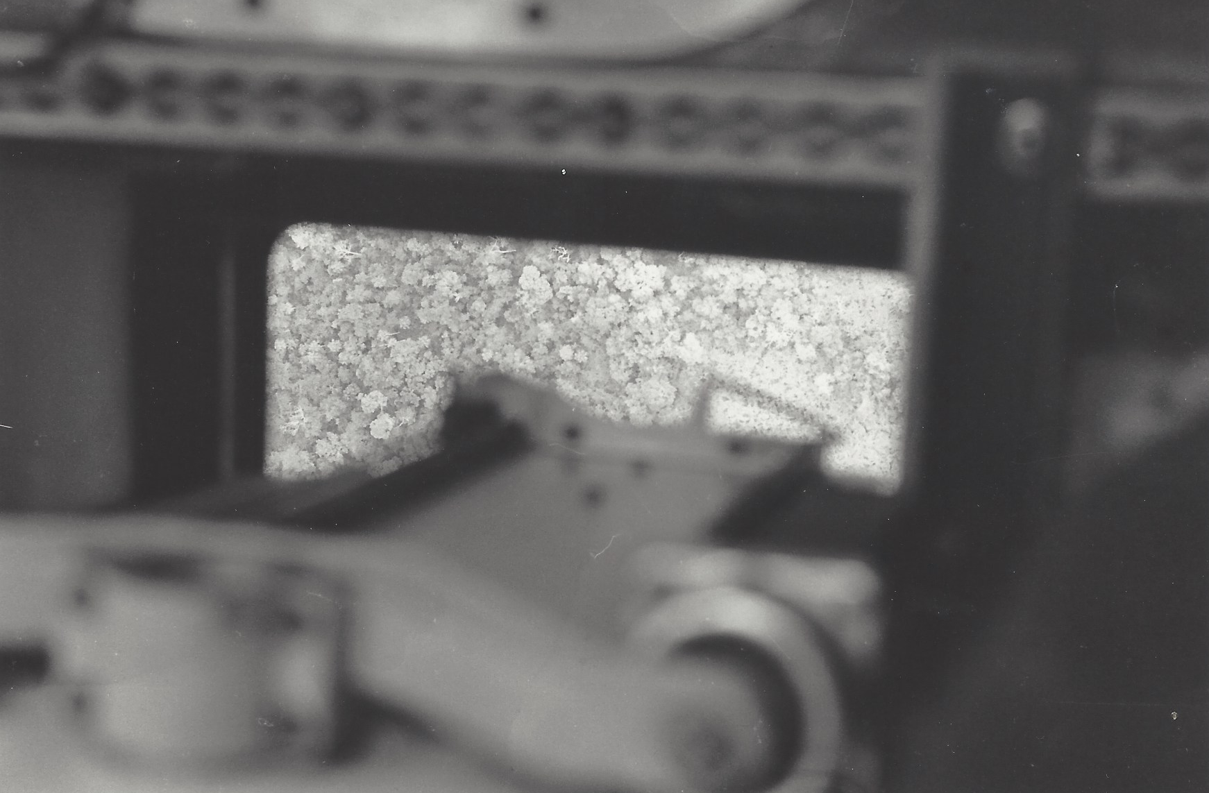
The signal return from the laser was strong and the printer began drawing a firm green line that occasionally touched the ground as we continued joining these lower points with our brown crayon, creating a crude extrapolation of the jungle surface.
We managed to fly for over two hours, covering about 40% of the project, until the clouds began to form and clot together, creating a menacing ceiling that seemed to be getting lower as the minutes passed. In those days there were no navigational aids so far south, so there was no way to fly using Instrument Flight Rules (IFR) and we were forced to fly visually all the way to and from Canaima.
After completing an east-west line I signaled Rudy to turn off the equipment and asked the pilot to return to the Canaima. He gave me the thumbs up and made a hard turn towards the airport.
What we saw on the horizon as soon as the turn was completed proved that we had waited too long to return. The horizon was blackened by a thick wall of rain that made VFR flying impossible.

The pilot turned to me and said, “Look for a place to land!” and I froze.
Rudy, who was a veteran of the region, probably saw my panicked face, and patted me on the back, signaling that I should go to the window and begin looking. Fortunately, a few minutes later, we found a small, dirt runway that was barely long enough for the twin-engine plane. Rudy tapped the pilot on the shoulder and signaled in the direction of the open patch of jungle.
The pilot smiled and gave him the thumbs up. A few seconds later, with landing gear down and full flaps deployed, we approached a wet piece of jungle that had been deforested and flattened just enough to accept small single-engine planes. The pilot used every inch of that improvised runway and we landed safely.

A Franciscan priest surrounded by small Yanomami children came running to the aircraft and helped us deplane. We spent the night in the improvised mission under straw roofs that had no walls, but at least we had hammocks and a delicious dinner of cassava and fried fish. I wish I had photographs of the runway or the group that greeted us, but I was too caught up by the landing and spending the night in the jungle to think to take any.
The next day we woke to see that the skies were clear. We were also close enough to the project area that it made more sense to keep flying lines with the fuel we had remaining, rather than returning to our base.
That morning, we managed to complete 75% of the mission before the fuel gauges had reached ¼ full, so we decided to call it a day.
That night, back at our hotel rooms it was time to develop the film. With the ups and downs of the mission still fresh in our heads, we marked the photographs according to the sequence and the lines on the printouts. We undertook an arduous and tedious process of identifying every time we crossed a river and correlating that information with our time stamps on the paper printout.
It took hours, but by midnight Rudy and I had been able to identify exactly the location of every line flown over the past two days.
Over the next week, we completed the rest of the mission and returned to Caracas with long rolls of printouts, dozens of developed film cans and a notebook brimming with useful notations.
The office crew went to work and quickly assembled, on a large working table, covered by a clear sheet of mylar, the long printout lines aligned with the corresponding photographs. Once they were convinced they had the correct lines, they painstakingly transferred the ground hits to the mylar underneath, nothing the altitude on the right side of each point.
The resulting mylar resembled more of a conventional tachymetry map, which allowed the technicians to quickly interpolate between the points, creating a detailed set of contour lines that now reflected the bottom of the trees, not the tops.
The final product delivered to the customer was a set of maps with contour lines every 10 meters and a transparent mylar with the extrapolated contour lines of the jungle floor. The end user would be able to quickly determine the height of the canopy at any given point inside the project area.
Aftermath
Over the course of the office work, it was determined that flying a grid was really overkill and that there was no need to fly lines that would intercept each other. We decided that on future projects, only parallel lines would be flown, reducing the flight time required (and risks associated with that increased flight time) almost in half.
Learning from our mishaps in the first part of the mission, we also ordered a number of spare parts for the laser, knowing that eventually the strength of the signal diminished and it would have to be replaced periodically.
We were not the first to choose to fly only parallel lines, rather than a grid. This technique had been in 1976 when my boss, Herman Arp, flew a similar but larger mission. Our method of flying a grid was a test to explore whether a grid would result in better resolution, but it proved not to be the case. Mr. Arp’s findings were published in a technical paper on the American Society of Photogrammetry and Remote Sensing (ASPRS) in the U.S. That paper contains a lot more technical details about the technique and can still be found at this link.
Reflections
There is no doubt in my mind that these early experiments inspired people all over the world to begin exploring ways to increase the density of coverage and those efforts inevitably led to the creation of lidar, the Light Detection and Ranging technology that is available today.
It is incredible to believe that in only 50 years the technology went from a bulky piece of equipment with a camera and a printer, mounted on a twin-engine plane, to something that nowadays can be installed on a drone and create point clouds with millions of perfectly accurate points.
Only by living through the evolution, can we really appreciate the scale of the change that this half-century has brought to our profession. I’m glad I was part of it, even when it meant landing in wet, clay runways in the middle of nowhere.