Every Tuesday here at Geo Week News, we’ve been looking at stories from our friends around the industry covering the wide expanse that is the 3D technology space. Calling it a “wide expanse” is certainly no exaggeration, either, as we continue to see different industries, parts of the world, and professionals benefiting commercially, societally, or some combination thereof thanks to these tools. That continues today with another look at all of the ways both the hardware and the software required to create accurate 3D representations – be they full maps or individual assets – are making real-world impacts throughout the world, and outside of it.
This week, we have three more stories talking about three separate 3D systems making very different kinds of impact. First, we head over to the United Kingdom for a look at how 3D scanning along with artificial intelligence is being harnessed to preserve maritime heritage. Then, we head out of this world to see how 3D mapping is being used on the International Space Station. Finally, we come back to Earth and head under the sea to look at 3D mapping of coral reefs.
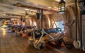
Archaeology meets AI to help Preserve Maritime Heritage
Art Dependence
Here, we have a story from the University of Southampton, who collaborated on this project with the National Museum of the Royal Navy. The collaboration involved a restoration of the HMS Victory – a famous warship from the Battle of Trafalgar – that included laser scanning to create a 3D model of the entire ship. The team also incorporated artificial intelligence to analyze the ship and help with the restoration project. It’s an example of a workflow that is made possible by both the laser scanning hardware that can create these accurate models along with improved AI to complete some of the tedious tasks formerly taken on by humans on the team.

CSIRO 3D mapping tech blasts off for International Space Station
The National Tribune
We talk a lot here at Geo Week News about all of the ways that geospatial technology, including laser scanning, helps to make our planet a better and safer place. That’s all still true, but we’re also seeing how these tools are helping missions off of our planet. This article covers just that, looking at technology built by Australia’s Commonwealth Scientific and Industrial Research Organization being used on the International Space Station. This technology will create accurate 3D maps of the ISS that are “in greater detail than has ever been achieved before,” according to CSIRO’s research group leader.
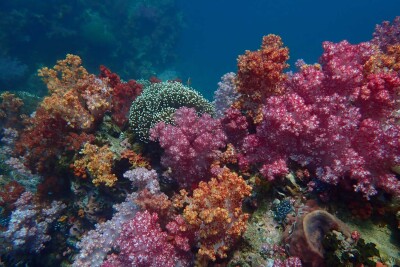
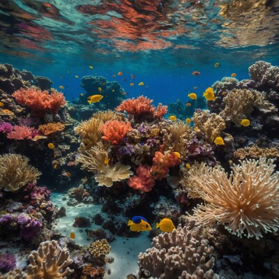
AI system can produce 3D maps of coral reefs
Pranjal Mehar | Tech Explorist
Finally, we go from the skies to the sea with a look at how similar 3D mapping technology is being used to better understand coral reefs. Not only are coral reefs some of the most beautiful naturally occurring spaces on our planet, but they also provide key insights into how wildlife can be affected, and already is being affected, by climate change. This article looks at how 3D mapping and AI can help provide detailed maps of these spaces and give us a much better baseline of understanding around these reefs.