The profession of surveying has undergone several major changes through history, but remains a crucial tool for gathering accurate geospatial information across industries. The technique, profession, art and science of surveying has been assisted by technological developments, including 3D laser scanning, mobile mapping and more.
Harald Saeger has seen many of these evolutions through his 45 year career in the surveying profession. Starting out assisting his father’s surveying company as a child, Saeger has been exposed to the entire gamut of tools available, and sees a bright future for the profession. Currently a Senior Account Executive for Laser Scanning at NavVis, his experience has now brought him to the world of mobile mapping. We caught up with Saeger recently to ask his unique perspective on the evolution of surveying.
Can you give us a little bit of your background in the surveying profession and mobile mapping industry?
Growing up, my father had his own surveying company, which was in the German countryside and not very technical, but that’s where I started off nearly 45 years ago. I started going with them into the field, and as a teenager I went with them as a measuring assistant. Then, after joining and serving in the military, I went to university and received a degree in Geodesy.
I studied at Bochum University of Applied Science, and I worked there as an assistant professor, and then in their facility management laboratory. I then took a job at Leica Geosystems, when I saw a job posting for a sales rep for 3D laser scanning. And that was in 2003, so 19 years ago, and that's where my business experience began.
From 2006 to 2008. I was employed by Z+F working with phase-based scanners,and then moved back to Leica in 2008. At the start of 2021, I made my way to NavVis as a Senior Account Executive for laser scanning professionals in Northern Germany.
What have been some of the major changes to technology that you’ve seen over this period of time that have advanced the surveying industry?
Even though we began, literally, in the countryside, my father was an early adopter of computers, using CAD systems and plotters, which was amazing to me at the time. But the main milestones that I recall were the total stations with reflectorless measurements that eventually became the base for 3D laser scanning. Then, of course, GNSS, which a lot of surveyors thought would be a substitute to replace total stations, and that once it hit the market, it would kick out the total stations. That thinking turned out to be completely wrong, and in reality, GNSS was a complementary technology for the surveying industry.
The story of GNSS is an interesting point for laser scanning. Why? Because we didn’t make the same mistake when we educated the market in the early 2000s about laser scanning. Nobody knew what a point cloud was or what they could do, or what kind of visualizations were possible. We sold laser scanning at that time as a “third column” in the surveying market. So you had your total station, you had your GNSS, and now you will get the traditional laser scanning - TLS - and that’s great.
For laser scanning, 2006 was also a milestone year, because that was the year that the Z+F IMAGER 5006 and the Leica HDS 6000 were released. These were the first sensors to have the power,storage,and control inside of the device, so it was the first all-in-one scanning device. The next milestone might be in 2010 with the FARO Focus, which was the first five kilogram scanner. It was unbelievable when we first saw it - we couldn’t believe how portable and powerful it was. Of course, the release of the Leica BLK360 weighing in at 1 kilogram was another key point as well. NavVis VLX and accurate mobile mapping systems were the next big step I would say - not the one-off systems, but the well-built systems that are designed to handle and deliver data quality close to a TLS.
So when it comes to mobile mapping, do you see mobile mapping as a potential replacement for traditional laser scanning, or as a complementary tool?
It’s absolutely a complementary tool. If I go to customers, I would never tell them, “Okay, now that you have a NavVis VLX, you can throw your traditional laser scanner away.” Most of our customers are using both in the same workflows. They almost always have a TLS, and because most of them have years and years of experience in the TLS or laser scanning market, they know exactly where they should use NavVis VLX. They know which projects are suitable and which are not so that’s why mobile mapping will always be complimentary.
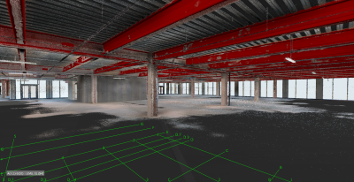
For example, I’m sitting in a building with six stories, and you would not want to scan six stories of façades with a NavVis VLX. But of course, on the inside of each floor, NavVis VLX will work perfectly. The accuracy is good enough to produce BIM LOD 300 models and such. Additionally, because of the speed difference, a customer can easily calculate and justify their ROI, because it is six to ten times faster to cover an area that size with a mobile mapping device compared to a TLS. So overall, I’d say that a hybrid workflow is always the way to go.
To learn more about the future of surveying and mobile mapping, watch a recent webinar from NavVis that takes on the evolution of these technologies.
Have you seen any of your clients use mobile mapping in a way that you didn’t expect - any new applications or something that was particularly well suited to mobile mapping?
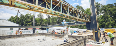
The best example for me are chemical plants. It would be extremely useful to have the whole site with everything visible in the point cloud and panoramic images, but nobody’s doing it because it’s too expensive or it takes too long. That’s a great application for NavVis VLX or a mobile mapping system. If you have a very big plant, you could even drive through the streets, and scan these large areas in an economical way, so that you can deliver the data quickly.
That’s the main point - to deliver the data quickly. For detailed engineering, you have to go in with a TLS and scan that area, but nothing more than that. Because for all the other needs; for security reasons, fire safety, locations of chemical showers in the plant, etc., the accuracy is good enough with the mobile mapping device. You can scan everything with a TLS, but it doesn’t make sense to do it. With mobile mapping in the mix, the field gets wider and wider, which allows you to now capture this kind of information in an economical way.
Mobile mapping systems can open completely new markets when it comes to documentation or visualization of facilities or sites in the cloud. I see this often with local town authorities. They don't necessarily have the budget to renovate or repair their facilities and structures as it often requires hiring expert resources for extended periods of time. With mobile mapping, municipalities can capture the information that they need, create documentation, and take action in a fraction of the time and, most importantly, at a much lower cost.
If you’re choosing between what type of scanner to use, are there other parameters that are important to consider when you’re trying to decide which tool to use for a particular job (besides speed and time)?
A lot of the engineers we work with are looking at accuracy of course, as well as resolution. I’ve seen some customers who want to model things in great detail, so accuracy, resolution quality, and distance/range could be factors to consider.
Going back to speed, I think that’s a big driver of economic impact. In conjunction with data quality and image quality, speed is the main point. Also, behind that data quality is a lot of intelligence in the filtering of the data within the systems themselves, which adds a lot of value. We once had a customer who tried to build a laser scanner himself, and when he saw the output and compared it to ours, he said, “Your point cloud is way too good!” And yes, it’s because of the filtering and processing that makes it easier to get 2D and 3D models out of the captured data. The resulting data is clean and small, even after exporting.
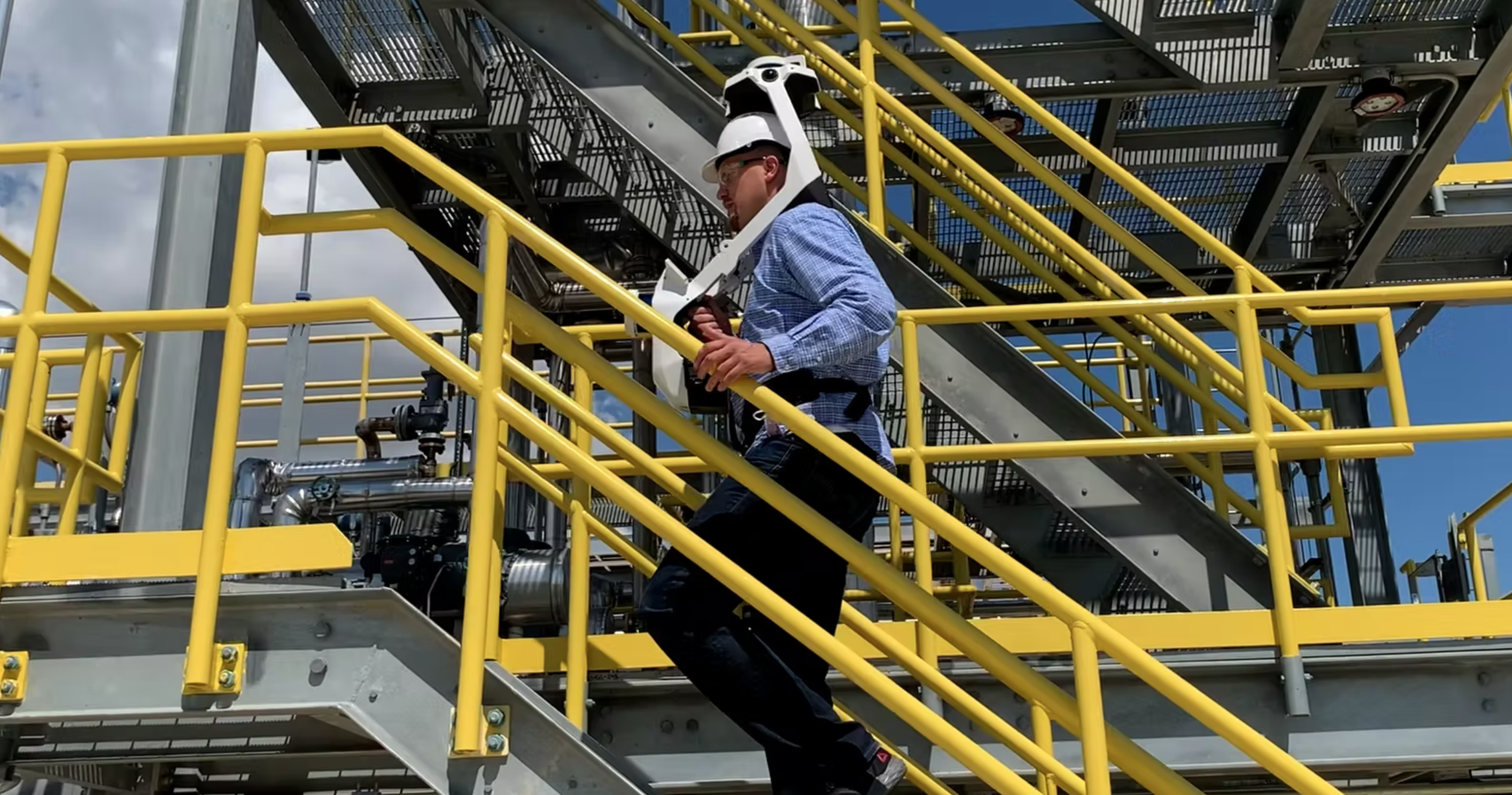
Form factor is important as well. Why does the NavVis VLX look like it does? Because form follows function. When I first joined NavVis, I saw an excellent presentation from our product development team explaining why NavVisVLX was designed to look like it does. Why is the sensor so high above your head? To accommodate hard hats on construction sites. Why is the center of gravity in front of me? So it remains upright rather than tilted like a backpack. With a backpack, every corner I turn I’d hit the scanner. When users wear NavVis VLX and work with it for the first time, they begin to understand those things and the reasons it looks the way that it does. And that could be why so many people are choosing it as such a dynamic system.
So for those who have not previously used mobile mapping and may still be unsure of its contribution, what would you like to tell them?
I always tell people to look at the output from a mobile mapping device compared to the data they capture with their traditional methods. When you talk to TLS-focused people, they tend to do cloud-to-cloud registration over unbelievable square meters of area, with hundreds of scans. It’s incredibly accurate, but for that size, I would use mobile mapping. Especially when it comes to huge sites, it’s just the best way to tackle it.
However, I will say that when situations change, like when you need to add buildings and surrounding buildings, you’ll often need the geometry. In the end, there will always be cases like this where using a combination (of mobile mapping and TLS) will be better, but I always encourage people to try it out.
I would like the market to know, however, that the accuracy - especially for NavVis VLX - is very high and very good for most mapping challenges on construction sites. We know our customers are looking for accuracy, and they want to use the best instrument for all the challenges they might face.
What are you excited to see on the horizon for the surveying industry?
Lots! If you look at, for example, what’s recently happened with the iPhone. With lidar you can see endless possibilities of where we are going. Maybe in the future you will have a mobile device like that where you can scan and visualize all of your surroundings, while Apple (or whoever) collects all the data. Or if you're driving your car and the car has lidar sensors, you can obtain your location and surroundings in real-time. Maybe we collect 3D data for digital twins with our daily equipment just on the way to work.
But in the near future, I would say that the main focus is software advancements. For example, getting good 3D models of the environment from point clouds directly with intelligent modeling tools. It is interesting to see what is happening with mesh functions, and maybe that's the first step. There are also some question marks on the horizon in terms of VR and AR and what is happening there. In the future, are we sitting on our couches with our glasses on and nobody's leaving the house? It’s hard to know,and it could go in a few different directions - but I’m excited to see what’s next.
Do you use traditional laser scanning or mobile mapping in your work? NavVis is conducting their 2nd annual international survey on the State of Mobile Mapping, and invite you to participate.

Take the survey >>