Background
Utility Detection and Mapping (UDM) Group is an Australian survey firm based in Cambridge, Tasmania. Founded by Rod Brumby in 2018, it conducts engineering, road, property and environmental surveys for public and private sector clients.
The challenge: Surveying a bridge quickly, safely and cost effectively
In July 2021, UDM Group was commissioned by a municipal council to survey a one-lane bridge in southern Tasmania’s Huon Valley for a flood study and bridge upgrade proposal. Located in a mountainous rural area, the bridge was surrounded by dense scrub.
Completing the assignment using traditional terrestrial equipment would have taken a team of two surveyors at least two days. Much of that time would have been spent cutting lines through snake-infested vegetation in order to capture line of sight measurements.
UDM Group sought a solution that allowed personnel to capture the data needed to complete the survey, quickly, easily and safely.
In 2020, UDM Group invested in a Hovermap LiDAR mapping system to complement its terrestrial survey equipment.
The solution: Send in Hovermap

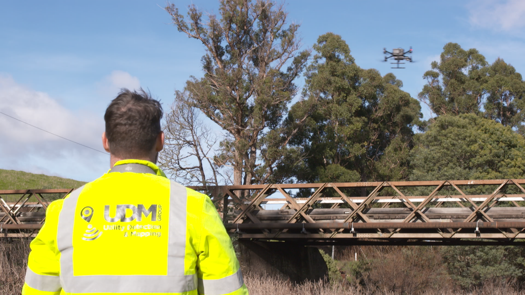
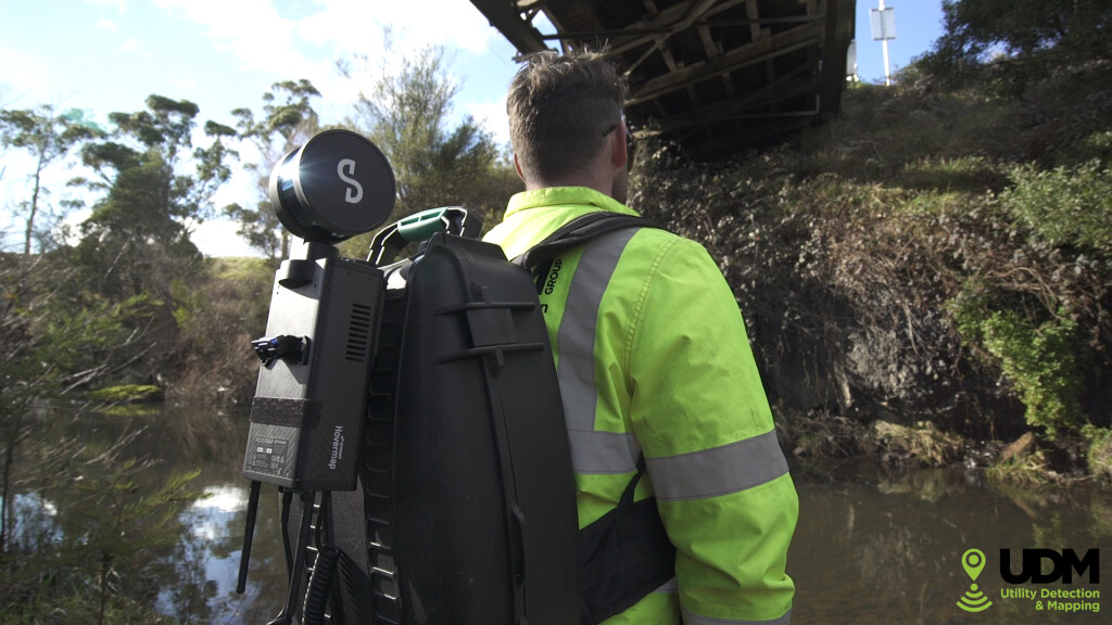
The Hovermap mobile scanner was used by a sole surveyor to capture the bridge and its surrounds in a 30-minute line of sight flight and a 5-minute walk of the site. Time on site was less than one hour.
“Hovermap allowed us to capture the data we needed in a matter of minutes. The system is simple to learn and easy to use. It significantly improves our efficiency on projects like this one and means we can turn them around for clients a lot quicker.” -Rod Brumby, UDM Group Managing Director
Deliverables:
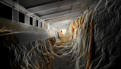
Hovermap data was processed the same day using Emesent software to produce a 3D point cloud. By stripping out the vegetation and bridge structures, UDM personnel were able to deliver a detailed digital elevation model of the site next day.

Benefits: Improved quality, faster turnaround time for clients
Deploying Hovermap allowed UDM to complete a complex and challenging assignment in less than an hour, with just a single surveyor on site.
“We’ve been able to increase the efficiency and safety of the project and been able to turn round the data very fast,” says Rod Brumby, UDM Group Managing Director.
The Hovermap’s versatility means UDM personnel capture the complete scene, quickly and safely.
“The Hovermap setup process is really easy. Take it out of the box, click onto the drone and we're up in the sky within a matter of minutes,” explains Brumby.
“Once we're finished flying, unclick the Hovermap and put it on the backpack to walk under the bridge to finalize the data capture.”
The feedback from UDM customers is positive. “They're really happy with the 3D point cloud that we can deliver,” Brumby notes.
“They can drop it straight into their CAD package or GIS with minimum fuss.”
Being able to obtain accurate, detailed survey data quickly has allowed UDM to provide a faster and more competitively priced service to its clients on this project and many others.
“We don’t have guys out in the bush, hacking through foliage, dodging snakes and clambering over structures. When we go to a remote site like this, we can use Hovermap to capture what we need quickly and safely.” Rod Brumby, UDM Group Managing Director
Key Achievements
-Improved safety and efficiency for the survey team
-30x faster data collection
-Reduced project delivery time and costs
-High-quality product deliverables
Building a Smarter Survey Business with Hovermap
Hovermap has helped Rod Brumby transform UDM from a one-man band to a business employing eight staff in just three years. Having the Hovermap scanner in its portfolio of tools has enabled the consultancy to tackle a diverse range of projects and sites, from infrastructure surveys and topographical studies to mines and water treatment plants.
Because Hovermap saves time and money, UDM is able to provide clients with fast, high quality service at competitive prices.
“Hovermap has increased our efficiency three-fold and allowed us to look at new opportunities and income streams for the business." -Rod Brumby, UDM Managing Director