

Contributed by HxGN Content Program
CORYS has gained a reputation for developing incredibly realistic computer simulators for the power, process and transportation industries. The total immersion ‘Replica Simulators’ that the company builds using 3D CGI technology to train new drivers on how to operate railroad locomotives may be CORYS’ most complex product because the rail networks extend for hundreds, if not thousands, of linear miles that must be reproduced accurately in the simulated environment.
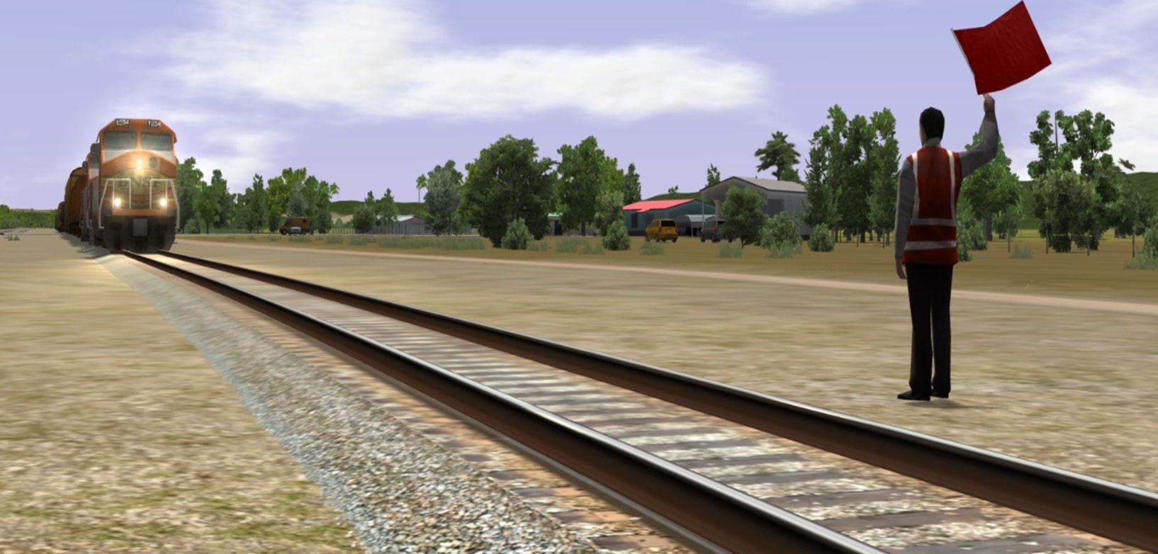
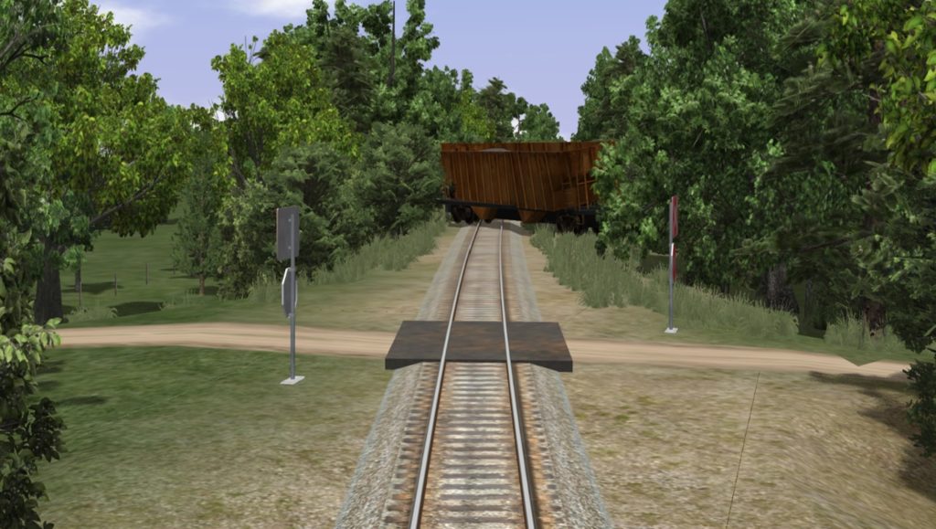
Railroad operators rely on these systems to prepare drivers under various computer-generated conditions, such as driving in rain, blinding snow and glaring sun. Changes to the track, signals and switches can also be simulated on the fly. The simulator can even be used to insert hypothetical scenarios, like a cow wandering the track or a vehicle stalled at a crossing.
These situations all occur within 3D computer-generated environments that precisely match the track geometry, surrounding terrain and cityscapes found on the railroad’s existing network. The driver simulators are critical to the railway’s safe, reliable and energy-efficient operation.
“The view from the simulated locomotive cab is exactly what the driver will experience in real life,” said Simon Musäus, Vice President of Business Development at Hexagon. “CORYS develops a simulator for each type of locomotive in the railroad client’s fleet.”
Enhanced training experience using digital twins
CORYS was among the first to embrace 3D object-based modeling technologies, dramatically enhancing the training experience for locomotive drivers. The immersive nature of its solutions and the ability for scene manipulation to generate a wide variety of operational scenarios the driver might encounter during an actual run.
CORYS chose Hexagon’s HxGN Content Program to provide the aerial data products for the 3D simulations because the data is accurate, up-to-date and immediately available. Of paramount importance for a rail network spanning hundreds of miles, the data sets are consistent over entire countries and regions. In addition, the Hexagon team has the expertise to customize the data – and in some cases acquire supplemental data – to meet CORYS’ precise simulation requirements.
“The Hexagon data provides a quantum leap in the detail, resolution and accuracy of the visual elements that make up the surroundings,” said Greg Hayes, Vice President, Business Development at CORYS. “This significantly improves training for territory familiarisation, situational awareness and operational vigilance.”
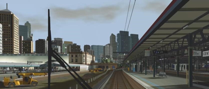
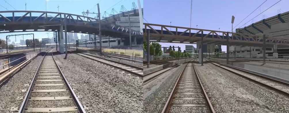
The 3D data sets delivered to CORYS by Hexagon are digital twins of the railway corridors extending 100 meters or more to either side of the track itself. The two main deliverables are extracted objects (buildings, trees, signals, signs, roads, waterways, etc.) and natural terrain in the form of elevation models.
Creating railway digital twins
The first step in a typical project is for the railroad operator to deliver a track chart, often digital but sometimes on paper, to Hexagon for use in mapping the locations of the track areas and signals to be modeled. All other data sets are georeferenced to these track coordinates.
In building the railway digital twin, Hexagon relies primarily on two HxGN Content Program products – countrywide Aerial Imagery (ortho and stereo) and Metro HD City Data. The countrywide Aerial Imagery is captured every two or three years for the United States and Western European countries at 15-30 cm resolution, sufficient for wide-area modeling of railscapes outside densely developed urban areas.
Hexagon extracts the position, identity and texture of objects around the track in 3D from the orthoimagery and stereo imagery. To ensure the accuracy of object identification, Hexagon uses digital video from the locomotives through the network. The team relies on the 3D information in the orthophotos and stereo images to derive digital terrain models of the landscape around the tracks.
Deriving objects within cities, especially at railway stations where buildings and other objects are more numerous and packed more closely, is a more significant challenge. This requires the ultra-high-definition Metro HD City Data, derived from simultaneously captured aerial imagery and LiDAR data captured with the Leica CityMapper-2 sensor. The optical image data is both nadir and oblique at 5 cm resolution, complemented by concurrent 20 points per square meter LiDAR point collection.
The combination of LiDAR point cloud and imagery allows Hexagon to derive objects with an accuracy of 10 cm or better. From these data sets, Hexagon generates Digital Terrain Models of the city railscape along with the extracted objects, such as buildings, trees and road surfaces, represented in their georeferenced locations and appearances at LOD3.2 (Level of Detail). CORYS uses these deliverables to feed into its modelling and simulation software.
Expanding the rail digital twin applications
The applications of the simulated railscapes have the potential to expand to departments within some railroads as the advantage of CGI digital twins is realized.
CORYS’ Hayes explained: “With all visual surroundings replicated accurately, the CGI can be implemented in visual tools for train dispatchers as they manage rail traffic, pre-job briefs for maintenance-of-way (MOW) teams, emergency response planning, and fire/rescue squad practice drills.”
For CORYS, the implementation of railscape digital twins in its simulators and other applications highlights the company’s commitment to safety. Developing more realistic and accurate locomotive cab simulations results in better-trained, more prepared drivers to deliver passengers and freight safely anywhere in the rail network. The HxGN Content Program provides geospatial data that is up-to-date and accurate, ensuring a super-realistic simulation. Just as importantly, the Hexagon team has the expertise to customize the data to meet CORYS’ exacting standards.
For more information visit Hexagon’s HxGN Content Program, visit or follow Hexagon on LinkedIn.


