
Q&A with Anders Rhodin, head of the survey division
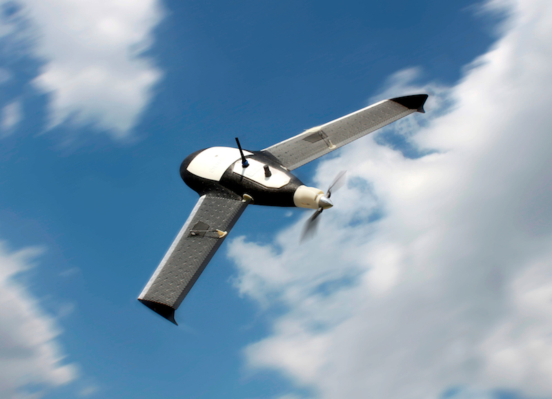
SUNNYVALE, Calif. – Trimble is an acquisitive company, but some of the company’s buys still seem to come out of left field. Such as this past week’s announcement it had acquired Gatewing, a maker of unmanned aerial vehicles for photogrammetry and rapid terrain mapping based in Gent, Belgium.
UAVs? Does Trimble have more military business in its sites?
Not exactly. Gatewing, said Anders Rhodin, business area director for Trimble’s survey division, have “really stayed focused on the surveying and mapping industry as they’ve developed as a company.” While there are hundreds of UAV makers trying to sell product and grow their businesses, “very few have targeted our market in that way,” Rhodin said. “We realized very quickly how well we aligned, both in terms of where we want to go and how we see the market. Either we’re both brainwashed in the right way or we’re both right.”
And how will UAVs make an impact on the survey and mapping industry?
“You’re filling the gap between traditional topo surveying and the high-altitude photogrammetry and putting something in between,” Rhodin said. “Compared to high altitude, it’s fairly low cost. You can do it often and quickly. It’s not affected by the weather; you fly under the cloud cover for instance. [UAVs are useful] where you want to be able to quickly survey bigger portions of land – there are rapid response possibilities where there are time-sensitive deliverables, disaster situations, after tornados. You might use UAVs for construction monitoring, where you might want to do it on a daily basis.”
He also said volume calculation, for mining applications, has been popular already. “You can get very precise volume estimations of stockpiles, which is almost impossible with traditional measurements,” Rhodin said. “Laser scanning is very good for that as well, but you often need to get on top to get an accurate reading. You’re also with a UAV out of the way of the normal working of the site – you don’t get in the way.”
Of course, applications are still being developed nearly every day. “I think your imagination is the limit here,” Rhodin said. “It’s not as accurate as total stations and GNSS, but this will absolutely be good enough in many cases.”
As for the likely target market, you can for the time being rule out much of the United States, with Federal Aviation Administration still tightly regulating the use of what the industry is beginning to more commonly refer to as unmanned aerial systems, or unmanned aircraft systems. However, Rhodin said, Australia, Canada, the UK, and Africa are all already fertile markets for Gatewing. Further, if potential customers are already surveyors, or have survey teams in house, the decision on whether to purchase a Gatewing system “will be a strict financial calculation,” he said. “The ease of use is tremendous. You don’t need a lot of training; two days of training is absolutely enough to get proficient with the UAS. But it depends on how often you need it.”
For now, Gatewing will remain strictly a photogrammetry-based solution, though the outputs include orthophotos, digital surface models, and straight point clouds. However, don’t be surprised if the two-kilo system is carrying lidar sometime in the future. “Knowing Trimble,” Rhodin said, “if it makes sense to combine technology, we’ll do it … we’re looking at the acquisition of Gatewing as the start of a center of excellence that will broaden into a product line, rather than a single product.”


