The Sanborn Map Company (Sanborn) has completed mobile Lidar data collection for two corridors in Glacier National Park and one corridor in Yellowstone National Park, USA, totalling approximately 65 linear kilometres.
Sanborn was selected for the project to provide data that could be used to determine the level of effort and cost to resurface the roads, which are in dire need of repair. In Yellowstone alone, about 300 kilometres of main roads are in a structurally deficient state, with poor quality road bases failing under the weight, speed and volume of modern traffic, for which they were not designed. Harsh winter weather and short construction seasons in both parks provide additional challenges.
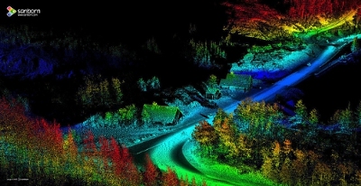
During the 2015 fall season, Sanborn acquired the Lidar point clouds, which were particularly dense with 300-500 points per square metre, along with accompanying georeferenced imagery. The firm’s post-acquisition approach involved auto-filtering the point clouds in the ground and non-ground classes. The points in the ground class were used to derive road centrelines and edges of pavement, and the non-ground points were used to derive guardrails in vector format.
“This project was particularly rewarding because both of these parks truly are national treasures,” said Arjan Mooij, Sanborn programme manager. “There’s no doubt that the quality data they provided will help streamline the process for their much-needed road repairs.”