
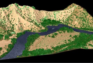
LiDAR data for the Embudo area to the southeast across the Rio Grande. Source: Albuquerque Journal
The Albuquerque Journal recently published a long (and worthwhile) article detailing the numerous benefits of the 3DEP in their home state—as well as the obstacles to finishing the project.
The 3DEP is an initiative to “respond to growing needs for high-quality topographic data and for a wide range of other three-dimensional representations of the Nation’s natural and constructed features.” A primary goal of the project is to collect LiDAR data sets and create elevation models for all American states and territories over a period of eight years.
Two years have passed since the project began and many states in the West, including New Mexico, remain largely unmapped.
In a state like New Mexico, such data sets can be used for applications including watershed, drainage, runoff, wildfire and urban impacts, transportation and utility corridors, tribal lands, energy development, and forest management. The data sets even has some less expected applications specific to the region, such as the preservation of lesser prairie-chicken habitats.
Once the data is collected in New Mexico, it will be made freely available to the public, much as the UK Environmental Agency has done with LiDAR data sets in England.
New Mexico’s need for updated data is critical. According to the article, existing elevation data for the state is more than 50 years old, and off by as much as 33 feet.
The biggest obstacle cited is funding. In the American West, where population is often spread out, counties and states have difficulty raising funds for LiDAR mapping. With a cost of $235 per square mile, gathering LiDAR data for New Mexico’s 121,736 square miles would cost around $28 million.
Currently the New Mexico Geospatial Advisory Committee is proposing that the state pay $2.5 of the total cost.
Mike Inglis, who sits on a planning and acquisition subcommittee of the NMAC, is quoted in the story as saying that “one of the difficulties we have is that the tools we use for data analysis require better data than we have, and it’s not just that we want a cool topographical map. But getting data and infrastructure supported by the Legislature can be hard to do. It can be hard to get them to understand the importance of data collection, but it’s critical.”
“A lot of times there are budgetary issues,” says New Mexico Association of Counties data integration administrator Erle Wright. “The more who can cooperate and contribute to these projects, the lower the cost is going to be for everyone. The economy of scale is huge.”
One hope for overcoming these obstacles is technological improvement. The rapid changes in speed, ease of use, and cost are making the technology less cost-prohibitive, and that improves the chances that New Mexico will receive its critical data sets.


