
Lokeren, Belgium, October 2nd, 2014 — Orbit GeoSpatial Technologies will showcase “Orbit UAS Mapping Pro”, version 11.0, at Intergeo, Berlin.
“Orbit’s UAS Mapping Pro 11.0 is an impressive product for all professional UAV systems engaged in mapping“, says Peter Bonne, CEO at Orbit GT. “Based on our 7 year experience in high precision UAS mapping, this software covers the complete UAS workflow for mapping purposes.”
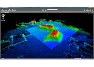
Orbit UAS Mapping Pro includes preflight setup, postprocessing, orthocreation, dense DEM creation, creation of contourlines, extraction of profiles, calculation of volumes and stereo-viewing. It also includes digitizing tools to convert raw data to 3D vector data ready for your GIS or CAD.
Orbit’s approach to continue support for photogrammetric techniques joins neatlessly with detailed user control over processing tools. Reports list out the results in high detail for professional use.
Come take a look at booth E2-038 in Hall 2.1.
About Orbit GeoSpatial Technologies
Orbit Geospatial Technologies is world leader in solutions for exploiting Mobile Mapping, UAS and Aerial Mapping data in managing, viewing, extracting, publishing, sharing and embedding in workflows. Orbit GT is headquartered in Lokeren, Belgium.
For more information, please contact
Mr. Peter Bonne
Orbit GeoSpatial Technologies NV
Industriepark E17, 2021
9160 Lokeren
Belgium
Phone +32 9 340 5757
Fax +32 9 340 5750
www.orbitgt.com


