
The newest upgrade of the popular least squares adjustment software for land surveyors increases productivity by automating basic functions.
West Kelowna, BC, Canada – MicroSurvey Software Inc. is pleased to announce STAR*NET 8.1, the latest and highly anticipated version of the industry-leading STAR*NET least squares network adjustment suite. With a multitude of new and improved tools, the software makes least squares adjustment even faster and easier than before.
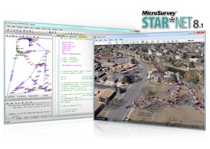
Several highly requested features have been added based on feedback received directly from STAR*NET users. All network plot display options are now customizable in an intuitive grid view that allows users to control the visibility, color, linetype and size of each network element to graphically differentiate conventional, GPS, and leveling observations. Directional linetypes indicate the direction and number of observations between each network station, and intuitive mouse controls allow for smooth zooming and panning in the network plot.
Additionally, a new “.PRISM” inline command lets users apply a correction for measurements that were collected with an incorrect prism offset setting. Support for Google Maps™ and Google Earth™ allows users to view and export network stations and connections in popular mapping formats, and a new Level Loop Tolerance Check allows users to instantly verify the vertical closure of level loops or traverses.
Other changes include:
- A new Online Updater that makes it easier for users to stay current with the latest STAR*NET updates.
- A new Data File Monitor that checks for any changes made by an external program to a loaded data file and prompts users to reload files from disk if needed.
- Improved file references for easy access to corresponding data files directly from the listing.
- Direct access to all conversion utilities through the Import menu, with help buttons for guidance.
- Improved MicroSurvey FieldGenius Support, including the ability to convert COGO measurements from raw files as bearing measurement records and to read GPS offset measurements from raw files.
- Improved Carlson SurvCE Support, including the ability to average shots in multiple sets, convert resection observations as direction sets, and import point descriptions with each vector.
- Improved Leica DBX Support, including the ability to export all set observations or average set observations for any sets collected with either the Sets of Angles or Traverse applications, export stakeout observations as measurement records, and export check shot deltas as comment records.
“We’ve created several powerful new productivity tools and wanted to make these immediately available to STAR*NET users,” said Brian Sloman, desktop products manager at MicroSurvey. “The flexible and independent control of conventional, GPS, and leveling data in the network plot, including the new directional arrows which indicate both the direction and number of observations for each network connection, can help you visually identify regions with lower redundancy without having to analyze the listing file. The new .PRISM inline command lets you correct distances without having to make potentially thousands of tedious calculations and manual edits, and the level loop tolerance check lets you immediately confirm whether or not your level loops or traverses fall within the maximum allowable tolerances for a desired standard of accuracy. Toss in the ability to view your data in Google Earth™ and Google Maps™, and it all adds up to a faster and easier least squares analysis.”
STAR*NET 8.1 is a free upgrade for any STAR*NET users who have a valid Maintenance Subscription and Support Plan. A STAR*NET upgrade tour is available at https://www.youtube.com/microsurvey.
To learn more or download a free demo, visit www.microsurvey.com.
Note: Google Maps™ and Google Earth™ are trademarks of Google Inc.
About MicroSurvey
MicroSurvey Software Inc., a member of the Hexagon family of companies, has been developing software and hardware solutions for the surveying and mapping industry for more than twenty five years.


