

Over the last 20 years, the usage of mobile phones has become nearly ubiquitous with global society, to the point where most of us don’t even really think about it; it’s simply a part of life. However, keeping these networks alive and growing them to keep up with ever-improving technology is easier said than done, and it’s a constant process with increasing urbanization bringing more potential interruptions to networks. Telecommunications companies have a vast network of cell towers - or mobile masts - and antennas to maintain connectivity, and with evolving technology along with regular deterioration of infrastructure new mobile masts need to be constructed, and existing ones adjusted. All of this makes for a complicated process on the part of the telecoms.
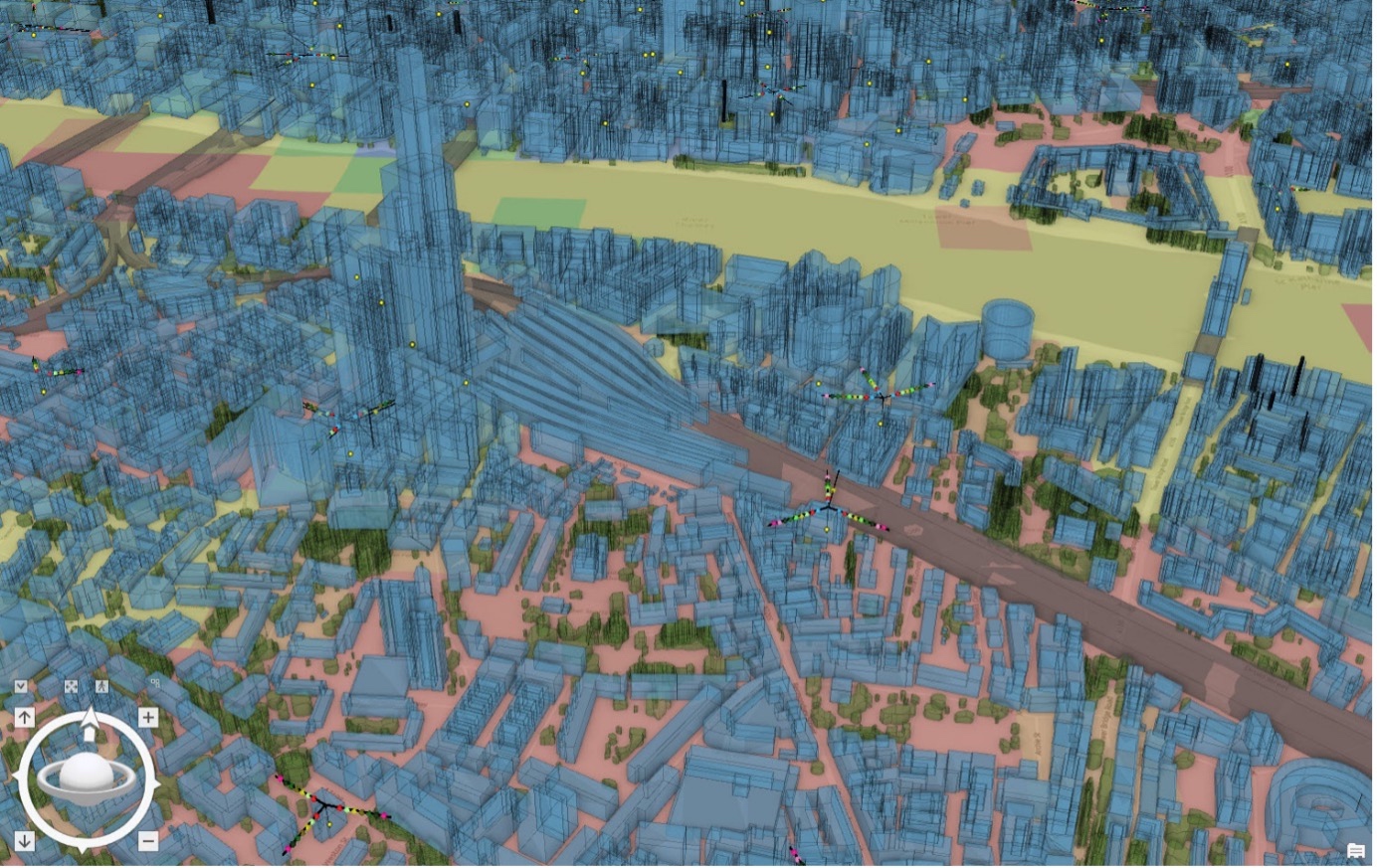
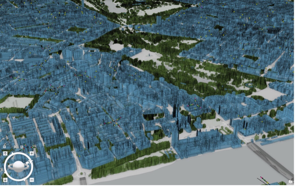
Vodafone, one of the largest telecom companies in Europe, is working to make that process more efficient for its engineers, getting an assist from Esri UK's GIS software and expertise. Working specifically in the UK, Vodafone created a national digital twin of its entire mobile mast network throughout the country, giving its engineers an interactive and accurate 3D model which can be used to strategize how it can improve existing networks and expand its network to better serve their customers, all without having to physically go out to the sites of these mobile masts.
The creation of this digital twin requires a vast amount of data, leading Vodafone to turn to Esri’s ArcGIS Enterprise platform, which “combines web mapping, image exploitation, real-time data handling, large-volume batch analysis, and spatial data science.” In order to create the model, Vodafone used satellite data to map the entire terrain, focusing on matching the dimensions of buildings and other potential barriers to service. Vodafone’s GIS Lead, Dr. Rebecca King, said in a press statement about the use of ArcGIS Enterprise, “Using ArcGIS Enterprise has allowed us to add the spatial dimension to a lot of data we were already working with, resulting in new levels of location intelligence.”
As a result, the company’s engineers now have a tool with which they can make informed decisions on how to best adjust the company’s network. The national digital twin provides Vodafone’s team with accurate knowledge of where things like buildings, hills, valleys, and trees are precisely located, all of which can interrupt or slow down connection between masts. With this knowledge, the company can more efficiently plan where to position new mobile sites for maximum connection, as well as identifying areas where upgrades or repositioning may be necessary. As an added benefit, the company also reduces its carbon footprint by not requiring physical site visits to make these decisions. With the expected proliferation of 5G in our cellular network, assistance with these kinds of decisions is all the more important.
This is a big step for Vodafone and its team of engineers, but it is only one as the company looks to continue adding more digitalization to its workflows moving forward. With this project so far looking like a success, they are now looking to test similar digital twins in other markets around Europe, pointing to Germany and Turkey as the next potential locations. Additionally, the company also plans to use this technology to support the rollout of new features like Massive MIMO, which strengthens capacity at individual sites. Vodafone notes that the network of connected devices is expected to grow globally to 30 billion by 2025, so these kinds of improvements will be necessary to keep up with that growth.
That helps explain the company’s "Vodafone 2025" strategy as well, in which they are looking to automate as much of their network as possible to more quickly respond to customer demands. At the moment, about 70 percent of its European network is on their on “on-premise” cloud, with the goal of getting that up to 100 percent by 2025.
This kind of digital twin is a necessary step given the near universality of usage of cell phones and other connected devices, particularly given the expected growth in that area and the introduction of 5G. It’s a sentiment echoed by Vodafone’s Lead Architect, Boris Pitchforth, who says in a press statement that this digital twin is “like Minecraft for data scientists,” and added, “We can be smarter and faster about how and where we add new 5G features, and target capacity increases with greater precision. There’s also the added benefit of being able to reduce our carbon footprint as our engineers won’t need to make as many site visits, especially to masts in remote areas.”


