
Panomap drives new service provider-asset owner relationship
KAWASAKI, Japan – Here at SPAR Japan, Toshiba Plant Systems & Services Corp. was featuring heavily its new way of reselling CSA’s PanoMap technology as a service. By putting piping design models, point clouds, and attendant 2D diagrams and maintenance information in the hands of employees out in the field, Toshiba is providing plant operators with a new way to manage their facilities.
Construction Systems Associates first demonstrated PanoMap, which allows large numbers of point clouds and models to be accessed on mobile devices, at SPAR 2011. At the time, applications were still being developed, but the idea was to bring the power of 3D data out into the plant itself, and away from the desktop.
Now, said Toshiba’s Akihiro Iwata, Toshiba is providing this functionality as a service to the asset owner. Rather than the asset owner collecting his or her various scans and models, loading them into PanoMap, and then outfitting their various field workers, Toshiba is doing that for them.
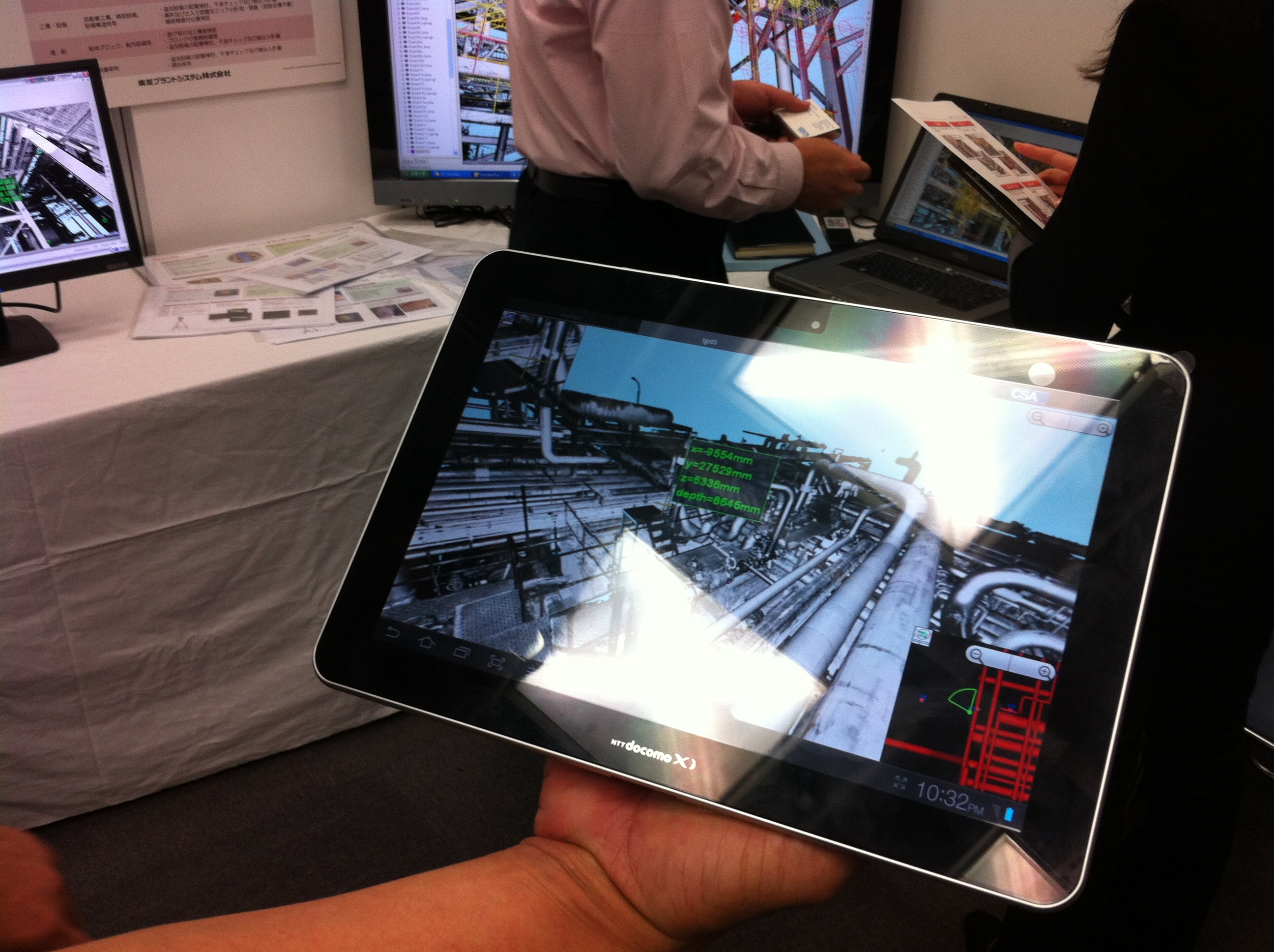
“We just give them a tablet,” said Iwata, demonstrating the PanoMap technology on a Galaxy device (he had an Android phone on which it worked as well). Toshiba manages the data, associates the various intelligence with the proper portions of the models and point clouds, and then simply delivers as many devices as the asset owner requires.
Say a clash is detected between existing pipe structure and a designed new piping run. It’s one thing to see that clash at the desktop, but to be able to easily locate where that clash would occur in the field can be extremely helpful for understanding of the problem. Further, inspection routes can be programmed into the point cloud or model, allowing field workers to easily navigate those areas management feels are most important for inspection. Finally, while out in the field, should a worker want to know where a certain pipe winds up, or what the entirety of that run looks like, he or she can simply access the 2D piping run for a quick understanding of the entire system.
Here’s Iwata demonstrating the PanoMap capabilities:
Combined with the tablet-based features Bentley has added to its ProjectWise offering (it was one of this reporter’s five attention grabbers from SPAR International), it’s pretty clear there’s a positive trend toward getting point cloud and 3D data out into the field using the new ubiquitous mobile devices we all have in our pockets and briefcases.


