
Justice Dept. says Colorado aerial imaging firm used cheap, Chinese labor on U.S. government mapping contracts
Geospatial firm Sanborn Map Company, Inc. will pay $2.1 million to resolve allegations it fraudulently billed the U.S. Defense Department for aerial mapping work of U.S. military supply routes in Iraq by using cheap, Chinese labor to produce the 3D maps.
The 2011 lawsuit (Peterson v. Sanborn Map Company, Inc. 4:11-cv-00902) was filed by James Peterson, a former Sanborn vice president, in St. Louis, Mo., federal district court. The lawsuit was filed under whistleblower provisions of the False Claims Act, which allow private individuals known as “relators” to sue on behalf of the government and to share in the proceeds of any settlement or judgment.
Based in Colorado Springs, Colo., Sanborn provides aerial and mobile lidar, aerial orthophotography, 3D modeling and visualization, oblique aerial imagery and software development. The 148-year-old company said it operates a fleet of 14 aircraft.
The Justice Department (DOJ) said in a statement Friday that Sanborn had contracted with the U.S. Army Corp of Engineers (USACE) to provide high-resolution, photogrammetric mapping and aerial imagery for 3D maps of U.S. supply routes in Iraq from 2005 to 2011.
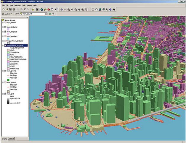
Aerial imagery for Buckeye program
The aerial mapping program was called “Buckeye,” which was created out of the need for unclassified, high-resolution geospatial data for tactical missions. By the end of the program in 2009, over 85,000 square kilometers of geospatial data was collected over urban areas and along main supply routes in Iraq.
In November 2007, Sanborn’s then-senior vice president and general manager, Robert Williams, had apparently agreed to a contract provision that required USACE to pre-approve the company’s use of all subcontractors, the DOJ said. Government contacts cannot be outsourced to subcontractors in countries not members of the North American Free Trade Agreement (NAFTA).
About six months later, Williams submitted Sanborn’s cost proposal for a USACE ‘RFP’ for digital orthophoto production. All cost and pricing data submitted by Williams reflected the work would be completed by Sanborn and not subcontractors, the DOJ said.
Several months later, in June 2008, Peterson said in court documents that Williams told him the company could not profit from the Buckeye mapping projects by doing it in-house and using Sanborn employees.
Outsourcing overseas
Peterson said he was going to outsource the projects to Spatial Data Consultants, Inc., a geospatial data production company in High Point, N.C., to funnel triangulation and digital orthophoto production to Eastdawn Corporation, an unapproved foreign subcontractor located in China.
“I am going to hide it through Spatial Data and they can take a cut of it for helping me hide it from the government,” Williams allegedly told Peterson.
Eastdawn Corporation was able to complete the orthophoto production at a rate much lower than the negotiated contract rate – as little as $8 an hour, well below the negotiated hourly rates between Sanborn and USACE, according to court documents.
Sanborn also contracted with IAVO Research and Scientific, in Durham, N.C., to subcontract the 3D map work overseas.
In September 2009, Williams presented a claim for final payment on the USACE contract, certifying that all contract requirements were met, court documents show.
“Allegedly, in an effort to save money, Sanborn used unapproved foreign subcontractors on three projects, which violated contractual obligations and caused delays on these projects,” the DOJ said in a statement. “Sanborn also allegedly used unapproved domestic subcontractors when Sanborn was required to complete all map work in-house and charged unrelated work to the government contracts.”
In all, the USACE paid Sanborn nearly $1.9 million for the work, not knowing it was completed by an unapproved foreign subcontractor, according to court documents Sanborn, meanwhile, was invoiced for just under $400,000 by Spatial Data and IAVO for 3D map work conducted through 2009.Williams gets 1 year probation, $3,000 fine
Williams, who resides in Austin, Texas, was laid off in 2011 and pled guilty to one misdemeanor count of theft of government money in 2012. He was sentenced last November to one year probation and fined $3,000.
The $2.1 million settlement agreement, in which Sanborn admits no wrongdoing in regard to the alleged claims, was approved Friday by U.S. District Court Judge Audrey Fleissig in the Eastern District of Missouri.
Sanborn has until Friday to object to the order. A request for comment and additional information was left for Sanborn attorney Amy Kappel. Meanwhile, whistleblower Peterson’s share of the $2.1 million settlement has not been determined.
“The Department of Justice will not hesitate to pursue companies that knowingly fail to comply with their contractual obligations, particularly obligations involving the protection of our national security interests,” said Stuart Delery, assistant attorney general for the DOJ’s civil division.
In the end, U.S. Attorney Richard Callahan, the top-ranking federal law enforcement official in the district, said the military data shared with the Chinese was not classified and the Department of Defense was actually satisfied with the 3D map work performed by Chinese workers.
Sanborn’s geospatial line now covers 70 major cities
In related news, Sanborn on Monday said its 3D geospatial and visualization product line now covers core downtown areas of nearly 70 major U.S. and international cities with the addition of the Atlanta, Boston, Miami and Seattle metro areas.
Cities are constantly evolving, expanding, deconstructing, and redesigning. In fact, Sanborn said its mapping operations have recorded as much as a 36 percent change in the central business districts of 40 of the largest U.S. cities in the past decade.
That’s creating a big demand for updated datasets from a broad range of users, including emergency response professionals, architects, engineers, real estate developers, urban planners, transportation managers, and utility providers, among others.
Sanborn creates its 3D geospatial products by collecting high-resolution aerial imagery to construct highly accurate building footprints, 3D building models, street centerlines and orthoimagery. The color-balanced imagery is sold in six-inch and one-foot pixel resolution and, depending on the city, meets U.S. National Map Accuracy Standards.
Sanborn also sells CitySets, an off-the-shelf collection of 3D city data that incorporates detailed building attributes derived from more than 1.2 million Sanborn Fire Insurance Maps and field surveys containing the history of approximately 12,000 U.S. cities and towns.
Check out Sanborn’s entire CitySets product line comprising 3D data for nearly 70 U.S. and international cities, including Dubai, New Delhi and New York City.


