The UAV lidar sector is advancing rapidly in 2025, with manufacturers introducing systems that deliver higher precision, improved efficiency, and broader application potential. Recent releases and use cases from GeoCue, RIEGL, Wingtra, DJI, and YellowScan demonstrate how UAV-based lidar technology is maturing, while bridging the gap between entry-level and enterprise solutions. UAV lidar platforms are also expanding into new domains such as bathymetric mapping and infrastructure inspection. As these innovations roll out, UAV-based lidar continues to establish itself as a critical tool for surveyors, engineers, and geospatial professionals seeking accurate, scalable data collection from the air.
Wingtra
VTOL drone for mapping and surveying provider Wingtra announced its first lidar drone mapping solution earlier this year. Wingtra LIDAR is Wingtra’s drone mapping solution that combines the WingtraOne fixed-wing drone with a high-performance Hesai XT32-M2X lidar sensor to capture accurate 3D terrain data for various applications like construction, urban planning, and forestry.
A few months later, the WingtraRAY surveying drone was released. WingtraRAY is a fixed-wing, vertical take-off and landing (VTOL) drone for professional surveyors, offering fast, precise aerial data collection. WingtraRAY offers six survey-optimized payloads for RGB, lidar, and thermal data, high-efficiency operation, autonomous safety measures like a parachute and obstacle avoidance. WingtraRAY was made publicly available in selected countries last July, with a global rollout to follow in October 2025.

Early 2024, YellowScan released its Navigator system, a bathymetric lidar that enables surveyors to map underwater topography, in rivers, ponds and coastal areas. The system extends its portfolio of UAV lidar systems. Since this release, the company has partnered with a variety of drone providers that integrate its sensors, and reported about international bathymetric and topographic mapping projects, including success stories in Sweden, Australia, and the US.
Last June, YellowScan teamed up with drone manufacturer Argosdyne in a strategic partnership focused on the EasyMapper drone series, which has been officially awarded the coveted C2 Class certification by the European Union Aviation Safety Agency (EASA).
VTR Drones (Ventus-Tech) is another YellowScan partner, who just announced the release of a new ultralight drone named the Hornet, that represents the innovation of tailsitters in unmanned aerial vehicle (UAV) design. This UAV is now integrated with the YellowScan Mapper+, providing an efficient solution for several lidar missions.
RIEGL
The Austrian Federal Railways (ÖBB) now use drone and laser scanning technology for railway inspections. BVLOS drones equipped with a RIEGL VUX-120 laser scanner help ÖBB to inspect its nearly 10,000 kilometers of rail. This method not only leads to significant cost savings but also enhances monitoring of the entire rail network. Using drones, railway tracks are inspected without disrupting operations, eliminating the need for closures, delays, or on-track fieldwork. This project is being carried out in cooperation with HERO.aero GmbH, a company specializing in customized UAV-based aerial vehicles (UAS).
By using RIEGL's state-of-the-art sensor technology, irregularities in vegetation and infrastructure can be reliably monitored from the air. This not only significantly improves inspection efficiency but also enhances the safety of railway personnel, as hazardous sections can now be safely surveyed without teams needing to enter the track area directly.
GeoCue
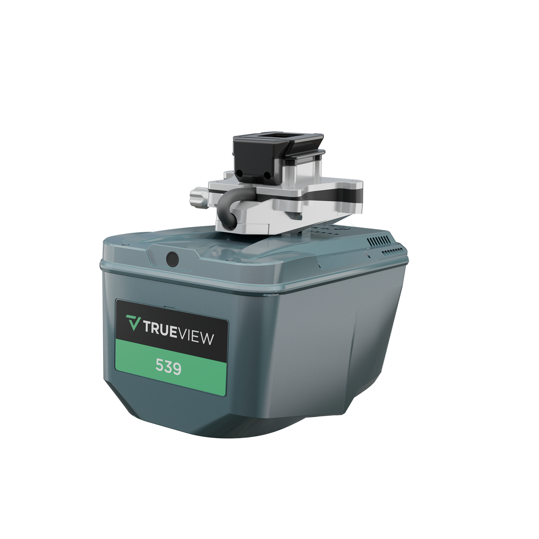
GeoCue’s latest UAV lidar and imagery system is aimed targets “customers who already own an entry level system, but are looking to take the next step”. That next step is the TrueView 539, that is very similar to the TrueView 540. The only difference is the camera: the TrueView 539 has a 26 MP global shutter camera, while the TrueView 540 has a 45 MP global shutter full frame camera.
Both systems can achieve absolute accuracy from 2 to 5 cm, incorporating CHC's PPK navigation solution combined with the scanner's 5 mm repeated ranging accuracy. The TruView 540 offers up to 8 lidar returns, and has usable a range of 400 m for targets with more than 20% reflectivity. The TrueView 539 offers up to 6 lidar returns, and has a usable range of 300 m for targets with more than 20% reflectivity.
In this article, Chad Dillard explains that the TV539 brings high-end lidar data to a price point between the mid-range sensors, and the entry level sensors: “If you wanted access to high-quality data, you needed to pay a higher price. The TrueView 539 changes that dynamic in favor of the customer. The data quality-to-price ratio is much better, so we think it will make this level of data more accessible.”
DJI
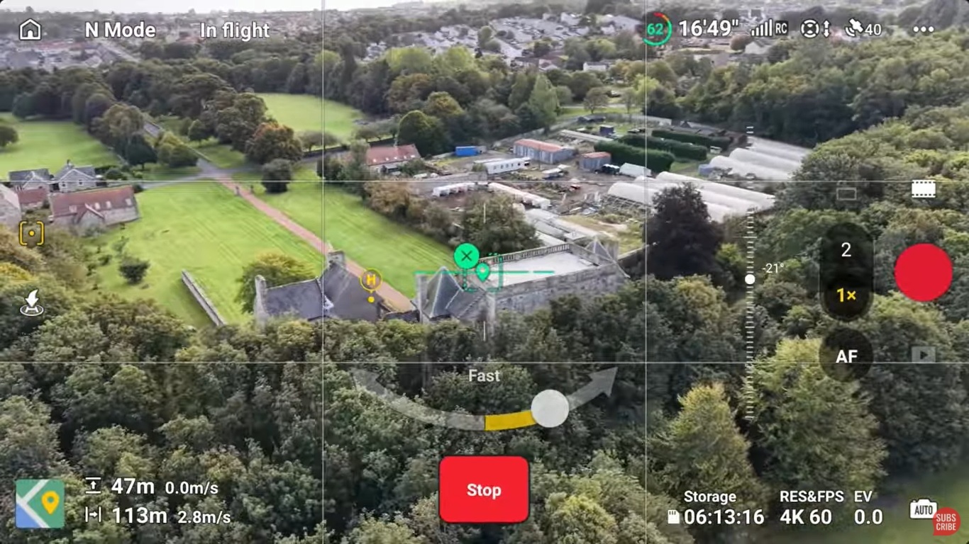
The following release is not a professional UAV lidar scanner, but an example of a consumer drone that uses lidar technology for obstacle avoidance, and is already used for remote inspections to create high-accuracy 3D points and models from video-derived imagery: the DJI Mini Pro 5.
DJI released the Mini 5 Pro drone in September 2025, raising the bar once again for miniature drone technology. The compact drone weighs only 249 grams, features a 50-megapixel camera capable of 4K60 HDR video, a 225-degree rotating gimbal for dynamic shots, and a flight time up to 52 minutes with an extended battery. Lidar-assisted obstacle avoidance system ensures smooth and safe operation.
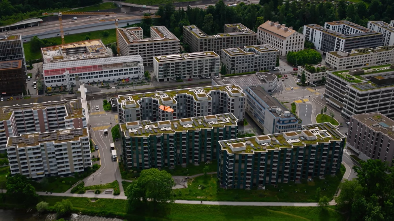
Although labeled as a consumer drone, professional surveyors Stefan Niculescu immediately realized the potential of the new drone for small and medium remote inspections and asset management. He shares his opinions after using the Mini 5 Pro for inspection work in a recent YouTube video. He thinks the Mini 5 Pro is perfect for capturing roofs, facades, and urban environments where bigger drones will cause problems. However, it won’t replace enterprise drones for large infrastructure or precision surveys.
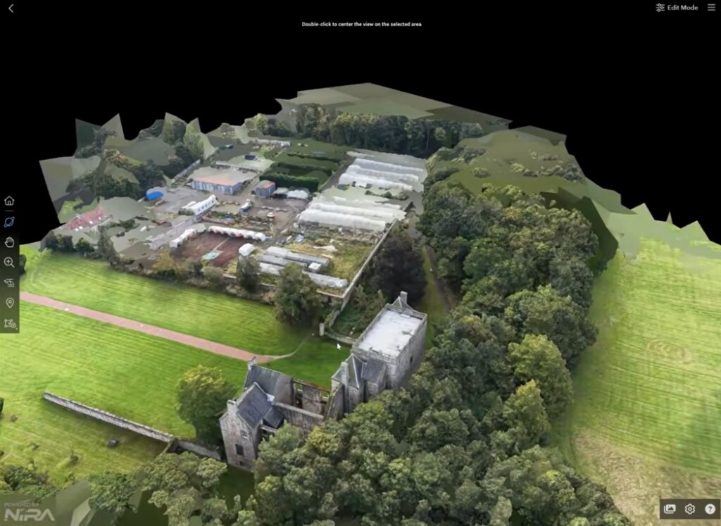
After flying the drone to capture 2D and 3D imagery, Niculescu extracts still-frames at a 3-second interval from the videos captured with the drone camera with RealityCapture. This is because there is a minimum 5-second interval when capturing imagery when the drone is flying. The software then aligns the separate images in a 3D model, that is exported directly to Nira, a collaborative platform for rendering massive 3D models in real time.