

Spatial intelligence based on data from GIS and satellite imagery has always been important, but if that value wasn’t already apparent it certainly became so over the last few years. Specifically with the COVID-19 pandemic, it has been crucial to have accurate, up-to-date information regarding where people and services are in order to slow the spread of an infectious disease and deploy resources to where they are most needed. These are important bits of information for a lot of reasons – not just an infectious disease – and with ongoing wars along with climate change, this data will only become more valuable. To that end, a consortium was recently announced with satellite data specialist Planet Labs, the Institute for Health Metrics and Evaluation (IHME), and the AI for Good Lab at Microsoft to illuminate “emerging threats to health and well-being.”
These organizations have been working together for a few years now on more of a trial basis, but are now looking to expand their work. Prior to this announcement, made last month, the trio had worked together in the early days of the COVID-19 panic. Andrew Zolli, Chief Impact Officer at Planet, told Geo Week News that “Planet began providing data to the IHME and Microsoft teams when not much was yet known about the rapid spread of COVID-19,” continuing that “the teams started monitoring public health facilities to see if they could detect and correlate an uptick of cars in parking lots as an early indicator of problematic health problems.”
Now, the consortium is taking the lessons they’ve learned and applying them on a larger scale for more problems. This effort is going to cover many different areas, including both people movement as well as crop monitoring, with a big focus on how climate change will affect public health and other measures of well-being. As Zolli said, once they figured out how useful this data can be for tracking population movement as it relates to risk, they figured, “Why not monitor people migrations catalyzed by climate change? Why not examine the intersection of food insecurity and public health?”
As noted, much of the work which will be done by this group is going to focus on the effects of climate change, which is expected to displace large groups of people around the world. The resulting migration will have a myriad of effects on the global population. To minimize the effects of things like food shortages, epidemics, and infrastructural breakdowns, having a clear picture of how many people have moved and where they are moving is crucial, and that data can be gleaned from the satellite imagery provided by Planet Labs.
Dr. Ali Mokdad, Professor of Health Metrics Sciences with the IHME, told Geo Week News, “We are interested in the movement of people to identify health needs and potential threats, such as identifying areas where vaccines and other medicines are in order. We can map crops and potential yield and be able to identify food insecurity and predict the impact on health and how the climate is impacting food production. All of this information is available in real time by satellite.”
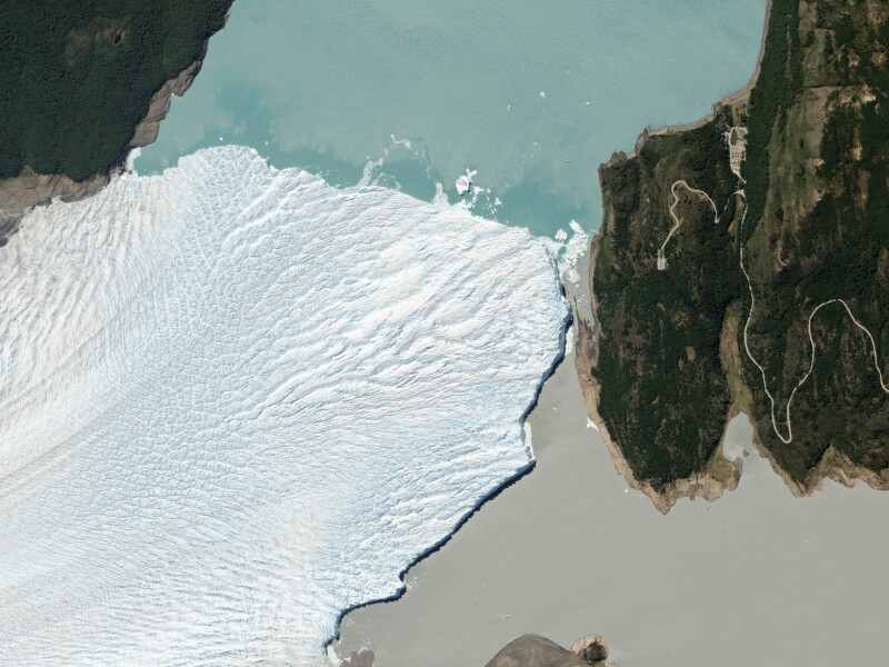
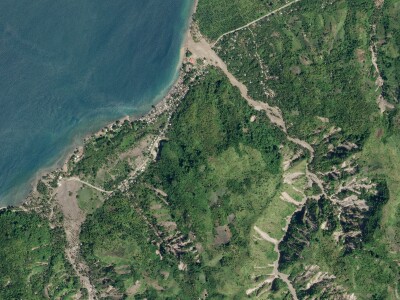
It’s certainly not true that this kind of work couldn’t be done before, or necessary relies on satellite data, but doing this work “on the ground,” so to speak, would require a much greater human effort in terms of both time and manpower, while also resulting in less accurate results. Planet Labs captures on average more than 300 square kilometers of Earth data on a daily basis, with the IHME having the ability to draw on those daily scans and any relevant archives. Whereas extreme weather events, or conflicts, or many other things could make an area unsafe for a human to survey, that work can be safely done via satellite no matter the conditions on the ground.
Crucially, this effort is intended to be a global one, which makes sense given the scope of the potential issues around climate migration, food shortage, and everything else at play here. As Mokdad told us, “We have learned from COVID-19 that we are very much interconnected, and understanding a problem in one country and how it will impact its neighbors and the rest of the world are crucial.” He points to the war in Ukraine as an example of this, with its obvious effects in that area as well as the global effects from potential food production issues in the region.
The effects of climate change, as well as other both man-made and natural occurrences around the world, are going to have massive effects on the global population. While it’s impossible to predict every issue, having the most current information to help both predict and react is going to be crucial going forward. That is what this partnership marks, with three entities adding their own expertise. Planet Labs provides the satellite imagery, the IHME brings expertise in public health issues, while Microsoft can help process and analyze data quickly with their AI tools. Together, the hope is they can make an increasingly volatile world more safer and more predictable.


