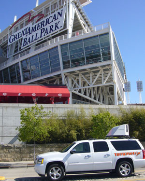
Can you obtain survey-grade accurate data from a mobile scan system going 45 mph? Yes, indeed, says Mike Frecks, principal, Terrametrix.
As a surveyor, Frecks thinks about precision constantly. The current leg of his career focuses on civil transportation infrastructure, including highway and railway, and how 3D laser scanning technology can provide survey-grade accurate, on-the-fly data while keeping operators safe from the dangers of traditional roadway collection methods. This past June, he and his team proved this possible during an 11-day mapping excursion in six cities. They used 3D Laser Mapping’s StreetMapper, with a reported accuracy of 8-13 millimeters, final position.
Scanning a Go-go
From Terrametrix’s home base in Omaha, Neb., Frecks and his crew headed southwest to Wichita, Kan., to scan 6.6 miles of interstate for TranSystems, a transportation solutions firm working for the Kansas Department of Transportation on a comprehensive rehabilitation job. In just two hours, Frecks and crew collected 6 gigabites of data (delivering about 5 megs). Compared to 30 ground-truthing shots supplied by TranSystems surveyors, “our RMS was six-hundredths of a foot,” Frecks says adding, “After we delivered the DTM of the paving, TranSystems shot cross sections, and their surveyors didn’t miss the DTM by more than two-hundredths of a foot!
“Traditional surveying would’ve taken two months,” he continues. “Static scanning would have taken two weeks. With mobile mapping, it took two hours. That’s eye-opening.”
Next stop: Cincinnati, where the crew scanned a 3-mile trolley route in the urban city canyon of the downtown and its surrounding areas in about an hour 45 minutes. Contracted by G. J. Berding Surveying, Inc., the purpose was to put scanning technology in front of city officials as a possible solution for a proposed trolley route in preliminary design phase. While the urban canyon environment caused concern, especially in regards to the performance of the GPS component, the robust system, along with well-executed mission planning, drove the project to output within StreetMapper’s specifications. If the project becomes funded, the trolley route will be implemented—and efficiently with solid geometry.
On to Montréal, Quebec, Canada. Here, Terrametrix scanned a major international sporting venue in the dark of night. The almost 2-mile coverage was collected in about an hour for a third party. Confidential mandates have prevented further information to be shared.
Then, on to Newark, N.J., where the team scanned a highway interchange for a bridge replacement project. Within 45 minutes, a half-mile of a four-lane divided highway with bridge detail was collected and a complete MicroStation digital terrain model and topo was delivered three days later.
Checking Against Static
With two stops left, Frecks was becoming increasingly impressed with the system. He set out for a project in Washington, D.C. to scan (and in some parts, re-scan) 6,600 feet of roadway for Dewberry. Terrametrix had scanned a portion of this pass a few months earlier using a static system. With the mobile StreetMapper, Frecks checked 1,482 points against the static data, resulting in an RMS error of 6.2 mm—two-hundredths of a foot. The maximum difference below the DTM was 9 mm and above was 39 mm. Amid heavy traffic and traffic signals, frontage roads and other obstacles serving up challenges, Frecks said the system performed well. In a single pass taking eight minutes at speeds of 10-40 mph, Frecks collected useful, accurate data, including 150 feet on both sides of the street, in a fraction of the time it took the static unit (88 static scans in six days).