

SPH Engineering is a drone technology developer from Riga, Latvia (EU). Their product portfolio includes integrated drone hardware and software systems, such as UgCS, a ground control software for drone mission planning and flight control. UgCS includes laser scanning-specific features such as lidar survey planning with automatic IMU calibrations, full 3D terrain following, and built-in photogrammetry, corridor, and vertical scan tools. It is used for vertical inspections, photogrammetry, powerline inspections, live video streaming surveys, and more.
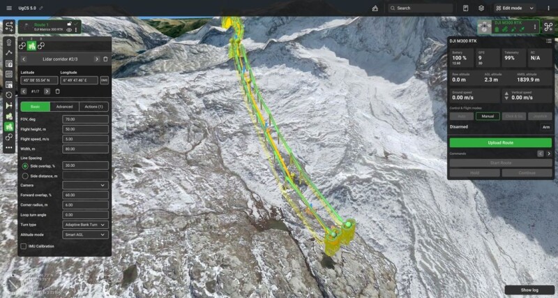
UgCS looks similar to a GIS application, combining a mapping interface and multiple user menus (widgets). The user interface of UgCS consists of two text-based menus and a map widget. The map widget shows a full-screen 3D view of the area of interest using one of two available height datasets. The map widget is fully customizable, so the user can add or turn off different map layers. The right part of the screen shows a drone control menu with all drone telemetry data, while on the left side, there’s a flight planning menu. SPH Engineering reduced the amount of visible flight planning tools for a better user experience in version 5.0.
A simple wizard lets users create a new drone flight route from scratch or use an existing one from a .csv or .kml file. Next, the user selects the drone that is used for the actual flight. UgCS supports the most popular drones and there’s a dropdown list with all supported drones. The payloads per drone are listed in a separate menu, so the user can select which payload (camera and/or lidar sensor) goes with their drone of choice. They can also create their own camera option and enter the correct parameters.
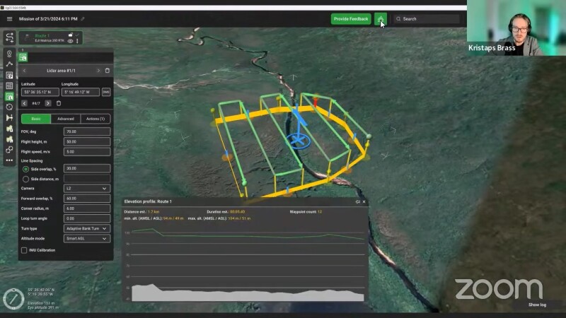
UgCS’ waypoint tools let drone pilots manually select waypoints for the drone to fly over or designate a coverage area and design a suitable flight pattern. UgCS 5.0 has three new tabs that allow the user to switch between actions, as well as basic and advanced planning parameters. A coverage area is selected by creating a simple square by drawing four points on a 2D map view, while a colorized point cloud requires additional camera action. A profile elevation button on the top of the screen shows a preview of the flight elevation. The actions tab enables setting the camera by altitude or distance to guarantee that images are taken with a specific overlap, which is required for a colorized point cloud.
Next, the user will need to set multiple flight parameters such as the FOV angle, flight height, flight speed, and side overlap percentage, among others. By clicking the IMU Calibration checkbox, the IMU is calibrated every 100 seconds or 1000 meters during the flight.
Here are some of the new features that have been announced earlier this year for the 5.0 version of UgCS that enhance the user experience:
- Simplified Flight Planning - SPH Engineering has simplified the flight planning process, making UgCS more accessible to newcomers while still keeping the functionality needed by seasoned professionals, which results in spending less time planning missions and gathering data faster.
- Faster file import / export -Default operating system dialog windows are now used for file selection, which makes file import / export seamless.
- Accessible flight overview - The elevation profile window displaying the flight height above terrain, mission duration, and other important parameters is now located in the top bar, allowing for quick previews when required.


