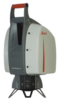
Yesterday Leica Geosystems announced ScanStation 2, a new time-of-flight 3D laser scanner whose maximum instantaneous scan speed is a blistering 50,000 points/second – more than 10 times the speed of its precursor. To our knowledge, this is the fastest TOF 3D laser scanner on the market. Operating speeds of competing time-of-flight 3D laser scanners typically range from 2,000 to 12,000 points/sec. – ScanStation 2 is clearly a breakthrough.
The new technology was developed by the design team at Leica Geosystems HDS headquarters in San Ramon, CA. The technical challenge was to reduce the pulse energy in order to maintain the instrument’s Class 3R (IEC 60825-1) eye-safety rating. Leica engineers accomplished this by lowering the single pulse energy from 200 nanojoules to 30 nanojoules. Using a lower-energy pulse allows the laser source to be pulsed much more rapidly while retaining the Class 3R rating. Leica Geosystems senior vice president, Geoff Jacobs, explains that in order to preserve the range resolution specification, significant changes in the laser source, receiver and timing electronics were required.
More productive capture; visual point location supports new construction and asset management applications
What does this mean for users? A knock against time-of-flight scanners has been that they capture data more slowly than phase-based scanners. After all, Leica’s phase-based scanner, the HDS6000, captures points at up to 500,000 points/second. As we’ve written previously, the main tradeoff between time-of-flight scanners and phase-based scanners is dynamic range versus acquisition rates. Phase-based scanners are typically faster but limited in range. ScanStation 2 is rated to 134m with an 18% albedo target, and 300m at 90% albedo. By comparison, the HDS6000 is limited to 50m with an 18% albedo target, and 79m at 90% albedo.
ScanStation 2 achieves more than tenfold speedup in data acquisition – obviously this ought to reduce field hours.
A less obvious benefit, but perhaps just as significant, is that the instrument’s visible green laser can now dwell on a specific point. This is because the new, lower-power device is intrinsically Class 3R eye-safe; by comparison, the previous ScanStation and the HDS3000 relied on a continuously moving laser beam to achieve Class 3R rating. This ability to use the instrument for visual location of points on surfaces opens up new greenfield construction applications – equipment placement, bolt hole location, elevations for form placement, some large-volume assembly operations – anything where position accuracy of order of millimeters is required. We’ve been saying this for some time – 3D laser scanning work processes can help make design perhaps 10% more efficient, but these new applications point the way to substantially greater savings in construction and asset management.
Pricing not expected to change significantly
What about pricing? While Leica Geosystems’ individual geographic operations have some autonomy in setting as-sold prices, Geoff Jacobs does not expect ScanStation 2 prices to vary significantly from existing ScanStation pricing. Thus we believe prices will not be more than 10% higher than for the previous ScanStation model.
Breakthroughs such as this are somewhat disruptive to buyers – just when you’ve bought the latest and greatest, along comes something better. Of course we expect this when it comes to buying computers, cell phones and iPods, and budget accordingly. To provide a measure of investment protection, Leica has made it possible for customers to send in their HDS3000 or ScanStation to be factory-upgraded to ScanStation 2. Pricing for upgrades was unavailable at press time.
Leica Geosystems reports that beta and demonstration units are currently in the field. Production shipments are scheduled to start in the second half of next month.
Version 5.8 of Leica’s Cyclone software was announced at the same time.


