

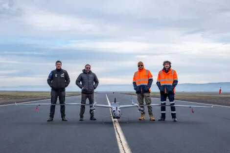
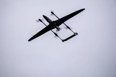
Phase One, Riegl and Carbonix have successfully joined forces and flown the Riegl VUX-12023 and Phase One iXM 100 medium format camera on Carbonix’s fixed-wing Ottano X. The combination of these highly sophisticated pieces of equipment is used in the field of remote sensing and geospatial data collection, serving critical use cases across the linear infrastructure and mining sectors.
This partnership puts Carbonix at the forefront of remote sensing technology, empowering critical sectors with multi-modal information crucial for decision-making, planning, and monitoring. The synergy between precise 3D lidar data, and detailed surface, color, and texture information from photographic imagery, enables Carbonix to provide a holistic solution that provides enhanced details about assets, assess environmental conditions, and creates digital twins with unprecedented accuracy.
What makes this collaboration very special is the scope, as the capability of this combined sensing platform has been proven in Australia and the US, covering more than 12,000 hectares in a single mission. Being able to capture detailed large scale colorized 3D models of the infrastructure and terrain is a game-changing result of this combined technology in commercial operations. This enables new ways to scale the collection of images and lidar data using drones to the largest areas.
Carbonix Ottano X drone specifications
Carbonix is an Australian manufacturer and solutions provider of commercial Unmanned Aerial Vehicles (UAV). Founded in 2012, the company has pioneered the development of long-range Vertical Take-off and Landing (VTOL) drones for aerial surveillance and precision data capture.
Riegl sensor and Phase One camera info
The Riegl VUX-120²³ is a lightweight and versatile airborne laser scanner offering a wide field of view of 100 degrees and a very high pulse repetition rate of up to 2.4 MHz, making it perfectly suited for high point density corridor mapping applications. Phase One’s iXM 100MP camera for drones incorporates medium format sensors with backside illumination (BSI) technology for improved high-light sensitivity and dynamic range. The iXM cameras are easily integrated with UAVs for diverse inspection and mapping applications.


