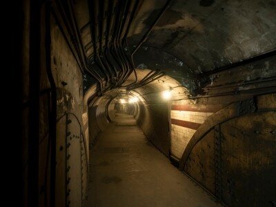
The adoption of reality capture in construction didn't begin with sophisticated hardware, it began with a simple frustration. In a recent Geo Week News Webinar, Kyle Duncan of Brasfield & Gorrie traces the origin to field crews taking photos on their phones with no way to place those images in a digital context. That gap drove partnerships with platforms like OpenSpace and HoloBuilder, and eventually the now-ubiquitous "shark fin" - a 360 camera mounted on a hard hat that lets workers capture site data with the press of a button. Today, the technology spans the entire project lifecycle, from pre-construction condition assessments to progress monitoring, embedded documentation, and post-construction warranty support.
Choosing the Right Tool
With drones, terrestrial laser scanners, SLAM scanners, GNSS units, and mobile 360 cameras all available, the challenge is no longer access to tools, but the discipline in choosing the right one.
David Epps of Envision Construction frames the decision around a simple principle, "Scanning is easy. Uncertainty is expensive."
His team evaluates every project at the outset and only deploys scanning when and where it meaningfully reduces risk or improves decision-making. TLS scanners are reserved for high-accuracy work like floor flatness studies and fabrication-level as-builts. SLAM scanners handle large interior walkthroughs where speed matters more than millimeter precision. Drones cover open sites and aerial progress tracking, with lidar payloads used when terrain needs to be captured through tree canopies. Hybrid approaches are common, SLAM for broad coverage, TLS dropped in where precision is critical.
The Active Site Challenge
Deploying scanning technology into a working construction environment requires coordination, preparation, and sometimes improvisation. Duncan describes driving from Birmingham to a job at Children's Hospital of Georgia, only to be unable to scan because the building was vibrating during a concrete pour. Both speakers have developed pre-deployment checklists: Is the floor swept? Is it dry? Lasers don't work well with standing water. Can the scanner be positioned without blocking equipment operators? A TLS on a tripod in the middle of a busy site will draw glares from forklift operators. Sometimes a drone wins simply because it can fly over everything, even if the resulting data is less precise. Drone docks are emerging as a way to take humans out of the equation entirely.
Turning Data into Decisions
The real challenge of reality capture isn't collecting data, it's making that data accessible and useful to the people who need it. Point clouds look pixelated to non-specialists, and demanding that field teams learn new software on top of their existing workload is a losing strategy. The solution many teams have landed on is platforms like FARO Sphere that present data in a familiar walkthrough interface while retaining the measurement capabilities of the underlying scan. Gaussian splats, a newer rendering approach that produces visually clean walkthroughs from scan data, are gaining traction because they eliminate the pixelated appearance that turns off non-technical users, while retaining the ability to pull actual measurements when a lidar backend is present.
When Scanning Catches What Others Miss
The most compelling argument for reality capture often comes from unplanned discoveries. Epps recounted a progress monitoring scan where, as a byproduct of scanning a structure, the scanner also captured nearby power lines. The data revealed those lines were within a code-restricted buffer zone of the planned building footprint, something no one had caught during design. Caught early, the team was able to redesign the affected portion rather than dismantle completed construction. Duncan described a similar case using GNSS-based as-built capture for underground utilities, where a telecom vault was found to conflict with a planned footer, four months before construction would have reached that point. The better the data, they agreed, the more these conflicts surface before they become crises.
Data Management at Scale
As scan datasets grow, data management becomes a discipline of its own. Epps described a single exported LAS file of 350 gigabytes and 25 billion points, far beyond what most software can handle. The practical approach is to decimate point clouds via grid-based sampling to reduce file size for sharing, while preserving full density where precision matters, and to organize data by structure, floor, or system rather than exporting one giant file. Survey control is non-negotiable. For archiving, Azure Cold Storage and similar services offer lower-cost options for data that won't be accessed frequently. For sharing with clients and field teams, web-based platforms like FARO Sphere allow navigation without specialized software.
The Internal Education Gap
Counterintuitively, both speakers said the bigger education challenge today is internal, not external. Owners largely just want the building built correctly and don't ask many questions about which tools are being used. The harder sell is to field engineers and superintendents who are skeptical of new workflows and already stretched thin. The strategy that works is making data available in interfaces people already understand, reducing their workload rather than adding to it, and surfacing insights rather than raw data. "We're trying to reduce their workload, not add to it," Epps said.
AI and Automation: What's Coming
The most forward-looking portion of the conversation centered on how AI is beginning to reshape both data processing and workflow design. Epps described building custom tools using Claude to automate tasks that previously took hours: decimating point clouds, comparing scan data against BIM models, running best-fit analysis. Duncan's team had a similar experience when a new hire using Claude reduced a four-hour workflow to one hour. The consensus: AI won't eliminate jobs in this field, but it will shift them, freeing specialists to focus on higher-value analysis rather than manual data wrangling. On the horizon, both speakers pointed to automated data capture through drone docks and robotic systems, AI-powered progress tracking tied to 4D scheduling, automated point cloud classification, and robotic layout systems that can mark up a slab in a fraction of the time a human crew would need.
"The more we can automate the data capture side of this," Epps said, "the more we can really dive into progress tracking, asset monitoring, predictive analysis, getting ahead of problems before they become problems."
To watch the full on-demand webinar: Reality Capture in Active Construction Environments