


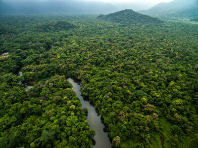
While focus around sustainability initiatives have undoubtedly intensified in recent years, our thinking about the environment is obviously not a new thing. The Environmental Protection Agency (EPA) in the United States, for example, was created more than a half-century ago. For many of us, our introductions to the damage being done to the environment was centered on the rainforest, and although efforts in tropical areas have provided tremendous help to deforestation there is always extra work to be done.
This is the ethos around an ongoing initiative that is underway by the group R-evolution, a subsidiary of Hexagon focused on sustainable innovation and green-tech investment. Using technologies from the Hexagon and Leica Geosystems product lines as well as investing in local businesses around vulnerable areas, the organization’s focuses vary and touch many different areas. They have projects that center around solar power, as well as desalination and a major project utilizing bathymetric workflows (among other tools) to enable the world’s first “blue” carbon credits in the sea.
Focusing on the rainforest piece of this, they also announced this year a new initiative starting with focus on rainforests in Costa Rica called Green Cubes. Using tools to collect data from above in crewed aircraft as well as on the ground, the concept “provides precise volume, health assessments and biodiversity trends of rainforests at scale, collaborating with scientists and local communities to strengthen conservation efforts, while offering forest owners a sustainable and recurring income,” according to the Green Cubes official website.
Recently, Geo Week News spoke with Javier Norro, Chief Product Officer with R-evolution, and Adina Gillespie, Vice President of Strategic Initiatives at Hexagon Geosystems, about this work.
At its core, the Green Cubes concept is not only about preventing deforestation, but also focusing on the local communities around the area and ensuring that they are still able to maintain a sustainable income amid any changes with the use of their surrounding areas. The Green Cubes are individual cubic meters of forest that are collected with 3D reality capture which can be sponsored by companies around the world to help them “meet the requirements for ESG engagement and differentiate through proactive contributions to biodiversity conservation.”
This project got started thanks to a conversation with a startup. Norro told Geo Week News that R-evolution has a venture capital arm where they do small seed investments for startups with sustainability-focused technology, and in that work they met a startup based in Singapore. They were focused on planting trees, but as conversations progressed they wanted to make a “bigger impact on the planet,” and felt that Hexagon’s technology could help them. Norro and the rest of the R-evolution team agreed.
“Today, every focus is about climate change, which is great. It’s about carbon credits, which is about planting trees,” Norro said. “But what happens with the trees that are already planted, and the forests that already exist and they live within? That’s where we started attacking that problem, which in simple words is: Deforestation and what causes it. That’s where we started.”
At its core, they are focusing on three aspects of the forest, Norro said. “In our model, we started from volume. That’s the main part, and that gives us the shape of the forest. Next, it’s about complexity – how many different kinds of species, and the structure of this forest. With that data, you can identify trends that lead to better conditions for biodiversity, or not. And then the last part is about biodiversity indication.”
Norro and Gillespie relay that there are a number of different data collection techniques involved in this work. Gillespie’s piece of the puzzle largely focused on the aerial data collection, which was done with Leica’s Country Mapper. First announced last June, the Country Mapper is a hybrid aerial mapping solution that includes sensors for both imagery and lidar mapping, and this was one of the first projects for which the unit was utilized. Gillespie told Geo Week News that the overall data collection period for this first initiative in Costa Rica required 11 flights over a two-week span in January, capturing 100 square kilometers and resulting in roughly 4.3 terabytes of data.

Additionally, the team collected in situ data on the ground using the BLK2Go, with Norro’s team leading that effort along with partner researchers from the University of Vienna. Along with that on-the-ground lidar data, soil samples were collected as well as information about local biodiversity using cameras and audio sensors. For the latter, AI capabilities were able to take some of the calls recorded with the audio sensors and differentiate between species of birds, frogs, and other wildlife.
In speaking with Norro and Gillespie, it becomes increasingly clear that this work is not just about the environmental piece of this. The local communities are just as important in this work, which is why the sponsorship model comes into play. The Green Cubes initiative is looking to ensure local communities can continue to bring in a sustainable income and maintain these communities. As mentioned above, Norro was on the ground for much of this project and talked to Geo Week News about the impact of being around these local communities.
“It was a super interesting experience being there with the locals and understanding their life and challenges. When we think about places like these, that diversity is disappearing because they’re cutting trees and so on. We really need to understand the situation of the local people as well.”
R-evolution is still very much in the early days of this work around Green Cubes, with the work in Costa Rica being a proof-of-concept of sorts. Moving forward, they would like to expand the work to other parts of the world, including Brazil, Southeast Asia, and Africa, and even expanding beyond rainforests to other types of forests. “We’re open to any location that may need help in terms of different biodiversity and ecosystems as well,” Norro said.
For now, the team is just excited about where they’ve gotten so far. Gillespie said, “It’s really exciting both on the commercial level, but also on the scientific level as well. The data set is so rich and there’s lots of interesting things that will be concluded out of this once we see it to the end.”


