

As was on display for so much of Geo Week 2023, companies all around the world are coming up with and improving upon some of the most impressive and important technological innovation in the geospatial world, which affects much of everyone’s day-to-day life. But while these companies are creating these products, whether they be hardware or software, we’re seeing that a lot of the impact they create come from public entities and federal projects, often in partnership with these private companies.
February 16-18, 2026 | Colorado Convention Center | Denver, CO, USA **Early Bird Pricing Ends 1/16**Join Us at Geo Week 2026!
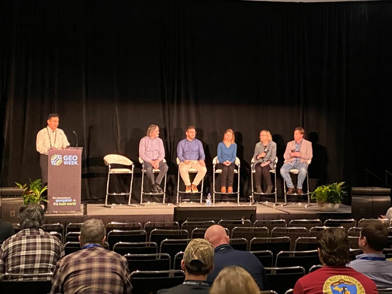
- Charles Papasodoro, Project Lead, Natural Resources, Canada
- Vicki Lukas, Chief, Topographic Data Services, USGS
- Brian Hadley, Elevation Data Aquisition Lead, USGS National Geospatial Program
- Cindy Thatcher, Geographer, USGS
- Jason Stoker, Physical Scientist, USGS
The first presentation came from Papasodoro, who provided updates on the state of Canada’s elevation data strategy. He discussed his organization’s role in collecting 3D data throughout the nation through standardized data acquisition methods, using this data to inform important decision-making. He also discussed the country’s two open elevation datasets, the HRDEM and HRDEM Mosaic, both of which are available on Canada’s Open Government website, with updated coverage coming on a yearly basis. After that, he looked to the future, noting that his organization plans to advance the FHIMP, the nation’s flood mapping program, continuing that coverage for up to five years, while also continuing efforts for new lidar acquisition throughout the country, and implementing a new topo-bathy DEM product.
Following that, the remaining four presenters, all of whom work for USGS, came together to discuss different portions of the organization’s work in the United States. Lukas started things off with an overview of the 3D National Topography Model, which brings together the 3D Hydrography Program and the 3D Elevation Program (3DEP) for a fully integrated 3D model. From there, Hadley focused in on the 3DEP and what that will look like moving forward with the next generation of the program. He indicated that the organization is planning to introduce its next generation, though plans are not finalized. That said, he did share that they expect to update this data every four to five years, compared to six to ten years today, mostly utilizing QL1 lidar data with some exceptions in Alaska. The cost of whatever the new plan will end up being is certainly going to be higher than today’s levels, but 80 percent of needs are expected to be met compared to 58 percent with the status quo.
Thatcher then talked about the program’s inland bathymetry aspect. She pointed out that just generally speaking throughout this year’s event, bathymetry was a hot topic of discussion, and USGS is certainly following with those trends. They are starting to map inland waterways throughout the nation, right now covering mostly the western part of the country but with plans to expand as the program matures. She also noted that this was reflective of attitudes they found in surveys as well, with this data being able to potentially be used for things like flood mapping, drinking water protection, and dam removal sciences.
Finally, Stoker came on to talk more about the future of the 3DEP in its next generation. Some of the new directions for the program he discussed were integrating more topo/bathy data, more seamless production, working more with DevOps, and new sensor research, with an eye towards mixing many different data types including that topobathy lidar, acoustic sonar, mobile lidar, SAR, and more. That’s where the DevOps comes in, as this is a software-centered issue to seamlessly bring this data together.
After this, all five speakers joined with Nayegandhi on the stage together for a panel discussion, including audience questions. Here, they talked further about some of the challenges about collecting this data, particularly in more remote and wooded areas like the northern parts of Canada and Alaska, but Papasodoro noted that the technology is starting to make this task easier. Both sides of the discussion also mentioned the collaboration that happens between the U.S. and Canada. They are working to solve many of the same problems with many similar areas, and they are sharing data and workflows to ensure everyone has the best information from which to work.
There was plenty more discussed in this session and it’s hard to capture all of the insight in one place, but it’s clear that data collection at the federal level is rapidly improving, providing more key information to leaders in both nations to make the best decisions possible.


