

Along with raising global temperatures, climate change has resulted in more frequent occurrences of extreme weather events like floods, landslides, heatwaves, and droughts – one estimate from a 2020 study indicates that these events were 83 percent more common from 2000-2019 compared to 1980-1999 – and that frequency is only expected to grow in the coming years. The fight against climate change has become more of a focus over the last half-decade or so, and that is certainly needed to slow this concerning trend. That said, it’s also important in the meantime to work on solutions to both predict these natural disasters as well as work as efficiently as possible in their aftermath.
The good news on this front is that there is plenty of technology already working towards these goals, including GIS tools and geospatial innovations that are only becoming stronger. We see companies in this space work towards this goal as well, with one notable partnership just announced specifically to address disaster recovery and prediction. The announcement comes from Hexagon, who announced that their Safety, Infrastructure & Geospatial division will be partnering with OSASI Technos Inc. to “deliver next-generation disaster management and monitoring solutions.” It adds that the “wide area remote monitoring systems with 3D visualization capabilities will allow governments to detect, predict and simulate impending disasters, enabling them to better plan for and respond to emergency events.”
Each of these companies were already working towards predicting and monitoring potential disaster sites, and now their tools can be brought together towards that same goal, combining sensor and hardware solutions from OSASI with real-time awareness and location intelligence capabilities from Hexagon’s Luciad Portfolio. The two will be used to monitor things like rainfall totals and water levels in potential flood areas to “provide advanced visualization and real-time analysis to unlock insights for predicting and detecting landslides, mudflows, slope failures, and other disasters faster.”
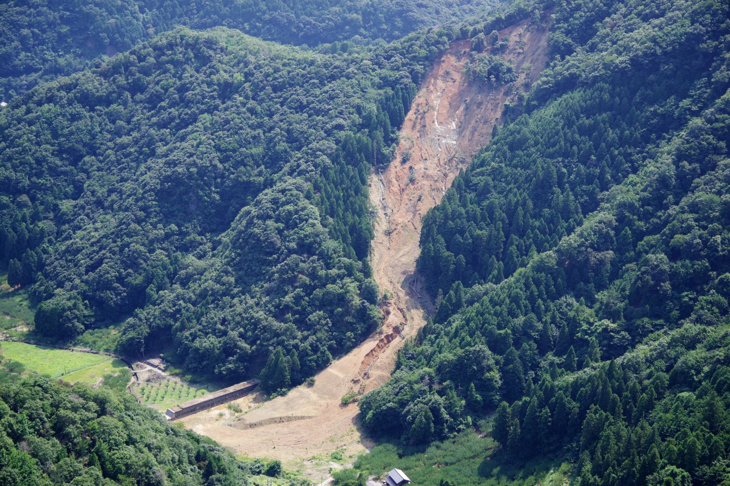
Having this kind of insight could potentially save lives by identifying risky areas before a disaster. For things like landslides and floods, which can happen in an instant in often remote locations, it’s impossible to predict exactly when they could occur, but having the knowledge that an area is particularly at-risk gives local residents a chance to either evacuate after storms or build up infrastructure to add extra protection. Additionally, these advanced visualization tools will allow for a disaster to be detected right away, both giving insight into which areas are the most in need of assistance and providing the maximum amount of time for rescue and assistance efforts.
OSASI Technos is a designer and manufacturer of sensing technology based in Japan and founded in 1972. They offer a variety of sensors, all based on measuring and monitoring natural environments, such as extensometers, water level loggers, and precipitation data loggers, among other tools. These sensors can be set up as part of a larger network throughout an area to monitor not only areas which could be potentially impacted by natural disasters, but also to assist in surveying projects and safety management on job sites.
Hexagon’s Luciad Portfolio, meanwhile, is a customizable platform to monitor and visualize geospatial data which can be used with many different datatypes, including proprietary or open source data, all of which can be integrated within the platform. It’s particularly useful in this kind of partnership, as it is specifically designed to be able to handle large amounts of data coming in in real-time, such as from the aforementioned sensors from OSASI.
On this partnership, Dirk Wagemans, senior vice president of commercial business for Hexagon’s Safety, Infrastructure & Geospatial division, said in a press statement, “By partnering with OSASI to deliver next-generation disaster management and monitoring solutions, governments have greater access to information and insights that could mitigate impacts of disasters and save lives.”
Maki Yano, president of OSASI Technos Inc, added, “With this new partnership, we aim to develop a new disaster monitoring solution for a wider area based on time-series data from the past to the present, integrating weather, water, and geological data by using Luciad's advanced visualization technology. By providing society with unprecedented intuitive information, we hope to contribute to disaster prediction and realize a safer society.”


