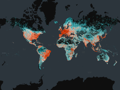
San Francisco, California | June 25, 2025 - The Overture Maps Foundation has announced the general availability of its Global Entity Reference System (GERS), a framework that provides a unique identifier for geospatial entities such as buildings, places, addresses, and road segments. The new system, according to the organization, will simplify the process for building mapping solutions across various industries, including automotive, local search, urban planning, ride-sharing, logistics, and more.
One of the most significant pieces of Overture's mission, GERS was built in part to reduce the time and financial expenditure required to ensure that data coming in from various data sources can be correctly associated with the correct entities in a map. Often, these costs can exceed the cost of liceensing the data, discouraging the use altogether. By providing open and standard IDs that can be used to directly associate additional datasets with the foundational map layers, GERS should be able to mitigate those concerns.
Overture notes that their open datasets includes 2.6 billion buildings, 64 million places, nearly 447 million addresses, and 321 million road segments, all of which can now be tied to a specific GERS ID. These entities are embedded directly within Overture's open map dataset, which are available under open-source licenses and are freely accessible for use in mapping, analysis, and application development.
“When we started Overture almost three years ago, we knew that to remake the geospatial industry, we had to solve the problems of adding rich data to the map. GERS does this and is the most impactful innovation of the Overture Maps Foundation so far,” said Executive Director Marc Prioleau in a statement. “It will drive innovation that impacts billions of consumers as well as companies, governments, and organizations globally. We fully expect it to become the standard around which the geospatial industry aligns.”
Representatives from industry leaders such as Microsoft and Esri have noted how these identifiers can reshape how organizations work with spatial data. Microsoft Vice President Jeffrey Hightower caleld data conflation a "hidden tax" in a statement, adding that GERS will allow new data to be added into systems in minutes. ArcGIS Content CTO of Esri Deane Kensok added that GERS will "accelerate innovation" within the industry.
Overture calls GERS unique within the mapping industry because of its opennes, its coverage of data cross the globe, the idea that it is tied to entities rather than coordinates, and its ability to enabled developers to do things like track changes to data tied to the unique ID, and more.
For more information on GERS, you can visit overturemaps.org/gers.


