
Hexagon also acquires UAV manufacturer Aibotix
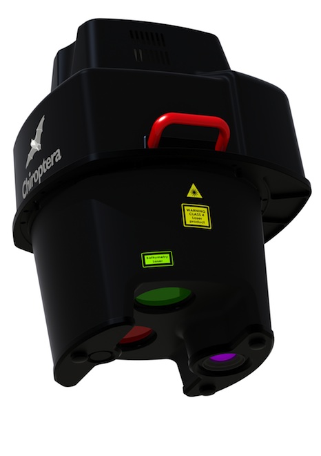
Leica Geosystems Inc. on Thursday introduced the CHIROPTERA II lidar system targeting market demand for high-accuracy, environmental data when surveying shallow water regions.
The updated system, debuting at the International Lidar Mapping Forum (ILMF) in Denver, simultaneously captures full waveform data in both the 35 kHz bathymetric channel and the 500 kHz topographic channel at depths of up to 15 meters to provide high-detail maps for environmental and coastal monitoring, infrastructure planning, and other near-shore applications.
The CHIROPTERA II incorporates the 80-megapixel Leica RCD30 medium-format camera, NovAtel SPAN GNSS-IMU subsystem, Leica MissionPro mission planning software and Leica FlightPro flight navigation software. It also features a new scanner package that allows installation in the Leica PAV100 stabilized mount, providing stabilization and reducing the number of flight lines needed, especially in turbulent weather.
Leica said being able to collect both bathymetric and high-point-density topographic data, plus high resolution aerial RGB images co-aligned with infrared images with a single sensor opens a new field of applications within coastal monitoring, coastal assets inventory, seabed environmental monitoring, charting applications, infrastructural planning, coastal erosion monitoring, seabed classification and other applications.
Headquartered in Heerbrugg, Switzerland, Leica is part of 3D imaging and measurement firm, Hexagon AB, and maintains U.S. headquarters in Norcross, Ga. The company also specializes in offering digital airborne and lidar sensors for the geospatial industry.
Hexagon, based in Stockholm, Sweden, is a publicly traded company (NASDAQ OMX Stockholm: HEXA B), with annual sales of more than €2.4 billion ($3.3 billion), acquired Airborne Hydrography AB, a manufacturer of airborne lidar systems for hydrographic and topographic surveys, and the original manufacturer of the CHIROPTERA, in October.
“Its depth penetration capabilities exceed those of competing sensors in its class, and its topographic point densities exceed those of other machines attempting to do both bathymetric and topographic data collection with a single laser unit,” said Anders Ekelund, managing director of Airborne Hydrography. “In this newest version, the scanner and controller have been separated to provide greater installation flexibility. Additionally, better detail can be extracted for both above-water and underwater features using a system that is not much more expensive than a traditional topo-only lidar.”
Hexagon buys Aibotix
In related news, Hexagon said it acquired Aibotix, a manufacturer of multicopter systems for aerial applications, including industrial inspection, aerial mapping, surveying, utility and security markets.. Terms of the deal were not disclosed.
Headquartered in Kassel, Germany, Aibotix is the maker of Aibot X6, a new generation of vertical takeoff and landing unmanned aerial vehicle (UAV).
“The Aibotix acquisition is an important addition to Hexagon’s photogrammetric and mapping technologies portfolio,” said Hexagon CEO Ola Rollén. “The growing number of applications for UAV-based solutions offers huge growth potential, especially in areas that require frequent and local updates such as smart city applications, dynamic GIS, and emergency response.”


