
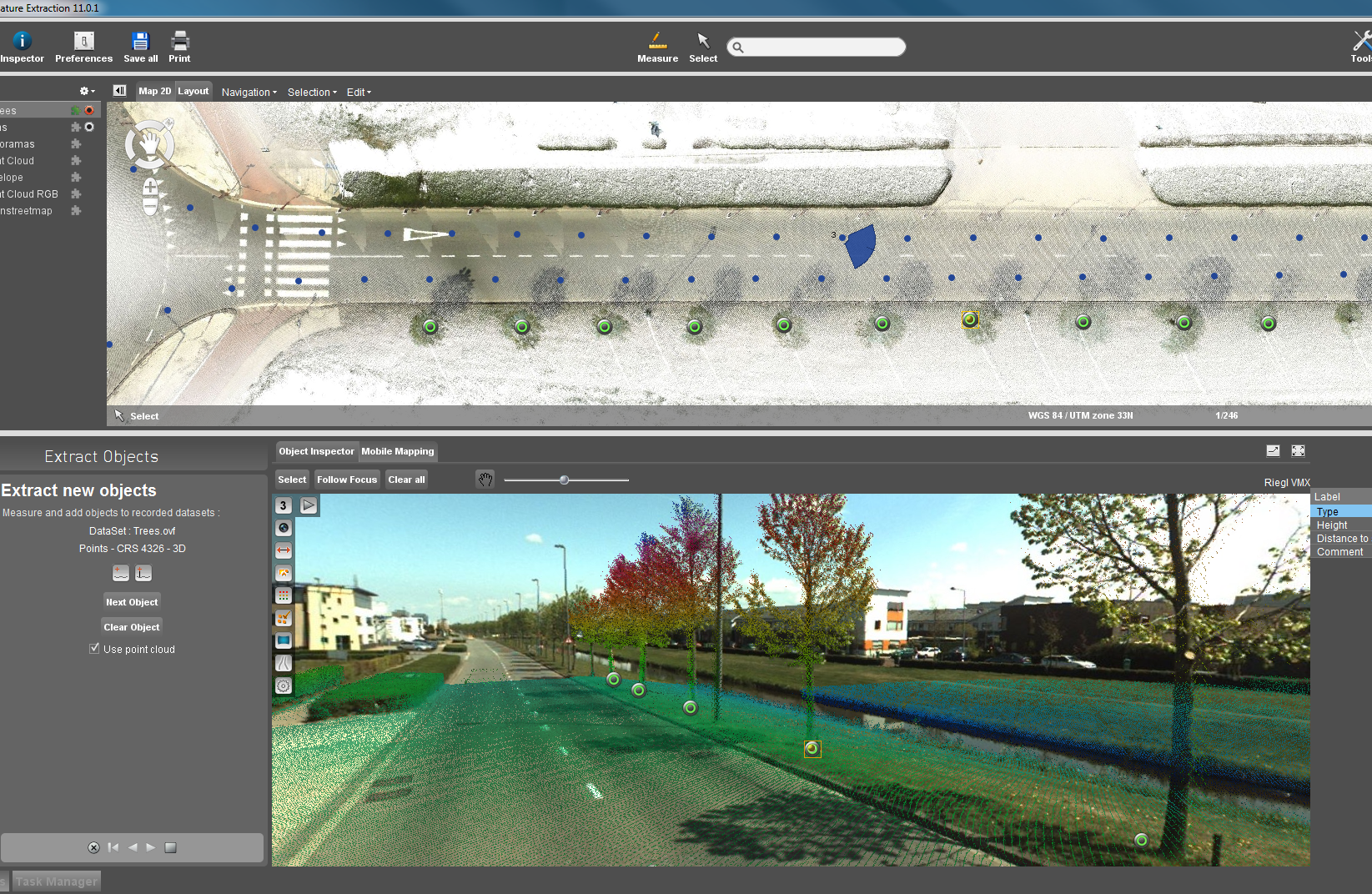
Orbit GT’s Mobile Mapping Asset Inventory (AIM) software can switch views between panoramic, 3D and planar within single measurement
Belgium-based Orbit GeoSpatial Technologies on Wednesday rolled out a new version of its Mobile Mapping Asset Inventory (AIM) software, saying it’s the first to support any kind of mobile mapping hardware setup.
Orbit GT develops software for managing, feature extraction, publishing, embedding and sharing mobile, UAS and aerial mapping data in workflows.
AIM v10.5 supports any combination of spherical and cubic panoramas and point cloud data. It also supports 3D point cloud-only setups without imagery.
It also supports hi-res planar images, even without the presence of panoramas or a point cloud. Planar images typically require proper calibration in order to be used for measurements and overlays, Orbit said.
“Whichever setup, professionals can now use the same tools to extract features, even switching views [between panoramic, 3D and planar views]within a single measurement,” said Peter Bonne, Orbit’s vice president of business development.
Another new feature of 10.5 is optimized data structuring, where all mobile mapping data is now managed in a single, database-like file system. The update is available for download here.
In related news, Orbit GT said ESRI The Netherlands has been appointed as reseller of its mobile mapping software products.
“We’re keen on providing our expertise and solutions in mobile mapping and obliques applications throughout the ESRI portfolio to the large ESRI community in The Netherlands,” said Bonne.
Marc Herbold, CEO Esri The Netherlands, and Peter Bonne of Orbit GT at ESRI UC last month in San Diego


