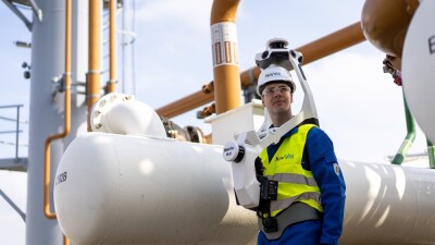
In May, NavVis announced a new wearable mobile mapping lidar system, named VLX3. Now, they have announced a partnership with Chinese lidar technology provider Hesai Technology, whose XT32M2X lidar sensor will be used exclusively for NavVis’ new VLX3 system. Hesai Technology’s lidar technology is used in a variety of industries, including automotive, robotics, and industrial.
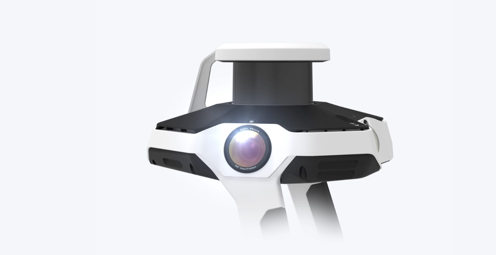
Sensor specifications
The XT32M2X is a 32-channel medium-range mechanical lidar sensor that generates 640,000 points per second, an amount that doubles for a dual return and triples for a triple return. The instrument range is 0.5 to 300m, with a range accuracy of around 1 cm and a range precision of 0.5cm - 1cm. The horizontal FOV is 360 degrees, while the vertical FOV is 40.3 degrees. These features will enable NavVis users to capture precise and comprehensive data with extreme efficiency. Based on the joint industry expertise of the two companies, Hesai has designed these lidar sensors specifically to serve industries such as reality capture, AEC, and scan-to-BIM.
VLX3 system specifications
The specifications mentioned above are for a single sensor, the new VLX3 system includes two new 32-layer lidars, carrying a range of up to 300 meters while capturing almost 1.3 million points per second. The accuracy of the VLX3 is also much higher than that of a single sensor: in a “dedicated test environment of 500 square meters,” NavVis found an accuracy of five millimeters. In addition to the two lidar sensors, the NavVis VLX 3 also includes four high-resolution (4 x 20 megapixel) cameras around the top of the system for a 360-degree panorama.
NavVis co-founder and CTO Georg Schroth stated that this new partnership underscores NavVis’ dedication to providing the highest-quality data and services to its clients, enabling them to make informed decisions based on reality and streamline their scanning workflows. The collaboration signifies a significant advancement in reality capture, equipping professionals with the capability to survey and analyze complex environments with a groundbreaking level of precision and efficiency.
An outdoor digitization project in China
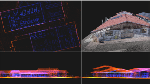
The VLX was recently used in a digitization project of five neighborhoods in Beijing’s Shijingshan District. The project area contained hundreds of buildings whose facades needed to be measured within six weeks. Additionally, data needed to be collected about the location of water and gas pipes and plan renovation activities to comply with China’s development strategy as laid out in the country’s five-year plan.
The NavVis VLX mobile scanner quickly and easily obtained the actual status of old neighborhoods and completed the renovation with high efficiency and speed as well as low labor cost: the data of five neighborhoods, including about 100 buildings in Shijingshan District, Beijing, were captured in just one week, which is more than ten times faster than the speed of traditional terrestrial laser scanners (TLS). Also, the data can provide a realistic basis for renovating old neighborhoods and help in construction planning and decision-making.