

This month, the United Kingdom’s Geospatial Commission officially launched the National Underground Asset Register (NUAR) to select locales throughout the UK. The NUAR, which is a digital and interactive map of infrastructure and other assets buried beneath the surface, is initially being made available to stakeholders in London, Northeast England, and Wales. This initial phase of the project has been developed with data coming from public and private organizations and companies which own underground assets in the areas being covered.
We should certainly note that the Geospatial Commission is being sure to rein in expectations of this rollout, noting in a blog post that this initial phase is just a “minimal viable product,” noting that it’s “not a final end product,” and that the intention is currently for it to “complement rather than replace” business-as-usual practices for stakeholders.
The NUAR initially started back in 2019 with individual pilot projects, with this release being their first widespread. There have been more focused initiatives from smaller public organizations as well as private ones, such as London’s Highway Apparatus Data Exchange System (HADES) and Northumbrian Water Group’s 2018 Innovation Festival, but this will be the first time the entire nation’s assets will be available under one shared umbrella. Indications from the UK government are that everything is still on track for the rest of England along with Northern Ireland to be available within the surface within the next two years.
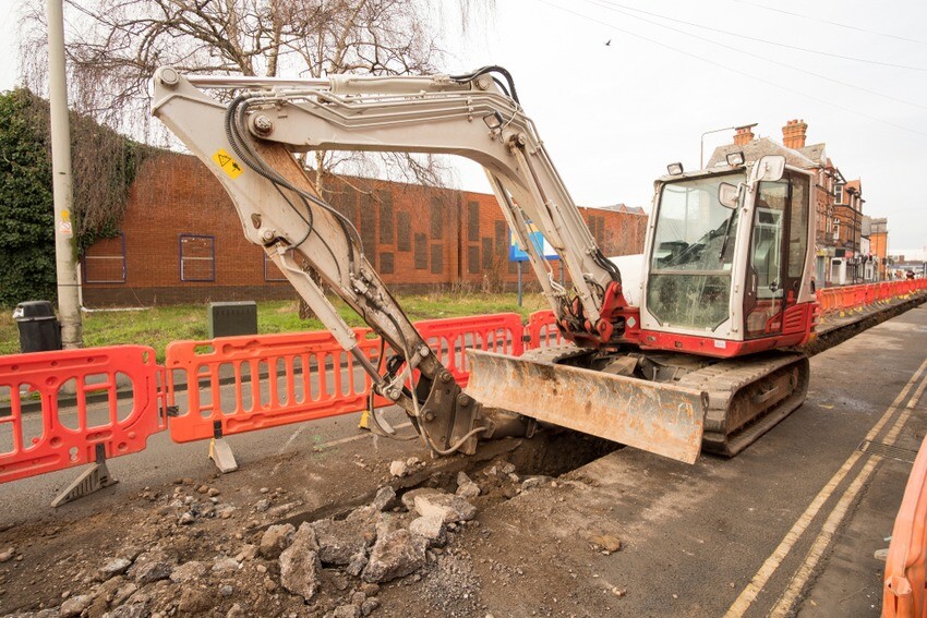
Developing this kind of easily accessible register of what is happening below the ground – this data-sharing platform will include not only the location of infrastructure, but also the condition of these assets – is crucial as construction demand increases around the world. According to information from the Geospatial Commission, there is an estimated four million kilometers of buried pipes and cables throughout the UK, and roughly four million holes dug for construction on an annual basis. If that seems like a setup for many danger occurrences, that’s because it is, with an estimated 60,000 accidental strikes of underground assets occurring in the UK every year.
Unsurprisingly, these kinds of strikes can be extremely dangerous to both workers and surrounding communities, with risks of everything from burst water mains, gas leaks, and even explosions. New technologies, ranging from things like GIS to create this kind of interactive map like the NUAR to 3D representations which can be viewed in augmented reality to overlay physically, can help prevent most of these strikes. As we’ve talked about here before, we don’t have great records for a lot of these underground assets, and records that are accurate are often held strictly by the asset owner.
According to those in charge of this initiative, NUAR will largely create its value from its storing and securing of data. Asset owners will provide their data to one single location, and everything coming in will be standardized to make it readable for everyone, with assurances from the Geospatial Commission that they will “secure data shared through the platform to safeguard and protect against misuse.”
Increased safety is certainly the most significant value add which will come as a result of the NUAR. One estimate from 2020 indicated that in the previous two decades in the United States, there were over 400 deaths and 2000 injuries attributed to underground strikes during excavations. Similarly in the UK, there were 318 reported injuries or fatalities between 2012 and 2017 for the same reason.
And even looking beyond injury, this kind of database should go a long way towards solving for two of construction’s major issues: Budget overtures and project delays. Unexpected strikes of underground assets are a significant driver of both of these problems, and can be solved relatively easily by simply knowing where things are located beneath the ground. The Geospatial Commission estimates that the economic cost of these accidental strikes is about £2.4 billion per year, with the economic benefits of the NUAR coming in at an estimated £350 million per year. This includes benefits both to the company doing the construction as well as surrounding businesses, who often have to close for a period of time after a strike.
"This first release of NUAR is a major milestone in a programme that will benefit everyone. By using the power of location data to plan and deliver street-works more effectively, it will improve the efficiency with which we supply essential services, and it will minimize the disruption experienced by other road users,” said Dr. Steve Unger, Independent Commission, Geospatial Commission.
“Many different asset types are buried beneath our feet, owned by many different organizations, large and small. We are delighted by the number of asset owners that have recognised the value of working with us, to make the data that they hold more accessible.”
Note: A previous version of this story incorrectly stated asset owners would be legally compelled to make data available for free.


