

From helping local governments understand their communities to real estate firms, construction, and insurance companies keep extremely accurate data on their buildings, mobile mapping is one of the most popular and critical topics in the evolution of surveying. In 2019, Mosaic saw that the demand in the mobile mapping and GIS surveying markets for higher-image quality wasn’t met, with most mobile mapping cameras lacking in this field, and started developing the Mosaic 51.
Designed to be the most durable, precise, and practical 360º camera for urban mapping & surveying, the Mosaic 51 now fully integrates with an external GNSS device to easily achieve RTK.
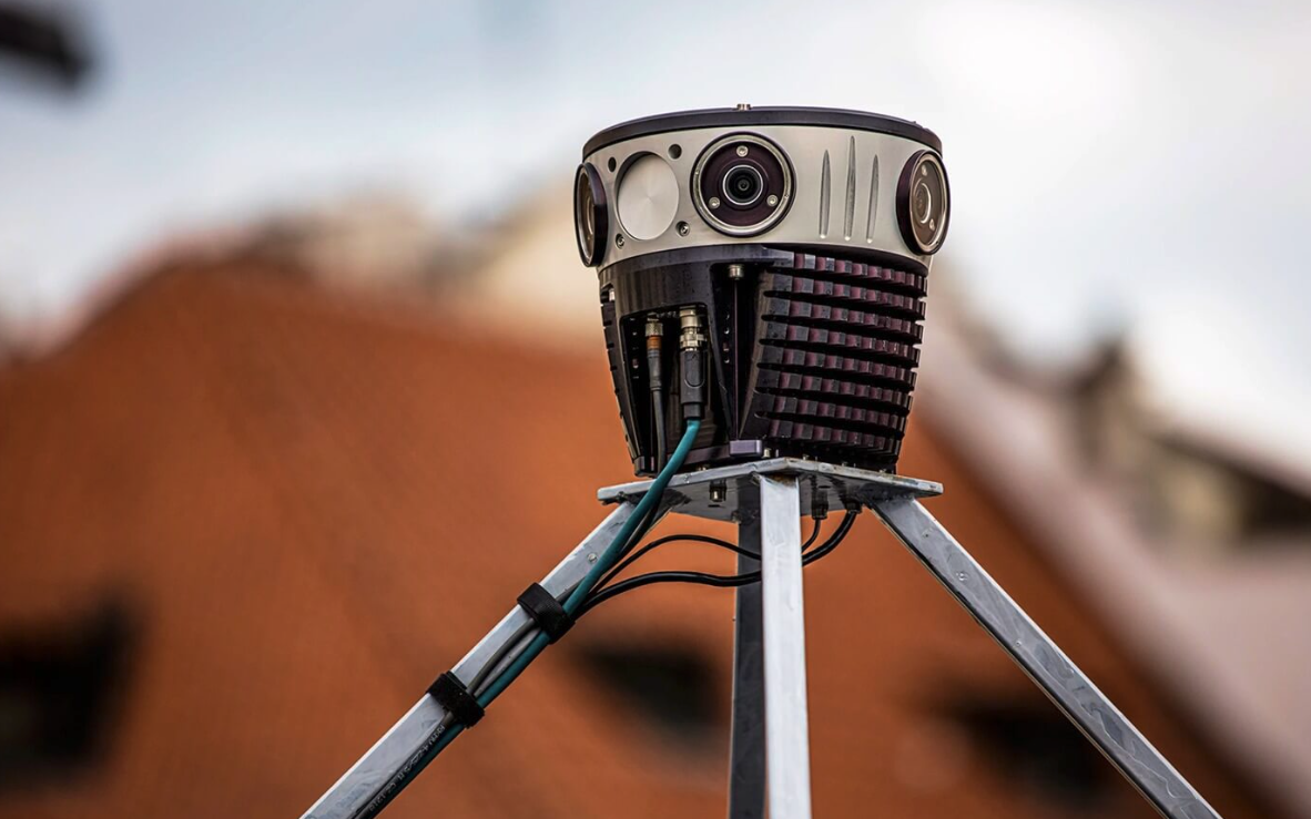
Built to get dirty, the Mosaic 51 is a purpose-built, AI-compatible, rugged, 360º camera for HD mobile surveying, GIS, railway, and infrastructure inspection. The Mosaic 51’s industrial frame, IP64 rating, and removable lenses mean it’s waterproof, dustproof, and guarantees that it will come home in the same condition it left in. According to Mosaic, its six easy-to-service 12-megapixel noise-free image sensors have proper thermal management and microsecond-level sync, providing a 72MP resolution - one of the highest available on a mobile mapping camera. Featuring an embedded computer, users don’t need a dedicated computer to operate and capture data, making it more functional and portable than traditional mobile mapping systems, which are larger, heavy, and require additional pieces of equipment.
While the camera comes with a built-in GNSS receiver with an accuracy of about 1.5 meters, the latest Mosaic 51 update gives users an even higher image resolution and position data precision. By integrating an Emlid Reach RS2 multi-band RTK GNSS receiver, users can now collect centimeter-precise results in any place on Earth, maintaining robust performance even in challenging conditions. Mosaic chose the Emlid Reach RS2 receiver not just because of its price but also because of its features. These include its ability to maintain robust performance in challenging conditions, achieve centimeter-level accuracy for distances up to 60 km in RTK mode and up to 100 km in PPK mode, and have a 22-hour battery life.
Catsurveys, a UK professional surveying company, has used the Mosaic 51 to help them speed up surveying processes and improve the quality of the data for Physical Infrastructure Access surveys. Not only did Mosaic 51 remove the need to increase site resources, but it also allowed the company to move the price point of individuals down by around 40%. Moreover, whereas a surveyor capturing images using traditional methods will cover about 200 homes per day, Catsurveys can now cover 3,500 homes in a day.
All Mosaic customers can now benefit from this integration, even with the company’s upcoming Mosaic X camera.


