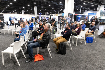
HOUSTON – At the SPAR International conference held here, Gene Quinn, vice president, Volkert Inc., a transportation design company that has worked with 13 state DOTs, mostly in the Southeast, presented a case study of using laser scanning on a highway project in Tampa, Fla., to create significant efficiencies.
Quinn, who heads up Volkert’s office in Gainesville, Fla., has managed digital survey projects on over 700 miles of Florida highways over the past 21 years.
Quinn’s case study on the Lee Roy Selmon Expressway in Tampa showed how Volkert tackled the design survey for improvements in the elevated 2.3-mile segment of the highway. Volkert combined GPS static and RTK, conventional data collection, static laser scanning and mobile laser scanning to provide a comprehensive design survey for the re-decking and widening of the segment from four to six lanes.
Volkert did all survey work from start to finish on the project for the Florida Department of Transportation (FDOT), said Quinn. The survey work was completed in January.
To acquire data for the design project, Volkert used a Reigl VZ 400 scanner on the superstructure of the expressway bridges and a Reigl VMX-250 mobile scanner on the deck surface. The company performed more than 90 static scans for the project.
FDOT required that the design database be developed in MicroStation software. “Florida has been slow to warm-up to the use of mobile but they are warmed-up to the use of static,” said Quinn.
After the data was extracted, Volkert used several technologies to reduce overall design time and create a final MicroStation design file.
“The richness of the data here was extreme, but we were able to get a lot of features out of this extraction that would normally have been a lot extra work,” Quinn said. This included items such as light poles, overhead lighting, and overhead utilities.
Quinn said they had a 12-week window to complete the project, and they completed it in 11 weeks. “This is fairly aggressive for a project of this nature. Meticulous planning was certainly essential … getting all the static scans and doing all the associated survey work underneath the bridge.”
Later in the session, Paul J. Kinder Jr. and Adam C. Riley of West Virginia University discussed how short- and long-range ground-based laser scanning could be integrated with airborne lidar.
“Our experience base has really been with airborne lidar,” said Kinder, “and the past couple of years we have started to work on ground-based lidar.”
For over seven years, WVU has been using an Optech ALTM 3100 airborne lidar system for a range of environmental/ecological forestry management-type and heritage/cultural resource applications. “It’s a workhorse, is pretty old now and pretty slow. But we find ourselves flying lots of flight lines, lots of overlap, especially for the smaller projects,” Kinder said. “So our experience base has really been with airborne lidar, and the past couple of years we have started to work on ground-based lidar.”
To make integration of the ground-based surface scans and airborne integration work, the RTK GPS surveys required for airborne lidar must be expanded to geo-reference the surface scans from WVU’s Faro and Riegl scanners. However, if done correctly, the two datasets can be combined to create a continuous point cloud that allows for a much richer picture of the environment being studied.


