The future of geospatial intelligence will in part be shaped by the young professionals studying it today, alongside rapid advances in technology and evolving industry demands. The continuation of this fast-paced evolution seems more than likely, supported by legacy knowledge, historical context, and the expertise of current leaders. In this series, we feature leading geospatial experts to share insights that may help guide the next generation toward success.
Dr. Shawana Johnson is a leader in the geospatial and remote sensing industry, with a career that began at the earliest stages of satellite commercialization and has continued through decades of global innovation and connection. Starting at General Electric in high-performance computing, she was recruited to join the team that helped transition NASA’s Landsat program from a government-only satellite system to one accessible for civil and commercial use. Working under the guidance of government intelligence leaders such as Jeffrey Harris of the National Reconnaissance Office and General James Clapper of the CIA, she contributed to the development of early global distribution networks for satellite and aerial imagery. That work laid important groundwork for the accessible mapping technologies we use today. After contributing to major aerospace transformations, Dr. Johnson founded Global Marketing Insights through a Small Business Technology Transfer program, supporting collaboration between various professional sectors in Earth observation.
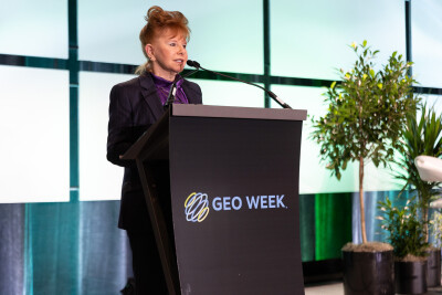
We are also lucky to have Dr. Johnson’s expertise as a member of our Advisory Board for Geo Week 2026. As someone whose career has been spent helping shape the industry of geospatial intelligence and bridging the gap between data and the ones who could most benefit from it, Shawana shares valuable knowledge and practical advice for those entering or advancing in the geospatial industry. In this piece, Shawana offers keen insight on trends to look out for, how to overcome challenges, and advice on how to truly thrive in this area.
Looking ahead to the next five years, what emerging or underappreciated breakthroughs in geospatial or remote sensing technology do you believe will have the greatest impact?
Dr. Shawana Johnson:
So today, I would say that if I finally started to talk about something I’ve been looking at for five years, maybe eight years, it would be quantum compute. I look at quantum compute from the fact that we need to protect ourselves as a nation and as a technology in a cyber-secure way.
I’ve spent a lot of time in laboratories and with folks at IBM Research and others who’ve created some quantum compute advancements that allow us to change our communications downlinks from satellites and even on the ground in the battlefield. We can change our wavelengths that we’re communicating on in a way that moves things so quickly through quantum compute, it would be very hard to do a cyber breach.
For me, in geospatial and remote sensing technology, that’s going to have a great impact. I’ll give you an example. There’s a company called IonQ. IonQ purchased a satellite company called Capella Space, and they’re going to be focused on the next sensor that Capella Space launches. They’ll be looking at ways to improve precision, navigation, timing, and protection of Capella Space from outside infiltrations.
When that work begins, we’re really going to enter a new age of communications in space. Actually, it will impact what happens on the ground as well, and we’ll start to see improvements, we hope, in cybersecurity.
Now, this is not easy. Quantum compute - the compute piece of it - is not large, but the amount of power that it requires, that kind of cooling capability for a computer that would be small, would take a room bigger than the one I’m in for its refrigeration.
These are big emerging technologies with challenges to be solved, but when they are, it puts us at the forerunner of on-orbit data centers, where we’re actually processing data in space and sending a final solution, combining it with aerial imagery at the time and on-ground capabilities quickly.
It has a big impact as you think about Golden Dome and other defense and Department of War solutions. It has a big impact, and that always has a big impact on the commercial world. So I would say that’s the most leading-edge thing that I’m involved in at this point in time.
You've worked across an extraordinary range of organizations, from two person startups spun out of national labs to large scale government programs. What has inspired you to stay committed to the geospatial and remote sensing industry throughout your career?
Dr. Shawana Johnson
You know, this career has just been a blessing. It's new and challenging and exciting every day. It's an honor to work and to serve your country with what I think are some of the best and the brightest minds in science, physics, math, business. I mean, you really never know who you're going to be speaking with, what their background is, and what you're going to learn. There I am in this room with this man who comes in and asks me these questions and then he leaves and I find out he's the honorable Jeffrey Harris, the director of the National Reconnaissance Office, when no one even knew that existed. Keeps me always engaged. Never, never discount any individual that you talk to in this industry. Ever. You have no idea who you probably are speaking with.
With your decades of leadership in geospatial business intelligence, what have been some of the most significant professional challenges you faced and how did they shape your approach to innovation and collaboration?
Dr. Shawana Johnson
I think the slowness of adoption on the commercial user side and in terms of analysts in the government even being able to access commercial technology; that's always been a pretty high bar to get over. This type of data and the type of processing we work in, you know, it's an added cost to your business when you want to jump into remote sensing technology.
Whether it's airborne, a waterborne vessel, an unmanned vessel, an unmanned aerial asset, or a manned aircraft, and the types of data that we can get from space now, it's still not inexpensive to jump into it. Commercially, businesses have to know there’s going to be some return on investment.
And then, on the government side - the government has its own assets and analysts that work for the government - they still have to find the time to learn about that commercial capability, get approval, and the ability to merge it into what they’re doing in their government process. That has been slow. We are now in a time period where that is starting to move forward, so that is changing, but that’s always been a hurdle to get through.
You have to do a lot of education with whoever it is you're working with, whether it's the government, academia, or industry professionals.
The other thing is, sometimes on the commercial side, once they know it’s a good idea to utilize these technologies and capabilities, there is a lack of realism or planning around the difficulty of expanding the commercial market. That’s when the venture capitalists came in and started investing heavily into the technology. That changed things, because now the commercial world was saying, “Okay, now I can build a business on this!”
However, the speed at which they hoped it would happen didn’t always match up with the timeline from investors. So that created another professional challenge: helping get them over that hurdle.
Based on that, in the new age of financing or getting venture capital money, there are many individuals that enter into these agreements and have what you call “an exit strategy.” Their goal is to get the business to a certain stage, sell it, and then exit the business. That’s very different from building a business organically for the long haul.
Fortunately, we have a lot of small businesses that do just that. However, they're small businesses, and in the new age of venture capital, equity partner capital, and all the mergers and acquisitions, we see a lot of it is built around what I call “exit strategy,” which is different from investing in an industry and building the business for the long haul.
Now, I'm not saying those things don’t help move an industry forward, but it does cause professional challenges. I’ll get called in a lot, and people will tell me how projects didn’t move forward in terms of a commercial market. I’ll then look at my team, and our researchers will look at the plans and say the plans didn’t really work the way they should have because they were focused on the short-term turnaround. Since they were more focused on making money or doing a merger or acquisition, they didn’t spend enough time.
So those are the top three. However, you asked me about innovation and how it changed my approach. I don't think it ever changed my approach to innovation and collaboration because that’s what I built my career on. Instead, it made me even more focused on my belief that it is the right thing to do: focus on collaboration and get partners that have highly specific capabilities.
Rising tides lift all boats, and together they’re stronger. So I think it made me more focused than ever before on looking at innovations, checking the market conditions, making sure there’s market growth opportunity, and then bringing in partners to collaborate to move that forward.
Abigail Hart
I recently watched a Geo Week webinar about Departments of Transportation (DOTs) adopting tech and it's interesting to me to hear about how the federal government is kind of a leader in adoption, but then at the state level it's a little bit harder to get there.
Dr. Shawana Johnson
Yes, it is. That’s because they operate differently and the way their funding is managed is very different. The federal government and the Department of War do things one way and at one speed, with perhaps a larger budget. As you try to move the technology down to a level where it's actually used locally - more commercially for those of us that are citizens of the Department of Transportation - then it becomes harder because they still need the data, but they have to buy the software and implement the technology.
There are hundreds of small businesses out there that you'll meet at Geo Week this year that do focus on things just like that for the Department of Transportation. But it is challenging for them, the big government starts it and then the technology seeps out to places that can take advantage of it to a really good provisional way that helps improve our lives. Whether it's snow plows to help get to their destinations faster and easier, or from a safety perspective where they're more thorough on the roads, or it's building information modeling and we learn more about exits and the quality of high-rise buildings; it's fascinating to see how it moves across state and local government and in the commercial world, but it does move eventually.
The geospatial field brings together talent from so many backgrounds and career spaces. What qualities or mindsets do you think help someone succeed and grow in this industry?
Dr. Shawana Johnson
First, curiosity to learn and never stop learning.
You don't ever become an expert. You keep changing your viewpoints and you take in more technology, and it changes the way you view problems and challenges. You must be curious to learn, and you must never stop learning.
Second thing is you have to be willing to do things outside your realm of comfort and capability. So you should always be saying: “well, I don't know if I'm going to understand that technology, but I'm going to dive in and see what I can do.” I think the third thing is you need to be a team player.
There are many other things you have to focus on. You need to learn to write on your own, not always using ChatGPT. You need to pay attention and be selective about the quality of inputs that you take in, so always do your research as well. This industry is blessed with extremely high-quality talent because of our beginnings. When you have the history of the industry, you can see where we came from. Whether it's airborne or spaceborne or the tech, we have inherited this great legacy of scientists and innovators and people who were really dedicated and motivated to move industries forward and did so. So learn, do things outside your realm of capability, be a team player, and keep your current skills as current as they can be.
You’ve worked at the intersection of government, defense and commercial innovation. What aspects of your work excite you the most each day, and what keeps you passionate about driving progress in this space?
Dr. Shawana Johnson
The fact that even you and others care about this work makes me very passionate, keeps me passionate about it. And geospatial is everywhere. We are not a market unto ourselves. We move across all markets.
Well, what could be more exciting than that?
You're never doing the same thing two days in a row. You're always engaged with other professionals who have equally as exciting careers and have had many opportunities to get where they are. So, for me, geospatial is everywhere. It crosses all market sectors and it leads you.
You had another question in there as well about “what advice do you offer young professionals and entrepreneurs.” We try to work with hundreds of young professionals and entrepreneurs and it's probably easier for us because we have big research capabilities and we move across all these industries. But I think, for me, the passion that drives me about the progress in the space is related to your next question about helping people build a meaningful career in geospatial intelligence and remote sensing. And I think you have to know yourself.
I always tell everybody to take as many professional profiles as you can, to learn and meet people, and never, never take anything for granted. Like when you meet someone, whether they're the quietest scientist and you might have to work harder to engage with them, do it. You need to get to know everyone and you'll see them your entire career and I'll give you a great example.
A few years ago I was in the Hawaiian Islands for a Pacific Defender exercise where we were showing a planetary scale capability that merged all types of airborne drone, unmanned, manned aircraft and space-borne capabilities in a variety of really unique technologies, from planetary scale mosaicking to 3D and virtual reality. And in that exercise, I met with General David Thompson, who at the time was working in his role there with the Air Force five years ago, maybe four years ago.
Then, recently a month ago at the Colorado Springs Space “Value of Space Summit”, which is put on by Space ISAC and they also are the ones that develop the Space Watch Center where we know what's happening to all our satellite communication devices on a regular basis on a daily basis. Well, I was on a panel at this big summit and there lo and behold on another panel was DT Thompson and that was General David Thompson. And became the vice chief of space operations (and I may not have that exactly right) for the Space Force. I got to see him again and chat with him. So get to know everybody. Don't ever discount anyone. You will see them again and again in your career, and they will inspire you to learn something new. They'll introduce you to somebody. So, that's where the passion comes from.