
In an ongoing GIS project for the San Diego County Regional Airport Authority, Woolpert LLP made a strategic decision to use laser scanning techniques to develop datasets to be incorporated into the maintenance plan for the San Diego International Airport’s infrastructure data management program. Key deliverables were floor and ceiling plans including all visible plumbing, mechanical and electrical (PME) features for the airport’s terminal buildings. Woolpert survey/GPS group manager Kevin L. Stacy, P.S., reports that using laser scanning to capture this data in Terminal 1 slashed field hours by two-thirds compared with conventional survey methods.
“Without laser scanning it would have taken two-thirds of a man-year to measure the building,” Stacy reports. Using traditional methods, the work process would have started with digitally scanning existing, out-of-date paper drawings. “Then a two-person crew would have gone into the facility, redrawn the plans on their pen tablets as they took physical measurements with mechanical and electronic tape, taken that data back to the office and cleaned it up.” But laser scanning cut field time “from about 1400 hours to 235 hours, not to mention the savings in per diem and other travel expenses,” Stacy reports. “And our scan ‘team’ was just one person, whereas a traditional measurement team would have had two people.” Data capture required “just two trips of ten days each, working an average of 12 hours a day.” The first trip came at the end of June 2003 and the second trip in early July 2003, separated by a week in the office to QA/QC the data from the first trip.
After scanning, office time required to produce 2D plans was 425 hours, which equaled the CAD cleanup time that would have been necessary to complete the drawings compiled in the field on pen-top computers had conventional methods of measurement been used.
Planning phase
In the planning phase, the San Diego Airport provided CAD drawings of the terminal that dated from 1970. Based on the drawings a preliminary scanning schematic was created. “We used the drawings to determine how many scans we thought we would need, and laid that out on the plans,” Stacy reports. Also based on the drawings, a conventional horizontal and vertical control network was designed that would be referenced during scanning. “My group is surveyors, so we attacked it from a traditional survey viewpoint,” Stacy explains. “We used targets and
did conventional survey traverse and leveling to keep our scans tight.”
“In an effort to reduce the on-site time for security clearance, our scanner operator completed all the paperwork, background checks and fingerprinting at our local Port Columbus International Airport,” says Stacy. “This was done to keep site time short and costs low.” Once clearance was obtained from Port Columbus, the information was transferred to San Diego. This reduced the on-site time for security badges and airport orientation and pictures to just one day.
Work plan adjusted to accommodate field conditions
When Woolpert’s surveyor arrived on site, he found the work plan would have to be adjusted to accommodate field conditions that weren’t reflected in the data that had been provided for planning. “He found that scanning would have to be executed in two shifts,” says Stacy. “We had previously thought he could work just during day, but we found he would also have to work at night, to keep pedestrians out of the scan scene in order to cut down processing time.” General public areas were scanned between 10:00 p.m. and 5:00 a.m., while airline offices, store areas and restaurants were scanned between 10:00 a.m. and 5:00 p.m.
Also, “the floor plan provided by the airport was not accurate, since some wide-open spaces had been converted to smaller offices” in the years since the plans were drawn, according to Stacy. The surveyor also found that extra coordination would be needed to gain access to lease spaces and storage spaces.
But Woolpert had planned for such contingencies. “Our laser scan technician is a registered surveyor, he’s our eyes and ears, so he can remain flexible,” Stacy reports. “We felt it was best to have someone with crew-chief experience who’s a registered surveyor, who would attack the job from that professional standpoint.”
Field work process emphasizes survey control
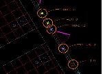
Before scanning, the operator established a control network by setting targets through the main ticketing areas and long halls of the terminal. Control targets were located every 4 or 5 scans, with intermediate (non-control) targets utilized for feature alignments. A conventional spirit level was used to transfer elevations to control targets, and a conventional total station was used to traverse through the control targets – “the same principle we would use in conventional survey, a primary traverse and then a secondary traverse.” Once scanning commenced, the operator took care to capture common features to ensure all the smaller areas could be aligned into the overall scan data.
“The survey field book was important too,” Stacy says. The operator “logged daily scan activities to overcome the necessity of ‘jumping around’ as access was obtained for controlled areas.” As he scanned, the operator had to adjust daily scan activities to accommodate access and provide a continuous workflow for the scanning. The field book was used to “keep track of where we had been, and where we had to go.”
Scanner choice: Riegl LMS-Z360
Survey personnel utilized the Riegl LMS-Z360 for laser scanning of all interior rooms on the two floors of Terminal 1. An attractive feature of this device is that it “works within a 90-degree scan window, from +50 to -40
degrees,” says Stacy. “And it can pivot upward to collect ceiling data without the operator having to move or readjust the scanner. While scan centers do not remain the same, the scan window is easily adjusted to overlap the previous scans.”
Why did Woolpert choose the Riegl scanner? “We looked at every laser scanner on the market,” according to Stacy. “We decided we needed a scanner that would work well inside and outside. We wanted to have something that was versatile enough that as we entered the laser scanning market, we could do a number of different types of projects. We’ve been doing buildings and as-builts, adding data to clients’ GIS systems, and DOT work, so that’s one of the reasons we decided on the Riegl.”
How has it worked out? “We’re surprised at how clean the data was,” Stacy reports. “I’m typically a skeptical person, so when we went out and did our first laser-scanning test on a bridge, we had our total station as
well. We measured points with both and compared them, and found we were getting survey-grade accuracy everywhere we measured when we aligned the clouds, as long as we did our due diligence on survey
control.”
Field lessons learned
• Advance planning is critical to knowing what to expect in the field, according to Stacy.
• Any preliminary legwork to determine access issues that can be integrated into the work plan is a must. Downtime was caused by having to arrange access through different entities (airport operations, airlines,
lease spaces). “My crew chief got frustrated with the downtime when people did not show up to let him into the work areas.”
• Optimize data transfer to the office so processing can begin before field personnel leave the site. “This lets you find the bare spots so your surveyor can take care of those while he’s still on site.”
• Data for the project totaled about 130GB after processing, Stacy reports. “High-speed Internet connectivity at the local hotel was inadequate, which resulted in the transferring of data to CDs and shipping them to the office every other day.” Finally, “we got smart and started using USB external hard drives for shipping data.”
• Reflectorless total stations are a must, “otherwise you have to have another body on your scan team. Our scan team is just one person with a laser scanner and a reflectorless total station, preferably a robotic one.”
• “A conservative [large]number of scans insures quality of data,” Stacy reports. To further ensure scan quality, the surveyor must be free to make decisions of where to adjust scans in the field, and not dependent on plans made back at the office.
• In scanning long hallways, “we should have taken more and smaller scans, or else densified control to facilitate alignment. Two straight lines in parallel became problematic when we were aligning scans of long
corridors.”
• Field measurements of doors and windows, as well as non-visual (hidden) features, were invaluable for QA/QC and total feature extraction.
• Ability to adapt on-the-fly to conditions encountered in the field is critical. “I had a young Marine working as a survey technician some years ago,” Stacy recounts. “He coined a phrase, ‘semper Gumby’ – ‘always flexible!’ You have to be able to adapt to the building locations.”
• Make sure the scanning system can be “configured to be truly mobile. Can you roll your tripod and dolly through a doorway without breaking down and setting back up?”
Data processing workflow
Stacy sums up the workflow for processing scan data:
• Section out the overall project into areas of manageable size.
• Align scans within each area.
• Cut sections for footprint of each area.
• Adjust footprints in CAD.
• Extract PME (piping, mechanical, electrical) features as well as doors, windows, overhangs and the like for floor plan. Extract ceiling tiles, lights, speakers, etc. for ceiling plan.
Riegl’s RiSCAN software was used to geo-reference primary scans containing a minimum of three targets each. Secondary scans would be aligned to the primary scans using “common features;” the extra targets placed to facilitate common features were helpful in aligning secondary scans.
PolyWorks’ best-fit alignment was used to adjust secondary scans to “locked-down” primary scans. “Once we had primary scans and locked down x,y,z coordinates on them, then we adjusted the secondary scans.” A problem encountered was that PolyWorks’ best-fit alignment of long corridors and hallways did not work with a large number of scans. To solve this, the operator experimented with the settings and reduced the number of scans to three or four when aligning with the locked-down primary scans.
Building the AutoCAD deliverable
• Create DXF files in PolyWorks.
• Transfer DXF file to AutoCAD. “You can’t bring more than one DXF file into a single AutoCAD drawing,” he says, “so we had to assemble multiple DXFs.”
• Insert AutoCAD drawing into overall floor or ceiling plan. (Stacy notes that PolyWorks can now export primitives such as polylines directly into Bentley’s MicroStation V8 as a complete floor plan, which can then be
saved in AutoCAD format.)
QA/QC and finalizing the deliverable
• Build the aligned geo-referenced footprint of the entire building.
• Complete the floor plan with door swings, windows, overhangs, etc. for the entire building.
• Complete the ceiling plan for the entire building.
• Add PME features to complete the project – “anything visible that we could extract and put on the plan.”
Data processing road bumps
In utilizing sections to develop footprints, the operator found that sections could not be cut through the raw aligned point clouds. The solution was to use PolyWorks’ IMMERGE process to build a mesh model, then use
its IMINSPECT function to cut sections.
In feature extraction, a problem was that noise levels around corners and doorways made detecting actual door sizes difficult from cut sections. The solution required close examination of scan data and extraction of individual polylines for each door and window. Feature extraction was greatly enhanced through use of the digital photos from the scanner. Additional photos were taken to supplement the field notes and measurements of key features and trouble areas.
Office lessons learned
“Chain-link fences and wire-mesh security fences hide a large percentage of data,” Stacy reports. In scanning, these are “best treated as solid walls and scanned from both sides, with supplemental field notes.”
Data processing needs dual processors and a workhorse graphics card. “My technical support group didn’t understand we needed a bleeding-edge computer to handle this data,” Stacy observes. “We have an aerial photogrammetry group that has the proper equipment, but tech support couldn’t understand why a survey group needed all that.” However, “this is one time that ‘bleeding-edge’ technology will pay for itself.”
Mass data storage/management capabilities are required for archiving scan projects. Data for this project totaled approximately 130GB, and required three 50GB data tapes or 32 DVDs for archiving. “Brace yourself when you ask your tech support department for terabyte storage upgrades to your server,” he advises. “Technical support groups are great, they try to standardize your office, but laser scanning is not a standard operation.”
Laser scanning benefits
Stacy sums up the benefits of laser scanning:
• “More accurate and cost-effective alternative to clients” than traditional methods of capturing existing conditions.
• “Increased field safety through remote measurement, which keeps field personnel out of dangerous environments.”
• High-resolution and true-color data.
• Geo-referenced digital photographs. This “lets you work in a point cloud, click on an area and see the corresponding digital photo in a different window. You can see what the object is.”
• Increased survey accuracy.
• High-volume field data collection.
• Minimal interruption to the existing environment. The Riegl scanner employed “uses a Class 1 eye-safe laser. You don’t have to stop everyday activities in the scene,” and post-processing software can filter
out people passing through the scene.
“This was one of our very early scanning projects, probably the third one we had done, and by far the largest,” Stacy reports. Did laser scanning require new work processes? “When we looked at adding laser scanner
to our toolbox, we approached it as just another survey tool. So our workflow with laser scanning is not very different from using any other data collection device. What we had to rethink was the computing hardware. Our people are used to working in 3D – laser scanning just involves a lot more points than they’re used to working with.”


