

Bluesky International is an aerial survey and geographic data company in the UK producing and maintaining seamless digital aerial photography and height data on a national scale in both Great Britain and the Republic of Ireland. Forest Surveys uses high-resolution imagery from Bluesky International to improve its understanding of terrain in difficult-to-access locations.
Working with clients across the forestry sector, Forest Surveys is using Bluesky’s up-to-date aerial photography to provide detailed assessments improving efficiency when planning and undertaking woodland inventories and surveys. The imagery also enables survey teams to assess potential risks before they arrive onsite, identify survey points and sample zones, and eliminate areas that do not require additional ground truthing.
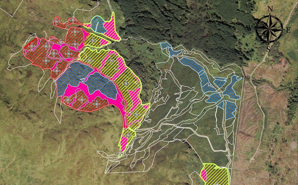
Forest Surveys provides a range of services for owners and managers of woodlands across the public, private and third sectors, with reliable information about timber stocks and woodlands. Working for a large private estate on the west coast of Scotland, Forest Surveys was commissioned to assess the success of a planting scheme that had been supported with grant funding from Scottish Forestry.
The site in question was remote and included elevations of up to 400 meters making it potentially difficult to access and presenting possible health and safety issues for field teams. The team of Forest Surveys needed to understand the terrain, ahead of any fieldwork, to minimize risk and make the best use of their time onsite.
While Forest Surveys had worked with satellite imagery before, they knew this wouldn’t provide the detail or currency required for this particular project so they ended up purchasing aerial photography for the entire site from the Bluesky online Mapshop. Using the Bluesky 12.5-centimetre resolution orthorectified aerial photos, Forest Surveys was able to identify the location and state of access tracks across the site. The planning team was also able to understand the proximity, and therefore potential risk, of hazards including craggy outcrops and steep slopes.
Planning of fieldwork continued with the identification of survey points and sample areas required to get the most accurate results that would be extrapolated across the entire site. It was even possible, in some areas, to eliminate sample areas from ground truthing as the Bluesky imagery provided sufficient detail for desktop studies.
Having realized the benefits of using geospatial data on this project, Forest Surveys is evaluating the application of other Bluesky products including the National Tree Map, which provides a detailed reference as to the location, canopy cover and height of trees 3m and taller, 3D height models which can further inform risk assessments and carbon assessments and multispectral imagery which is a useful indicator of plant and water health.


