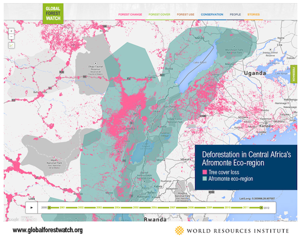
Global Forest Watch lets users customize their own deforestation maps
Global Forest Watch is now live, detecting changes in forest cover in near-real-time. The online forest monitoring and alert system is powered by Google Earth Engine, Google Maps Engine, crowd sourcing and open data to allows the public to track deforestation data from around the world.
The online resource, with monthly updated deforestation data, was created via a partnership between Google, the World Resources Institute (WRI), the University of Maryland, and dozens of other NGOs. Google said in a blog post that the GFW will help answer pressing questions such as “where, when, and why forests are disappearing.”
More than 500 million acres of forest have been lost in the past 10 years with only a small fraction being replanted. Scientists believe replanting forests is important to mitigate the impact of climate change as trees sequester CO2, keeping it out of the atmosphere.
Users on the site can find deforestation data dated back to 2000, zoom in on specific locations for more information, and customize their own maps.


