

Last week in Kissimmee, Florida, the United States Geospatial Intelligence Foundation (USGIF) held their annual GEOINT Symposium, bringing the geospatial intelligence community and private geospatial data companies together under one roof for a three-day event. GEOINT features a variety of speakers from different backgrounds and sectors – there were 215 speakers at this year’s event – as well as an exhibit floor that featured 245 exhibitors. This year’s show was particularly special in the geospatial intelligence community, as it marked the 20th anniversary of not only the very first GEOINT Symposium but also of the creation of USGIF itself. You can find Geo Week News’ takeaways from the events here.
As part of our experience at GEOINT, Geo Week News was able to spend some time exploring the show floor speaking to various exhibitors showing off their newest and flagship products. We’ve already discussed a conversation with Synspective founder and CEO Motoyuki Aria around their Earth observation satellites. Geo Week News also had a chance to speak with Mike Childs of Blue Marble Geographics, a Maine-based provider of GIS and geospatial software solutions.
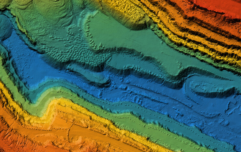
Childs was the original developer of Global Mapper Pro, the expanded version of Blue Marble Geographic’s flagship product. Global Mapper is a GIS software solution, taking in point cloud data from lidar and photogrammetric workflows and providing tools for processing and analyzing said data. Childs was on-site largely demonstrating the capabilities of this tool in the defense and intelligence space – which, of course, makes sense given the focus of this particular conference – though he told Geo Week News that the differences between this user base and enterprise ones don’t differ all that much outside of the data that comes in. He noted that defense and intelligence users generally use more satellite hyperspectral imagery as their base data, which goes back to our second GEOINT takeaway in the article listed above.
In addition to talking about some of those differences, Childs was also able to provide Geo Week News with an extensive demonstration of the Global Mapper Pro offering, showing off the capabilities with imagery and lidar data collected with UAVs. Among the many features he demonstrated were things like terrain painting, breakline calculations, contour generation, and AI-enabled capabilities like finding the most efficient route with baseline elevations between two points.
One thing that stood out just generally walking around GEOINT as well as plenty of other shows – including Geo Week – is that the number of tools for collecting this kind of data is enormous and only continues to grow, making a tool like Global Mapper crucial to derive these insights. While this particular event was focused on the defense and intelligence industries, and Childs did delve into some of the specifics for that industry, it was clear from this demonstration how these tools can benefit a variety of industries and users, both inside the intelligence apparatus and out of it.


