When Geo Week board members were asked which recent breakthroughs are still underappreciated, yet likely to have the biggest impact over the next five years, their responses pointed away from trends dominating recent headlines. The most consequential changes, they argue, are happening quietly in how geospatial data is collected, processed, shared, and applied.
From mobile mapping systems and edge computing to cloud-native data structures and interoperability, these developments may not generate hype, but they are already reshaping geospatial workflows and expectations.
Mobile Mapping’s Expanding Role
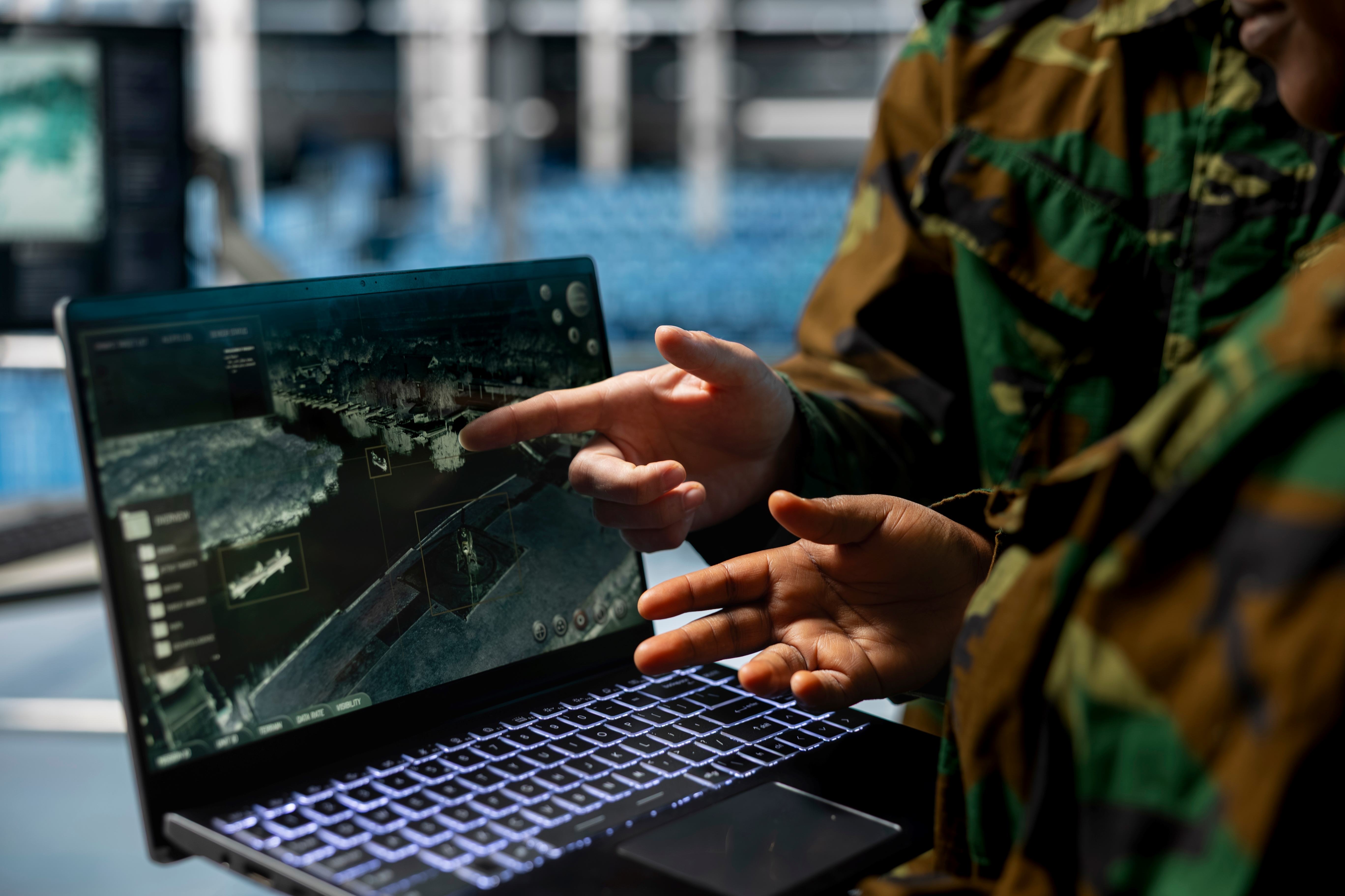
Land mobile mapping systems are one example of a technology whose importance is growing faster than its visibility. According to Dr. Mohamed M.R. Mostafa, the convergence of lidar, high-resolution imagery, GNSS, and inertial sensors on mobile platforms is driving major shifts across industries.
“Land Mobile Mapping Systems is currently an underserved topic at major geospatial conferences, despite its immense and growing impact,” Mostafa said.
He noted that these systems are enabling more efficient infrastructure asset management for governments while also serving as a critical data source for high-definition maps required for advanced autonomous vehicle development.
Intelligence Moves to the Field
Several board members pointed to edge computing as a breakthrough that is already delivering practical benefits. Patrick Lohman emphasized how shrinking AI models and lower-cost compute are changing field operations.
“As compute gets cheaper and AI models shrink, field workers now have expert-level intelligence running directly on their phones or drones, no internet required,” Lohman said. “Instead of collecting data and waiting for analysis, they get instant validation in the moment.”
Jason Stoker echoed this sentiment, describing edge computing as a way to manage the industry’s growing data volumes. Processing data closer to the sensor, he said, reduces latency and bandwidth demands while enabling faster decisions in applications like disaster response and infrastructure monitoring.
AI’s Most Practical Gains
While AI dominates many industry discussions, some respondents argued that its most meaningful advances are still being underestimated, particularly in focused analytical tasks.
“If you look at the very specific use case of classifying a ground surface from a point cloud, the advances in the AI models over just the past year have been incredible,” said Martin Flood. “Most recent AI ground classifiers already do a better job than a traditional algorithmic approach, and it is not even close.”
Flood added that while models will never be perfect, they are already good enough to eliminate much of the manual editing and cleanup that once defined point-cloud workflows.
The Quiet Revolution in Data Infrastructure
Others emphasized that some of the most important breakthroughs are largely invisible to end users. Stoker highlighted cloud-native geospatial formats and standards as foundational to the industry’s future.
“Formats like COGs, COPC, Zarr, GeoParquet, and modern point-cloud streaming protocols are revolutionizing how we store and access massive datasets,” he said. “STAC is quietly becoming the backbone of discoverability and interoperability for geospatial data.”
Aaron Addison framed this progress more broadly as an interoperability success story. “It’s not flashy or exciting,” he said, “but massive headway has been made.” Moving away from proprietary formats toward APIs and standardized data access, he added, has removed long-standing barriers to sharing and reuse.
A Shift in the Geospatial Skill Set
Dr. Julia Wagemann focused less on specific tools and more on how geospatial work itself is evolving. While AI will continue to influence the field, she argues its most underrated impact is how it changes expectations for professionals.
“AI doesn’t eliminate professions; rather, it shifts them,” Wagemann said. She emphasized that geospatial practitioners will increasingly need broader domain context, starting with real-world problems and working backward to apply spatial analysis, rather than producing maps without clear paths to action.
Quantum Compute
At the leading edge of emerging technology, Dr. Shawana Johnson pointed to quantum computing as an area with long-term implications for geospatial and remote sensing.
“When that work begins, we’re really going to enter a new age of communications in space,” Johnson said, pointing to advances in precision, navigation, timing, and cybersecurity. While technical challenges remain, she noted that progress in this area could eventually influence both defense and commercial geospatial applications.
Incremental Advances, Lasting Change
Taken together, these perspectives suggest that the next five years of geospatial innovation will be defined less by a single breakthrough than by steady advances across data collection, processing, infrastructure, and professional practice.
These shifts may be easy to overlook today, but they are laying the groundwork for how geospatial technology will be used, and valued, across industries in the years ahead.