
geoConvergence will publicly demonstrate Scan2Twin for the first time at Geo Week 2026, unveiling its methodology for delivering operational digital twins ready for asset management, work orders, and facility operations at portfolio scale. The demonstration showcases a workflow designed to address the cost and complexity barriers preventing digital twin adoption across large facility portfolios.
The demonstration takes place Sunday, February 16, 2026, from 3-4PM in the Demo Zone, Booth #535 at the Colorado Convention Center in Denver.
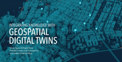
ABOUT SCAN2TWIN
Scan2Twin is geoConvergence's Esri-native methodology that controls the full pipeline from LiDAR point clouds through BIM processing to operational ArcGIS Indoors deployment. The approach structures data around assets, work orders, and space use delivering facility intelligence ready for immediate operational application rather than visualization alone.
The methodology combines three reality capture methods to collect survey-grade data from facility environments without disrupting operations:
• NavVis VLX3 wearable systems for continuous mobile mapping
• BLK2GO handheld scanners for detailed environment capture
• Robotic quadruped for accessing restricted or low-clearance spaces
Automated anonymization ensures PII (Personally Identifiable Information) and HIPAA compliance where required. The Esri-native pipeline integrates seamlessly with existing agency GIS workflows.
THE LIVE DEMONSTRATION
Attendees will watch raw scans transform into operational digital twins during the 1-hour session. The demonstration illustrates how facilities teams gain practical capabilities:
• Turn-by-turn indoor routing to assets
• Work order visualization in spatial context
• Space management and planning tools
The workflow demonstration covers reality capture execution, BIM processing, and ArcGIS Indoors deployment with extracted assets and GeoBIM outputs.
In addition to Scan2Twin, geoConvergence will showcase ReservAssist and Scenario Planner, proprietary tools that extend digital twin functionality into space reservations and facility planning.
WHO SHOULD ATTEND
The demonstration is designed for facility managers, GIS professionals implementing ArcGIS Indoors, and organizations managing facility portfolios. geoConvergence's on-site team will be available throughout the three-day conference to discuss technical workflows, project applications, and implementation approaches.
ABOUT GEOCONVERGENCE
Founded in 2004, geoConvergence is an Esri Gold Business Partner specializing in digital twin solutions for facility management. With Indoor GIS and Federal Small Business Ready designations, we deliver cost-effective, end-to-end workflows from mobile LiDAR capture through BIM processing to ArcGIS Indoors integration. Our Esri-native pipeline requires no custom development, aligning with how organizations already buy and run GIS. Technical precision in field data collection, paired with delivery expertise, supports facility management, scenario planning, wayfinding, and capital planning at scale.
February 5, 2026
geoConvergence Introduces Scan2Twin: Mobile Mapping for Digital Twin Creation & GIS Integration
geoConvergence will publicly demonstrate Scan2Twin for the first time at Geo Week 2026, unveiling its methodology for delivering operational digital twins ready for asset management, work orders, and facility operations at portfolio scale. The demonstration showcases a workflow designed to address the cost and complexity barriers preventing digital twin adoption across large facility portfolios.


Want more stories like this? Subscribe today!
Read Next

March 11, 2024
About the Author
Geo Week News regularly publishes press releases submitted or posted by leading companies and organizations. Please submit any releases for consideration to [email protected].